-
You are here:
- Homepage »
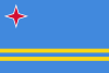
- Aruba »
- Aruba (general) » Oranjestad
Oranjestad Destination Guide
Delve into Oranjestad in Aruba
Oranjestad in the region of Aruba (general) with its 29,998 residents is a city in Aruba and is the capital of this country.
Current time in Oranjestad is now 01:04 PM (Saturday) . The local timezone is named " America/Aruba " with a UTC offset of -4 hours. Depending on your travel modalities, these larger destinations might be interesting for you: Sint Nicolaas, Sabaneta, Fontein, Brasil, and Arasji. While being here, make sure to check out Sint Nicolaas . We encountered some video on the web . Scroll down to see the most favourite one or select the video collection in the navigation. Are you curious about the possible sightseeing spots and facts in Oranjestad ? We have collected some references on our attractions page.
Videos
Missy Elliott - Let me fix my weave
From her album "This Is Not a Test!" The video www.youtube.com is from sm3ltz sm3ltz 's channel : www.youtube.com ..
Great ARUBA CARNAVAL video (Watch in HD)
2011 Aruba Carnival, Carnaval in Dutch or Papiamento. Aruba's biggest annual cultural celebration on the island! Aruba's Carnival is beautiful, gorgeous and most of all fun and safe. During this parad ..
'S Wonderful - Joao Gilberto.mp4
Background Music Playlist at Yemanja Woodfired Grill Restaurant ..
Aruba Weddings | Radisson Aruba Resort, Casino & Spa
For the best in Aruba wedding locations, please visit www.weddinglocation.com Get married in Aruba ..
Videos provided by Youtube are under the copyright of their owners.
Interesting facts about this location
Trinidad Stadium
Guillermo Prospero Trinidad Stadium (officially known as Complejo Deportivo Guillermo Prospero Trinidad) is a multi-purpose stadium in Oranjestad, Aruba. It is Aruba's National Stadium, named after Guillermo Trinidad, a politician from the same neighbourhood (Dakota). Originally the Stadium was named after former Dutch Queen Wilhelmina, but the name was changed in 1994 after the renovations were completed. The stadium hosts soccer matches and also track and field competitions.
Located at 12.51 -70.02 (Lat./Long.); Less than 1 km away
Barcelona, Aruba
Barcelona is a settlement on the island of Aruba, located near the west coast of the island.
Located at 12.52 -70.02 (Lat./Long.); Less than 1 km away
Camacuri
Camacuri is a village on the island of Aruba, located towards along the western coast of the island.
Located at 12.51 -70.02 (Lat./Long.); Less than 2 km away
Bubali
Bubali is a settlement on the island of Aruba, located towards the northern end of the island.
Located at 12.55 -70.04 (Lat./Long.); Less than 3 km away
Hooiberg
Hooiberg is a 165 m high volcanic formation on the island of Aruba. It is located almost in the center of the island and can be seen from virtually anywhere on the island. The Dutch word hooiberg, literally translates into haystack in English and is the name of a hay-rick called a hay barrack. Many have remarked about the panoramic views obtained atop Hooiberg. There are 562 concrete steps that lead to the top of the mountain. On a clear day Venezuela can be seen.
Located at 12.52 -70.00 (Lat./Long.); Less than 4 km away
Pictures
Related Locations

Information of geographic nature is based on public data provided by geonames.org, CIA world facts book, Unesco, DBpedia and wikipedia. Weather is based on NOAA GFS.