-
You are here:
- Homepage »
- Australia »
- New South Wales » Whitebridge

Whitebridge Destination Guide
Touring Whitebridge in Australia
Whitebridge in the region of New South Wales is located in Australia - some 217 mi or ( 349 km ) North-East of Canberra , the country's capital city .
Time in Whitebridge is now 12:51 AM (Saturday) . The local timezone is named " Australia/Sydney " with a UTC offset of 11 hours. Depending on your budget, these more prominent places might be interesting for you: West Wallsend, Toronto, Tomago, Sydney City, and Pelican Flat. Being here already, consider visiting West Wallsend . We collected some hobby film on the internet . Scroll down to see the most favourite one or select the video collection in the navigation. Check out our recommendations for Whitebridge ? We have collected some references on our attractions page.
Videos
Hunter, New South Wales
Did you know there is now even more on the menu in the Hunter? Once known only for it's wine and industry, The Hunter is now one of Australia's most popular tourist spots. Beautiful countryside, rolli ..
Redhead Beach and Bush Walk Newcastle New South Wales Australia 29-3-2009
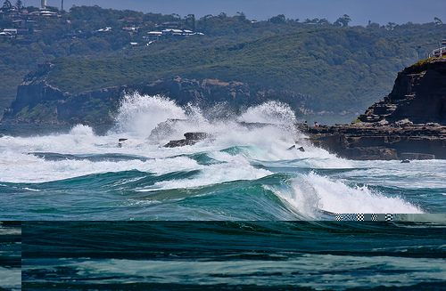
Redhead Beach is situated in Newcastle New South Wales Australia. Australia has some of the best surfing beaches in the world. The best thing about our beaches is that we have zillions of them and the ..
Wine Tour!!
On a day long wine tour, around Hunter Valley ..
Bogey Hole Adventure Newcastle Australia 3D
now you have been for a drive with me ,sat on the beach, lets go for a walk with a blues tune playing 2 z BoGey Hole built in 1820 one of Newcastle's hidden treasure's,. ..with some of the best views ..
Videos provided by Youtube are under the copyright of their owners.
Interesting facts about this location
Belmont railway line
The Belmont railway line is an abandoned coal haulage and passenger rail line from Adamstown, New South Wales to Belmont, New South Wales. This was a private railway, being the property of the New Redhead Estate and Coal Company and was generally known as the Belmont Branch. It is in the process of being converted into a cycleway or rail trail - The Fernleigh Track.
Located at -32.97 151.72 (Lat./Long.); Less than 2 km away
Kahibah Public School
Kahibah Public School is a government primary school in Kahibah, New South Wales, Australia. Originally established in 1938 in the Kahibah Memorial Hall, it moved to its current location in 1954. It caters for students from Kindergarten to Year 6 with a total enrolment of approximately 287. The school's Principal is Pam Richardson. The school is a registered war memorial.
Located at -32.97 151.71 (Lat./Long.); Less than 2 km away
Glenrock Lagoon
Glenrock Lagoon, an intermediate freshwater small coastal creek, is located within the Lake Macquarie local government area in the Newcastle and Hunter regions of New South Wales, Australia. The lake is located near the Newcastle suburbs of Adamstown and Dudley and is situated about 153 kilometres north of Sydney.
Located at -32.97 151.73 (Lat./Long.); Less than 2 km away
Kahibah, New South Wales
Kahibah is a suburb of the City of Lake Macquarie in New South Wales, Australia, located 9 kilometres from Newcastle's central business district. Kahibah is the closest suburb to Glenrock Lagoon, and is drained by Flaggy and Little Flaggy creeks which flows into Glenrock Lagoon 2 km to the east. The suburb's name is from the Aboriginal name word "Ky-yee-bah", which meant either a place for games or to be active and eager.
Located at -32.97 151.70 (Lat./Long.); Less than 3 km away
Charlestown Square
Charlestown Square is a major regional shopping centre in Charlestown, New South Wales, a suburb of the city of Lake Macquarie. It is owned and operated by General Property Trust. It was formerly managed by Lend Lease Corporation. Originally built in 1979 as a 2-story structure, the centre has undergone several extensions and renovations. It currently has over 170 stores and is one of the largest shopping centres in the Hunter Region. The centre now has 3 levels, and includes two food courts.
Located at -32.96 151.70 (Lat./Long.); Less than 3 km away
Pictures
Historical Weather
Related Locations
Information of geographic nature is based on public data provided by geonames.org, CIA world facts book, Unesco, DBpedia and wikipedia. Weather is based on NOAA GFS.