-
You are here:
- Homepage »
- Australia »
- Queensland » Carindale

Carindale Destination Guide
Touring Carindale in Australia
Carindale in the region of Queensland with its 15,135 citizens is a city located in Australia - some 586 mi or ( 943 km ) North-East of Canberra , the country's capital city .
Time in Carindale is now 03:19 PM (Saturday) . The local timezone is named " Australia/Brisbane " with a UTC offset of 10 hours. Depending on your travel resources, these more prominent places might be interesting for you: Wynnum, Woodridge, Wellington Point, Mt Gravatt, and Coorparoo. Being here already, consider visiting Wynnum . We collected some hobby film on the internet . Scroll down to see the most favourite one or select the video collection in the navigation. Check out our recommendations for Carindale ? We have collected some references on our attractions page.
Videos
Safety 1st One Safe Capsule - http://www.bubsngrubs.com.au
Safety 1st One Safe Capsule Video Review by www.bubsngrubs.com.au - Lowest Price in Australia! ..
2012 & The Mayan Hunab Ku :: Time Is Art :: The Time Is NOW
A journey into the world of HunabKu and Maya... What are we doing to planet earth? IT'S TIME TO AWAKEN FOLKS Music and spoken word by Russell Hibbs and Second Nature. ..
Chicco Cortina Magic Travel System Review by Bubs n Grubs
The Chicco Cortina Magic Travel System is super light and comes loaded with features both mother and baby will love and enjoy. www.youtube.com The Chicco Cortina Travel Magic System combines the Corti ..
Garden City Christian Church 'Your Name'
Garden City's Praise and Worship Album "Your Name" is now available on iTunes and amazon.com! ..
Videos provided by Youtube are under the copyright of their owners.
Interesting facts about this location
Carindale, Queensland
Carindale is a suburb of the city of Brisbane, which has a population of approximately 15,135 people and contains around 4,976 dwellings. The greater area was formerly known as Belmont. In 1973 Carindale Nursing Home was opened in Foxglove St, Mt Gravatt East and in 1978 permission was granted to the developers to use Carindale as the name of the new shopping centre. In 1980 the suburb of Carindale was created.
Located at -27.50 153.10 (Lat./Long.); Less than 1 km away
Whites Hill
Whites Hill is a hill and public reserve situated in Holland Park in Brisbane’s South East. The reserve covers an area of 53 acres (21.5 hectares) bound by the surrounding suburbs of Camp Hill, Coorparoo, Carina Heights and Mount Gravatt East. The site is popular with locals, with the reserve offering many sporting and recreational facilities.
Located at -27.51 153.08 (Lat./Long.); Less than 2 km away
Camp Hill, Queensland
Camp Hill is a largely residential suburb in the south-east of Brisbane, Queensland, Australia. It is located approximately 4 km from the Brisbane central business district and, as its name suggests, is elevated and commands fine views of the CBD. It has an area of 4.6 square kilometres.
Located at -27.50 153.08 (Lat./Long.); Less than 2 km away
Carina, Queensland
Carina is an eastern suburb of Brisbane, Queensland, Australia about 7 kilometres from the Central Business District. It adjoins the suburbs of Carindale, Carina Heights, Cannon Hill and Camp Hill. It is predominantly residential and was developed in the 1950s and 1960s. There are 4 schools in the suburb of Carina including St Martins primary school (Catholic Primary School), Carina State School, Mayfield State School and San Sisto College (Girls Catholic Secondary School).
Located at -27.48 153.10 (Lat./Long.); Less than 3 km away
Mansfield, Queensland
Mansfield is a suburb of Brisbane, Australia, situated approximately 11 kilometres south-east of the CBD. It is located in the region of the city which is now colloquially known as the "Bible Belt" due to the large number of people who have settled there to be close to Fundamentalist Christian schools and churches. It was named in 1967, after the Queensland governor of the time Sir Alan Mansfield. The suburb recorded a population of 8,473 at the 2011 Australian Census.
Located at -27.53 153.10 (Lat./Long.); Less than 3 km away
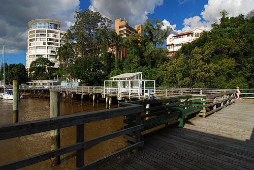
Pictures

Historical Weather
Related Locations


Information of geographic nature is based on public data provided by geonames.org, CIA world facts book, Unesco, DBpedia and wikipedia. Weather is based on NOAA GFS.