-
You are here:
- Homepage »
- Australia »
- Queensland » Peeramon

Peeramon Destination Guide
Explore Peeramon in Australia
Peeramon in the region of Queensland is a town in Australia - some 1,260 mi or ( 2028 km ) North of Canberra , the country's capital city .
Current time in Peeramon is now 07:29 PM (Tuesday) . The local timezone is named " Australia/Brisbane " with a UTC offset of 10 hours. Depending on the availability of means of transportation, these more prominent locations might be interesting for you: Topaz, Tolga, Tarzali, Kairi, and Jaggan. Since you are here already, make sure to check out Topaz . We saw some video on the web . Scroll down to see the most favourite one or select the video collection in the navigation. Where to go and what to see in Peeramon ? We have collected some references on our attractions page.
Videos
Bali Cottage - Crater Lakes Rainforest Cottages
Bali Cottage of the Crater Lakes Rainforest Cottages. The cottages are set adjacent to World Heritage Rainforest in the Cairns Highlands, North Queensland, Australia. Visit our website www.craterlakes ..
Crater Lakes Rainforest Cottages
Crater Lakes Rainforest Cottages is set adjacent to World Heritage Rainforest in the Cairns Highlands, North Queensland, Australia. Visit our website on www.craterlakes.com.au ..
Nautical Cottage - Crater Lakes Rainforest Cottages
Nautical Cottage of the Crater Lakes Rainforest Cottages. The cottages are set adjacent to World Heritage Rainforest in the Cairns Highlands, North Queensland, Australia. Visit our website www.craterl ..
Pioneer Cottage - Crater Lakes Rainforest Cottages
Pioneer Cottage of the Crater Lakes Rainforest Cottages. The cottages are set adjacent to World Heritage Rainforest in the Cairns Highlands, North Queensland, Australia. Visit our website www.craterla ..
Videos provided by Youtube are under the copyright of their owners.
Interesting facts about this location
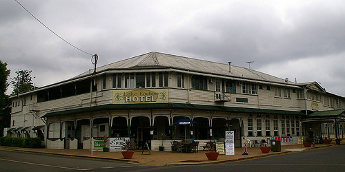
Lake Eacham
Lake Eacham: (originally Yidyam or Wiinggina) is a popular lake of volcanic origin on the Atherton Tableland of Queensland, Australia, within the World Heritage listed Wet Tropics of Queensland.
Located at -17.29 145.63 (Lat./Long.); Less than 4 km away
Mount Quincan
Mount Quincan is a volcanic mountain near Yungaburra on the Atherton Tableland in Far North Queensland, Australia. The extinct volcano is one of many cinder cones in the Atherton Tableland region. Quincan, a type of Scoria, is mined from the south west quadrant of the mountain. Quincan is used in road construction, driveways, weed control and domestic gardening.
Located at -17.30 145.58 (Lat./Long.); Less than 4 km away
Shire of Eacham
The Shire of Eacham was a local government area of Queensland. It was located on the Atherton Tableland, a plateau forming part of the Great Dividing Range west of the city of Cairns. The shire, administered from the town of Malanda, covered an area of 1,126.4 square kilometres, and existed as a local government entity from 1910 until 2008, when it amalgamated with several other councils in the Tableland area to become the Tablelands Region.
Located at -17.35 145.59 (Lat./Long.); Less than 5 km away
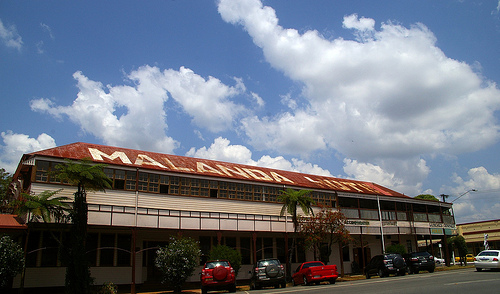
Malanda, Queensland
Malanda is a medium-sized town on the Atherton Tableland in Far North Queensland, Australia. It is located 85 kilometres from Cairns and 732 metres above sea level. Malanda first developed in the 1900s after the discovery of tin and copper at Herberton saw a steady stream of miners and engineers moving over the mountains from the coast. At the 2006 census, Malanda had a population of 1,009.
Located at -17.35 145.59 (Lat./Long.); Less than 5 km away
Malanda Falls
The Malanda Falls are located just out of the Malanda on the North Johnstone River, on the Atherton Tableland in Far North Queensland, Australia. They are not as spectacular as some of the surrounding falls on the Tablelands, however are a very popular swimming spot for residents of the area, and an important historical site. The North Johnstone River is prone to significant flooding in the wet season.
Located at -17.35 145.59 (Lat./Long.); Less than 5 km away
Pictures

Historical Weather
Related Locations
Information of geographic nature is based on public data provided by geonames.org, CIA world facts book, Unesco, DBpedia and wikipedia. Weather is based on NOAA GFS.