-
You are here:
- Homepage »
- Bangladesh »
- Khulna » Bagherhat

Bagherhat Destination Guide
Discover Bagherhat in Bangladesh
Bagherhat in the region of Khulna is a town located in Bangladesh - some 83 mi or ( 133 km ) South-West of Dhaka , the country's capital .
Local time in Bagherhat is now 12:10 PM (Thursday) . The local timezone is named " Asia/Dhaka " with a UTC offset of 6 hours. Depending on your flexibility, these larger cities might be interesting for you: Rajshahi, Dhaka, Umajuri, Santoshpur, and Naoapara. When in this area, you might want to check out Rajshahi . We found some clip posted online . Scroll down to see the most favourite one or select the video collection in the navigation. Are you looking for some initial hints on what might be interesting in Bagherhat ? We have collected some references on our attractions page.
Videos
Biggest Tidal Mangrove in the World (ohhhh ahhhh!) Hildreth75's photos around Sunderbands
Preview of Hildreth75's blog at TravelPod. Read the full blog here: www.travelpod.com This blog preview was made by TravelPod using the TripAdvisor™ TripWow slideshow creator. Learn more about these v ..
Videos provided by Youtube are under the copyright of their owners.
Interesting facts about this location
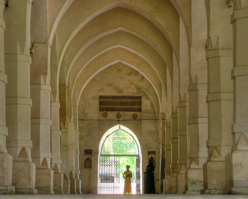
Mosque City of Bagerhat
The Mosque City of Bagerhat is a formerly lost city, located in the suburbs of Bagerhat city in Bagerhat District, in the Khulna Division of southwest of Bangladesh. Bagerhat is about 15 miles south east of Khulna and 200 miles southwest of Dhaka. Originally known as Khalifatabad and nicknamed the "mint town of the Bengal Sultanate", the city was founded in the 15th century by the warrior saint Turkish general Ulugh Khan Jahan.
Located at 22.66 89.80 (Lat./Long.); Less than 1 km away
Bagerhat Government High School
Bagerhat High School is a government high school located in the heart of Bagerhat town in Bangladesh. It was established as Nurul Amin School in 1947 by getting help from the British Government. After dividing countries, in 1967, this school became a government high school. It is considered one of the best school with national standard teaching staff of the Jessore District in the Khulna Division.
Located at 22.66 89.79 (Lat./Long.); Less than 1 km away
Bagerhat Sadar Upazila
Bagerhat Sadar is an Upazila of Bagerhat District in the Division of Khulna, Bangladesh. Bagerhat Sadar (Town) The municipality was established in 1958. It consists of 9 wards and 31 mahallas. http://www. banglapedia. org/httpdocs/HT/B_0033. HTM
Located at 22.66 89.79 (Lat./Long.); Less than 1 km away
Sixty Dome Mosque
The Sixty Dome Mosque (Bengali: ষাট গম্বুজ মসজিদ Shaṭ Gombuj Moshjid) (more commonly known as Shait Gambuj Mosque or Saith Gunbad Masjid) is a mosque in Bangladesh, the largest in that country from the Sultanate period. It has been described as "the most impressive Muslim monuments in the whole of the Indian subcontinent.
Located at 22.65 89.78 (Lat./Long.); Less than 1 km away
Khan Jahan Ali's Tank
Khan Jahan Ali's Tank is a lake-like tank in front of Khan Jahan Ali's tomb Complex in Bagerhat District, Bangladesh. The tank has several crocodiles in it. The species of those are marsh crocodile. People believe that if they appease the hunger of these crocodiles with chicken or goats, they would have the desire of their heart fulfilled. Whenever anybody makes such an offering, the caretaker of the tomb complex, or mazar, calls out the crocodiles, shouting 'Kalapahar, Dhalapahar, come!'.
Located at 22.66 89.76 (Lat./Long.); Less than 3 km away
Pictures
Historical Weather
Related Locations
Information of geographic nature is based on public data provided by geonames.org, CIA world facts book, Unesco, DBpedia and wikipedia. Weather is based on NOAA GFS.