-
You are here:
- Homepage »
- Dominican Republic »
- Independencia » Jimani

Jimani Destination Guide
Explore Jimani in Dominican Republic
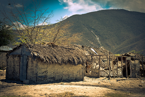
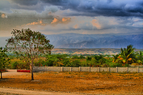
Jimani in the region of Independencia with its 6,567 inhabitants is a place in Dominican Republic - some 122 mi or ( 196 km ) West of Santo Domingo , the country's capital city .
Time in Jimani is now 11:04 AM (Thursday) . The local timezone is named " America/Santo Domingo " with a UTC offset of -4 hours. Depending on your budget, these more prominent locations might be interesting for you: Santo Domingo, Santiago de los Caballeros, Santa Cruz de Barahona, San Juan de la Maguana, and Puerto Plata. Since you are here already, consider visiting Santo Domingo . We saw some hobby film on the internet . Scroll down to see the most favourite one or select the video collection in the navigation. Where to go and what to see in Jimani ? We have collected some references on our attractions page.
Videos
Lac Azuei, Haiti
Adventure around the lake Azuei, Jumani in the Dominican Republic to Haiti. ..
Haiti Earthquake: Victims Arrive to Hospital at Dominican Republic Border
What I saw on the third day after the 2010 Hatian earthquake, after victims arrive to the provincial hospital in Jimaní, Dominican Republic. I dispensed medicine here and then served for 4 days at two ..
2010 Haitian EQ Good Samaritan Hospital
Relief efforts at Good Samaritan Hospital ER ..
Project Haiti 2009 Slideshow
A slideshow of pictures from Project Haiti's spring break medical outreach trip in 2009. ..
Videos provided by Youtube are under the copyright of their owners.
Interesting facts about this location
Jimaní
Jimaní is the capital and the second largest city of the Independencia Province of the Dominican Republic. It serves as one of the two main thoroughfares to Haiti, with a duty free open air marketplace operating on the border with the Haitian town of Malpasse. Half of the town was completely washed away in the flash flood of May 25, 2004, killing many of the citizens during the night. It is still in the process of rebuilding.
Located at 18.48 -71.85 (Lat./Long.); Less than 1 km away
Rivière Soliette
The Rivière Soliette (in Haiti) or Arroyo Blanco (in the Dominican Republic) is a river in the southwest of the Dominican Republic. On 24 May 2004, it overran its banks resulting in the death of over one thousand individuals, with hundreds more injured and homeless near the city of Jimani.
Located at 18.48 -71.83 (Lat./Long.); Less than 2 km away
Malpasse
Malpasse is a town in the Croix-des-Bouquets arrondissement, inside the Ouest Department of Haiti. It is located around {{#invoke:Coordinates|coord}}{{#coordinates:18|29|20|N|71|53|1|W| | |name= }}. Its border crossing to Jimaní is one of the four chief land crossings to the Dominican Republic.
Located at 18.49 -71.88 (Lat./Long.); Less than 4 km away
Chaîne de la Selle
Chaîne de la Selle is the name of a mountain chain in Haiti. Part of it is Pic la Selle, which is the highest point of Haiti at a height of 2,680 meters (8,793 feet) above sea level.
Located at 18.37 -71.98 (Lat./Long.); Less than 20 km away
Etang Saumâtre
Étang Saumâtre is the largest lake in Haiti and the second largest lake in Hispaniola, after Lake Enriquillo. It is also known as Lac Azuéi (Lake Azuéi); it is called Lago del Fondo in the Dominican Republic. Its Taíno name was Yainagua. The Étang Saumâtre, the brackish water lake is a twin of the Enriquillo Lake, is 22 kilometres east of Port-au-Prince on the fertile Plaine du Cul-de-Sac.
Located at 18.60 -72.01 (Lat./Long.); Less than 21 km away
Pictures

Related Locations
Information of geographic nature is based on public data provided by geonames.org, CIA world facts book, Unesco, DBpedia and wikipedia. Weather is based on NOAA GFS.