-
You are here:
- Homepage »
- Faroe Islands »
- Streymoy » Strendur

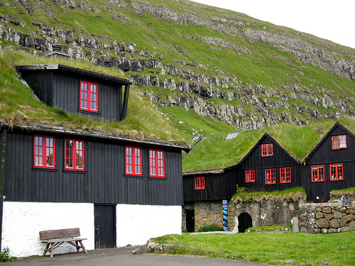
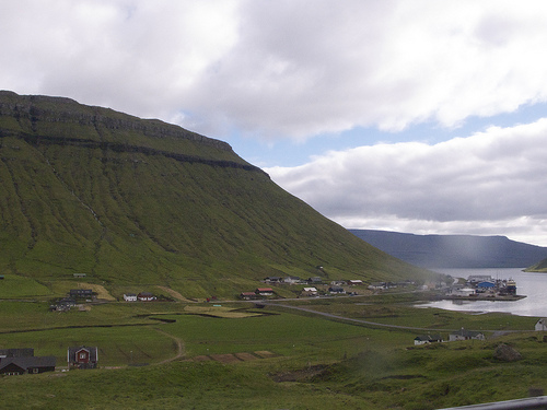
Strendur Destination Guide
Delve into Strendur in Faroe Islands
Strendur in the region of Streymoy with its 854 residents is located in Faroe Islands - some 7 mi or ( 11 km ) North of Tórshavn , the country's capital .
Local time in Strendur is now 09:02 PM (Friday) . The local timezone is named " Atlantic/Faroe " with a UTC offset of 0 hours. Depending on your mobility, these larger destinations might be interesting for you: Tvoroyri, Tórshavn, Sevlendi, Sandur, and Midvagur. While being here, you might want to check out Tvoroyri . We discovered some clip posted online . Scroll down to see the most favourite one or select the video collection in the navigation. Are you curious about the possible sightseeing spots and facts in Strendur ? We have collected some references on our attractions page.
Videos
Go on a vacation Misa
It took us 1 day to film it.. and 3 days to just CLIP AND EDIT IT! Studio 11 and movie maker were bitches! Anyway now we're finally done, so... here you go, everyone x) sorry for making you wait :D so ..
The Faroe Islands - the world's best kept secret!
faroeislandsfan.com The Faroe Islands - a group of 18 islands - is located midway between Iceland, Norway and Scotland, and the 48500 inhabitants speak the Faroese language. This language is linguisti ..
faroe island's, fastes ride ever
if you get dizzy watching the movie, close your eyes and enjoy the music :))))))) ..
Faroe Islands Timelapse
View to Toftir on Eysturoy, Faroe Islands Created with iTimeLapse , available on the iTunes app store. ..
Videos provided by Youtube are under the copyright of their owners.
Interesting facts about this location
Svangaskarð
Svangaskarð is a multi-purpose stadium in Toftir, Faroe Islands with two football fields and a sports arena for athletics around the lower field. It is currently used mostly for football matches. The stadium holds 6,000 people. It was the sole home ground of the Faroe Islands national football team from 1991 and until the Tórsvøllur Stadium was built in the capital Tórshavn in 1999 and is still occasionally used for international football matches.
Located at 62.10 -6.74 (Lat./Long.); Less than 1 km away
Kolbanargjógv
Kolbanargjógv is a village on the western coast of the Faroese island of Eysturoy in the Sjóvar municipality. The 2007 population was 39. Its postal code is FO 495.
Located at 62.10 -6.78 (Lat./Long.); Less than 2 km away
Runavík Stadium
Runavík Stadium is a multi-use stadium in Runavík, Faroe Islands. It is currently used mostly for football matches and is the home ground of NSÍ Runavík. The stadium holds 2,000 people.
Located at 62.11 -6.72 (Lat./Long.); Less than 2 km away
Runavík
Runavík is a comparatively urbanised village in the Faroe Islands. It lies on the south half of the isle of Eysturoy. The municipality of the same name incorporates 14 settlements including Æðuvík, Rituvík, Saltangará, Glyvrar, Lambi, Lambareiði, Søldarfjørður, Skipanes, Skáli, Skálafjørður, Funningsfjørður, Funningur, Elduvík and Oyndarfjørður which together form a long, narrow residential conurbation over 10 kilometre long following the east bank Skálafjørður.
Located at 62.12 -6.72 (Lat./Long.); Less than 2 km away
Saltangará
Saltangará (population 764) was founded in 1846 and is situated on the eastern side of Eysturoy Skalafjordur-inlet between Rituvík and Søldarfjørður. The name is derived from three words: angar comes from the Old Norse angr which means a fjord or bay; á means a stream; and salt has the same meaning in Faroese, Icelandic and English.
Located at 62.12 -6.72 (Lat./Long.); Less than 2 km away
Pictures
Related Locations

Information of geographic nature is based on public data provided by geonames.org, CIA world facts book, Unesco, DBpedia and wikipedia. Weather is based on NOAA GFS.