
Explore Ascain in France
Ascain in the region of Aquitaine with its 3,365 inhabitants is a town in France - some 425 mi or ( 684 km ) South-West of Paris , the country's capital city .
Current time in Ascain is now 02:28 PM (Friday) . The local timezone is named " Europe/Paris " with a UTC offset of 1 hours. Depending on the availability of means of transportation, these more prominent locations might be interesting for you: Serres, Sare, Saint-Jean-de-Luz, Pau, and Olhette. Since you are here already, make sure to check out Serres . We saw some video on the web . Scroll down to see the most favourite one or select the video collection in the navigation. Where to go and what to see in Ascain ? We have collected some references on our attractions page.
Videos
Bro Lurch and the Mormon Church
Inspired by Dr. Seuss, with a music of Nikkfurie from La Caution "Aquaplanning remix". Traduction : Bro. Lurch and the Mormon church (Frère Lurch et l'église mormone) - Je suis Lurch Je suis Lurch Frè ..
Procession Fête Dieu Saint Jean de Luz
Procession traditionnelle (1315!) des catholiques dans le monde entier. ..
Amazing French bull fight! A man gets gorged by the bull then hit like a freight train! july 2010
video of french bull fight in Saint Jean de Luz, where members of the public volunteer to play with the bulls...games like throwing hoops over the horns, getting the bull to run thru giant hoola hoops ..
SAN JUAN DE LUZ
FOTOS CON MUSICA DE SAN JUAN DE LUZ WWW.ELOTROMUNDODEPACO.COM ..
Videos provided by Youtube are under the copyright of their owners.
Interesting facts about this location
Nivelle (river)
The Nivelle is a 41 km long river in the Basque Country flowing largely south-east to north-west, with only 7 km of its length being considered navigable. The river results from the union of various streams in Urdazubi, going on to cross the Spanish-French border at Dantxarinea after 14 km meandering across Navarrese soil. The river pours into the Bay of Biscay on the bay of Saint-Jean-de-Luz (French for Donibane Lohizune) after cutting its way between this town and Ciboure on its final stage.
Located at 43.39 -1.67 (Lat./Long.); Less than 6 km away
Jardin botanique littoral Paul Jovet
The Jardin botanique littoral Paul Jovet (2.5 hectares) is a nonprofit botanical garden located at 31, avenue Bernoville Gaëtan, Saint-Jean-de-Luz, Pyrénées-Atlantiques, Aquitaine, France. It is open several days per week in the warmer months; an admission fee is charged. The garden was first envisioned in the 1980s by French botanist Paul Jovet (1896-1991) of the National Museum of Natural History in Biarritz.
Located at 43.40 -1.65 (Lat./Long.); Less than 7 km away
Untxin
The Untxin is a coastal river of the French Basque Country, in Aquitaine, Southwest France. It rises on the northern slope of the Xoldokogaina (479 m), in the east of Biriatou. The motorway of the Basque Coast (A63) is settled in its valley. It collects in Urrugne waters from the Mandale. The Untxin flows into the ocean in Ciboure.
Located at 43.33 -1.72 (Lat./Long.); Less than 8 km away
Battle of the Bidassoa (1813)
In the Battle of the Bidasoa (or the Battle of Larrun) on 7 October 1813 the Allied army of Arthur Wellesley, Marquess of Wellington wrested a foothold on French soil from Nicolas Soult's French army. The Allied troops overran the French lines behind the Bidassoa River on the coast and along the Pyrenees crest between the Bidasoa and La Rhune (Larrun). The nearest towns to the fighting are Irun on the lower Bidassoa and Bera on the middle Bidasoa.
Located at 43.34 -1.72 (Lat./Long.); Less than 8 km away
Lac de Saint-Pée-sur-Nivelle
Lac de Saint-Pée-sur-Nivelle is a lake in Pyrénées-Atlantiques, France. Its surface area is 0.12 km²
Located at 43.35 -1.52 (Lat./Long.); Less than 8 km away
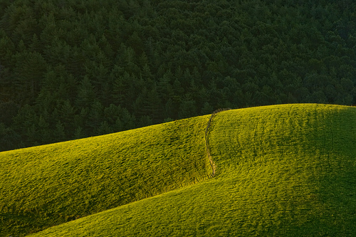
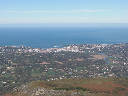
Pictures


Related Locations
Information of geographic nature is based on public data provided by geonames.org, CIA world facts book, Unesco, DBpedia and wikipedia. Weather is based on NOAA GFS.