-
You are here:
- Homepage »
- France »
- Languedoc-Roussillon » Le Barcares

Le Barcares Destination Guide
Delve into Le Barcares in France
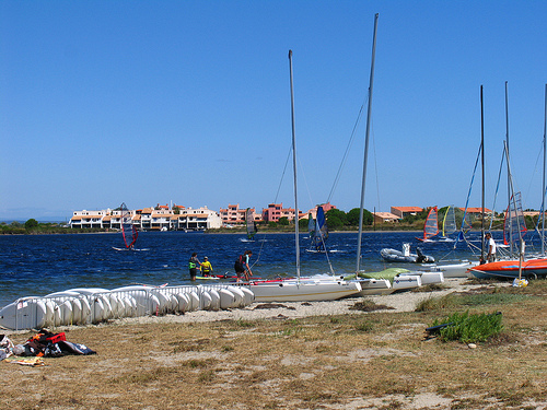
Le Barcares in the region of Languedoc-Roussillon with its 3,831 residents is a city in France - some 420 mi or ( 676 km ) South of Paris , the country's capital .
Current time in Le Barcares is now 11:54 PM (Saturday) . The local timezone is named " Europe/Paris " with a UTC offset of 1 hours. Depending on your travel modalities, these larger destinations might be interesting for you: Villeneuve-de-la-Raho, Perpignan, Montpellier, Leucate-Plage, and Grenoble. While being here, make sure to check out Villeneuve-de-la-Raho . We encountered some video on the web . Scroll down to see the most favourite one or select the video collection in the navigation. Are you curious about the possible sightseeing spots and facts in Le Barcares ? We have collected some references on our attractions page.
Videos
Electrobeach 2012 - #EMF2012 : Official Aftermovie
There were more than 40.000 people last 26th of July for the 4th Edition of the French biggest Electronic Music Festival ELECTROBEACH in Port-Barcarès (Southern France) with Serebro & Dj Mos, Flaix FM ..
Résidence la Pinède - Le Barcarès - Port Barcarès - location de vacances
Résidence luxe, très proche de la plage, du village, des animations et des commerces. logements spacieux de qualité, climatisés, tout confort. la résidence idéale pour vos vacances en famille. a proxi ..
SEREBRO Mama Lover live Electrobeach Festival 2012
SEREBRO Mama Lover live Electrobeach Festival 2012 ..
poolbuildfrench
While on holiday in Barcares, France from Ireland, the campsite owners told us they were building a new pool, noticing that they had a webcam, I thought it might make an interesting timelapse project. ..
Videos provided by Youtube are under the copyright of their owners.
Interesting facts about this location
Agly
The Agly Riveris a river of southwestern France. Its source is in the Corbières hills, near Camps-sur-l'Agly. It flows through Saint-Paul-de-Fenouillet, Estagel, Rivesaltes and Saint-Laurent-de-la-Salanque before it flows into the Mediterranean Sea near Le Barcarès.
Located at 42.78 3.04 (Lat./Long.); Less than 1 km away
MV Moonta
MV Moonta is a 1931 built Australian coastal passenger ship. Later in life she became the landlocked casino ship and tourist attraction Casino Le Lydia in Le Barcarès, France. {{#invoke:Coordinates|coord}}{{#coordinates:42|49|38.92|N|3|2|28.34|E|region:FR_scale:25000 |primary |name= }}
Located at 42.83 3.04 (Lat./Long.); Less than 4 km away
Étang de Leucate
Étang de Leucate or 'Étang de Salses is a lake in Pyrénées-Orientales and Aude, France. At an elevation of 0 m, its surface area is 54 km².
Located at 42.85 3.00 (Lat./Long.); Less than 7 km away
Têt (river)
The Têt is the largest river in Roussillon, southeastern France. It is 116 km long. The Têt has its source at the foot of the Pic Carlit in the Pyrenees. It crosses the Pyrénées-Orientales département from West to East and ends in the Mediterranean Sea, near Perpignan.
Located at 42.71 3.04 (Lat./Long.); Less than 8 km away
Gate of the Catalan Countries
The Gate of the Catalan Countries (Catalan: Porta dels Països Catalans), a work of the sculptor Emili Armengol, marks the Northern starting location of the Catalan Countries in Salses, Pyrénées-Orientales . After more than 20 years since the beginning of the project (often stopped, and even sometimes forbidden), it was finally inaugurated on September 28, 2003, being visible from the highway. Its conception and execution was in charge of the Union for the Catalan Region.
Located at 42.85 2.94 (Lat./Long.); Less than 11 km away
Pictures
Historical Weather
Related Locations
Information of geographic nature is based on public data provided by geonames.org, CIA world facts book, Unesco, DBpedia and wikipedia. Weather is based on NOAA GFS.