-
You are here:
- Homepage »
- France »
- Rhone-Alpes » Saint-Germain-Laval

Saint-Germain-Laval Destination Guide
Discover Saint-Germain-Laval in France
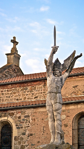
Saint-Germain-Laval in the region of Rhône-Alpes with its 1,610 habitants is a town located in France - some 223 mi or ( 359 km ) South of Paris , the country's capital .
Local time in Saint-Germain-Laval is now 09:04 AM (Tuesday) . The local timezone is named " Europe/Paris " with a UTC offset of 1 hours. Depending on your flexibility, these larger cities might be interesting for you: Villemontais, Verrieres, Vendranges, Valence, and Trelins. When in this area, you might want to check out Villemontais . We found some clip posted online . Scroll down to see the most favourite one or select the video collection in the navigation. Are you looking for some initial hints on what might be interesting in Saint-Germain-Laval ? We have collected some references on our attractions page.
Videos
AIR SHOW IN FRANCE (Meeting aérien, Roanne 2008)
..
Helloresto - Francis MENAUT LOURTAS - salon du tourisme Roanne
Interview de Francis MENAUT LOURTAS du Port de bully à Bully. Plus d'info sur www.helloresto.fr et sur www.hellorecette.fr. Montage et réalisation www.younivers.fr ..
Festival des Lumières 2011.avi
Compte-rendu des principales scènes de l'édition 2011 des Fêtes des Lumières à Lyon... avec ajout de photos traitées en fausses couleurs. ..
Videos provided by Youtube are under the copyright of their owners.
Interesting facts about this location
Château de La Roche (Saint-Priest-la-Roche)
The Château de La Roche is a restored castle situated in the in the commune of Saint-Priest-la-Roche in the Loire département of France, 20 km from Roanne. The castle stands on an island in the lake formed by the Villerest dam.
Located at 45.90 4.10 (Lat./Long.); Less than 10 km away
Château de Couzan
The Château de Couzan is a ruined castle in the commune of Sail-sous-Couzan in the Loire département of France. The castle stands on a rocky outcrop to the west of Sail-sous-Couzan in the Monts du Forez range above the Lignon du Forez river. The châtellenie of Couzan was the most important in the former province of Forez. The castle is owned by a private society. It has been listed since 1890 as a monument historique by the French Ministry of Culture.
Located at 45.73 3.97 (Lat./Long.); Less than 12 km away
Château de Chalmazel
The Château de Chalmazel is a castle situated in the commune of Chalmazel, in the Loire département of France. It is located in the Haut-Forez, between the towns of Saint-Étienne and Thiers. Its name in medieval times was Saint-Jehan-des-Neiges. The castle dominates the valley of the Lignon and it was built to be an impregnable fortress on the instructions of the Count of Forez.
Located at 45.70 3.85 (Lat./Long.); Less than 19 km away
Forez
Forez is a former province of France, corresponding approximately to the central part of the modern Loire département and a part of the Haute-Loire and Puy-de-Dôme départements. The final "z" in Forez is not pronounced in the Loire département, however, it is pronounced in the western part of the former province, essentially when referring to the correspondent Forez Mountains (on the border between Puy-de-Dôme and Loire. The name is derived from the city of Feurs.
Located at 45.74 4.23 (Lat./Long.); Less than 19 km away
La Vallon Airfield
La Vallon Airfield is an abandoned World War II military airfield in France, which is located approximately 6 km north-northeast of Montbrison (Departement de la Loire,Rhone-Alpes); about 385 km south-southeast of Paria. La Vallon was an all-weather temporary temporary sod airfield built by the XII Engineer Command. The runway was 7800' in length; 300' wide and aligned 13/31.
Located at 45.65 4.08 (Lat./Long.); Less than 21 km away
Pictures
Historical Weather
Related Locations
- Saint-Germain-le-Gaillard (Basse-Normandie)
- Saint-Germain-le-Gaillard (Centre)
- Saint-Germain-le-Fouilloux (Pays de la Loire)
- Saint-Germain-le-Chatelet (Franche-Comté)
- Saint-Germain-Laxis (Île-de-France)
- Saint-Germain-Lavolps (Limousin)
- Saint-Germain-la-Ville (Champagne-Ardenne)
- Saint-Germain-Laval (Île-de-France)
- Saint-Germain-Laprade (Auvergne)
- Saint-Germain-la-Poterie (Picardie)
- Saint-Germain-Langot (Basse-Normandie)
- Saint-Germain-la-Montagne (Rhône-Alpes)
- Saint-Germain-l'Aiguiller (Pays de la Loire)
- Saint-Germain-la-Gatine (Centre)
- Saint-Germain-la-Chambotte (Rhône-Alpes)
- Saint-Germain-la-Campagne (Haute-Normandie)
Information of geographic nature is based on public data provided by geonames.org, CIA world facts book, Unesco, DBpedia and wikipedia. Weather is based on NOAA GFS.