-
You are here:
- Homepage »
- Greece »
- Peloponnese » Elafonisos

Elafonisos Destination Guide
Explore Elafonisos in Greece
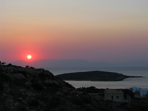
Elafonisos in the region of Peloponnese with its 745 inhabitants is a place in Greece - some 109 mi or ( 176 km ) South of Athens , the country's capital city .
Time in Elafonisos is now 05:36 AM (Wednesday) . The local timezone is named " Europe/Athens " with a UTC offset of 2 hours. Depending on your budget, these more prominent locations might be interesting for you: Tripoli, Teria, Talanda, Lacedaemon, and Patras. Since you are here already, consider visiting Tripoli . We saw some hobby film on the internet . Scroll down to see the most favourite one or select the video collection in the navigation. Where to go and what to see in Elafonisos ? We have collected some references on our attractions page.
Videos
Elafonisos the Aegean emerald
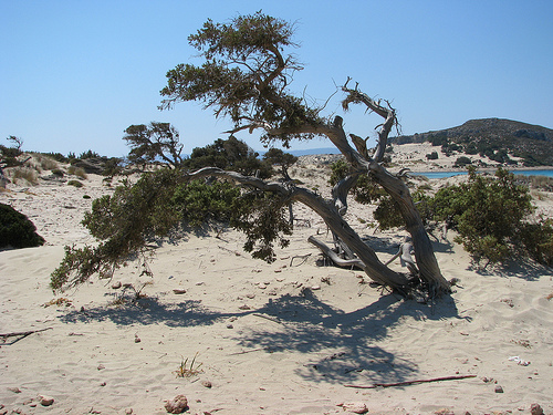
www.elafonissos.gr Elafonisos island, with crystal clear water and white sand in Aegean Arhipelago. ..
olive oil production
This video is part of what the boys learned about olive oil production, from our trip to Greece. ..
trip to turkey & greece in 1969
offroad through europe and turkey by borgward b 2000 ..
gythio-elafonisos 2010 ytube.wmv
Trip to Gythio-Ellafonisos in Hellas (Greece) August 2010 with Harley Davidson Club Hellas ..
Videos provided by Youtube are under the copyright of their owners.
Interesting facts about this location
Pavlopetri
The city of Pavlopetri, underwater off the coast of southern Laconia in Peloponnese, Greece, is about 5,000 years old, and is the oldest submerged archeological town site. Pavlopetri submerged town is located between the Pavlopetri islet across the Elafonisos village and the Pounta coast. The coast, the archeological site as well as the islet and the surrounding sea area are within the region of the Elafonisos Municipality, the old “Onou Gnathos” peninsula (according to Pausanias).
Located at 36.52 22.99 (Lat./Long.); Less than 1 km away
Aegean Sea
The Aegean Sea is an elongated embayment of the Mediterranean Sea located between the southern Balkan and Anatolian peninsulas, i.e. , between the mainlands of Greece and Turkey. In the north, it is connected to the Marmara Sea and Black Sea by the Dardanelles and Bosporus. The Aegean Islands are within the sea and some bound it on its southern periphery, including Crete and Rhodes. The Aegean Region consists of nine provinces in southwestern Turkey, in part bordering on the Aegean sea.
Located at 36.47 22.95 (Lat./Long.); Less than 5 km away
Velanidia, Laconia
Velanidia is a Byzantine village in Laconia, Greece, within the municipality of Voies. It is about 17 km from Neapolis. It includes several Byzantine churches, Cape Malea and the Lighthouse of Cape Maleas.
Located at 36.53 23.05 (Lat./Long.); Less than 7 km away
Voies
Voies is a former municipality in Laconia, Peloponnese, Greece. Since the 2011 local government reform it is part of the municipality Monemvasia, of which it is a municipal unit. It is on the southern tip of Cape Malea. It is a predominantly agricultural region with a few minor villages and one dominant town. Vatika is the common term for the area, but Voies is used in a more official context, particularly for postal situations.
Located at 36.51 23.06 (Lat./Long.); Less than 7 km away
Platia Ammos
Platia Ammos is a beach in the prefecture of Larissa. The beach is approached, leaving the Kokkino Nero and continuing uphill now, the way to the Stomio Beach. The huge trees that shade at midday the beach, offering a natural umbrella and black and white pebbles on the wide sandy beach that adorned it, are main characteristics.
Located at 36.37 22.95 (Lat./Long.); Less than 16 km away
Pictures


Historical Weather
Related Locations
Information of geographic nature is based on public data provided by geonames.org, CIA world facts book, Unesco, DBpedia and wikipedia. Weather is based on NOAA GFS.