
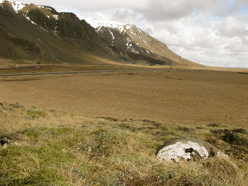
Discover Hveragerði in Iceland
Hveragerði in the region of South with its 2,281 habitants is a town located in Iceland - some 23 mi or ( 37 km ) South-East of Reykjavík , the country's capital .
Local time in Hveragerði is now 04:08 AM (Saturday) . The local timezone is named " Atlantic/Reykjavik " with a UTC offset of 0 hours. Depending on your flexibility, these larger cities might be interesting for you: Sauðárkrókur, Akureyri, Ulfljotsvatn, Selfoss, and Reykjavík. When in this area, you might want to check out Sauðárkrókur . We found some clip posted online . Scroll down to see the most favourite one or select the video collection in the navigation. Are you looking for some initial hints on what might be interesting in Hveragerði ? We have collected some references on our attractions page.
Videos
Capturing Iceland
Please comment and enjoy Iceland through the eye of the Photographer Tim Vollmer original from Teningen, Germany based in Iceland. ..
About Bananas at Iceland
A short trip trough the bananahouse of the Agricultural University of Iceland, Hveragerði ..
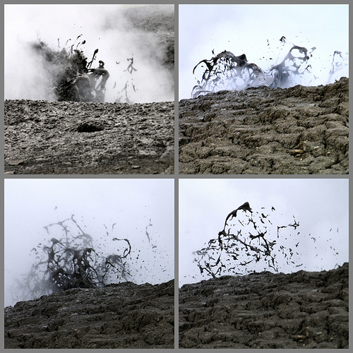
Hveragerdi, marmite de boue
www.regeafaitunbeauvoyage.fr ..
'Golden Circle' tour Honeybees's photos around Hengill, Iceland (grand circle tours iceland)
Preview of Honeybees's blog at TravelPod. Read the full blog here: www.travelpod.com This blog preview was made by TravelPod using the TripAdvisor™ TripWow slideshow creator. Learn more about these vi ..
Videos provided by Youtube are under the copyright of their owners.
Interesting facts about this location
Kaldaðarnes
Kaldaðarnes is an ancient farm estate in Iceland on the banks of the Ölfus river, around 8 km west of Selfoss. Records of a farm at this location exist back to year 1200 where it is stated that Kaldaðarnes was one of few farms with rights to offer ferry service across the Ölfus river. At Kaldaðarnes there was a church during Middle Ages and in the church there was a wooden cross that was believed to have healing powers, drawing pilgrims to the church.
Located at 63.93 -21.17 (Lat./Long.); Less than 8 km away
2008 Iceland earthquake
The 2008 Iceland earthquake, magnitude 6.3, struck on May 29, 2008 at 15:46 UTC. There were no human fatalities, but 30 injuries were reported and a number of sheep were killed. The epicenter of the earthquake was between the towns of Hveragerði and Selfoss, about 45 kilometers east-southeast of the capital, Reykjavík. It was the strongest earthquake to hit Iceland since the summer of 2000.
Located at 63.99 -21.01 (Lat./Long.); Less than 9 km away
Selfoss Airport
Selfoss Airport is an airport serving Selfoss, a town in the Árborg municipality in southern Iceland, on the banks of Ölfusá river. Selfoss Airport is a private owned airport.
Located at 63.93 -21.04 (Lat./Long.); Less than 11 km away
Flói Nature Reserve
The Flói Nature Reserve is a bird and nature reserve located in southern Iceland. It includes a stretch of the east shore of the Ölfusá River. The reserve measures roughly 1–1.5 km ( ) wide by 4.5 km long, with an area of about 5 km . It is an Internationally Important Bird Area as recognised by BirdLife International. It is all low-lying wetland, on average only 2 m above sea level, and is subject to seawater flooding at the spring tide. There are vistas of the surrounding mountains.
Located at 63.90 -21.18 (Lat./Long.); Less than 11 km away
Árborg
Sveitarfélagið Árborg is the biggest municipality in southern Iceland. It was formed in 1998. The population of Árborg was 7,827 (January 2011). The biggest town in the municipality is Selfoss, with a population of 6,512. Eyrarbakki and Stokkseyri are two communities on the southern coast and Sandvíkurhreppur is a rural administrative region between those three other towns. It is also the 8th most pop. city in Iceland
Located at 63.94 -21.00 (Lat./Long.); Less than 12 km away
Pictures


Related Locations
Information of geographic nature is based on public data provided by geonames.org, CIA world facts book, Unesco, DBpedia and wikipedia. Weather is based on NOAA GFS.