
Explore Damghan in Iran
Damghan in the region of Semnān with its 67,694 inhabitants is a town in Iran - some 167 mi or ( 269 km ) East of Tehran , the country's capital city .
Current time in Damghan is now 09:23 AM (Wednesday) . The local timezone is named " Asia/Tehran " with a UTC offset of 3.5 hours. Depending on the availability of means of transportation, these more prominent locations might be interesting for you: Zeynalabad, Sa'idabad, Hoseynabad, Verkian, and Heydarabad. Since you are here already, make sure to check out Zeynalabad . Where to go and what to see in Damghan ? We have collected some references on our attractions page.
Videos
Videos provided by Youtube are under the copyright of their owners.
Interesting facts about this location
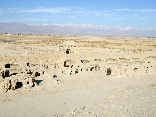
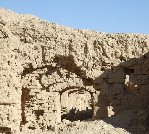
Tarikhaneh Temple
The Tarikhaneh Temple, also called the Tarikhaneh Mosque, is a Sassanid-era monument located on the southern limit of the present day city of Damghan, Iran. This structure was initially used as a Zoroastrian Fire Temple during the Sassanid period, however, after the fall of the Sassanid Empire it was rebuilt and converted into a mosque in the 8th century. The monument is, thus, known as the oldest mosque in Iran.
Located at 36.16 54.35 (Lat./Long.); Less than 1 km away
856 Damghan earthquake
The 856 Damghan Earthquake or the 856 Qumis earthquake occurred on 22 December, 856 AD. The earthquake had an estimated magnitude of 7.9, and a maximum intensity of X (intense) on the Mercalli intensity scale. The meizoseismal area (area of maximum damage) extended for about 350 kilometres along the southern edge of the eastern Alborz mountains of present-day Iran including parts of Tabaristan and Gorgan.
Located at 36.20 54.30 (Lat./Long.); Less than 6 km away
Abdeya
Abdia is a village in the country of Shahrestan, in the Semnan Province of Iran. The village is on the outskirts of the central city Damghan. The village has a subterranean water supply. The economy is based on agriculture and cattle. The old name of this village was watery. Watery is the name of the son of the Achaemenid kings who reigned for many years before the Damghan.
Located at 36.06 54.38 (Lat./Long.); Less than 12 km away
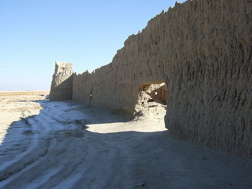
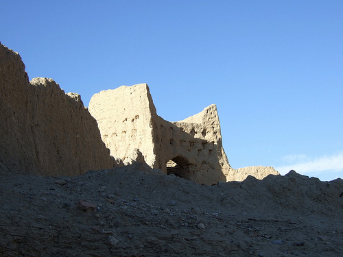
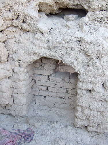
Gerdkuh
Gerdkuh or Girdkūh, a.k.a. Dej-e Gonbadān (دژ گنبدان, "fortress of the domes") is one of the main Ismaili's Hashshashin fortress used by Hassan-i Sabah and conquered by Hulagu Khan later. Due to circular shape of mountain peak, it was named Gerdkuh, Gerd for "circular" (round) and kuh for "mountain". This shape made it very difficult to access by invaders.
Located at 36.16 54.16 (Lat./Long.); Less than 17 km away
Pictures


Historical Weather
Related Locations
Information of geographic nature is based on public data provided by geonames.org, CIA world facts book, Unesco, DBpedia and wikipedia. Weather is based on NOAA GFS.