
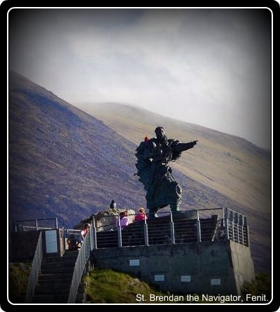
Discover Ardfert in Ireland
Ardfert in the region of Munster is a place located in Ireland - some 163 mi or ( 262 km ) South-West of Dublin , the country's capital .
Local time in Ardfert is now 02:26 AM (Friday) . The local timezone is named " Europe/Dublin " with a UTC offset of 0 hours. Depending on your mobility, these larger cities might be interesting for you: Derry, Lisburn, Belfast, Tralee, and Sligo. When in this area, you might want to check out Derry . We discovered some clip posted online . Scroll down to see the most favourite one or select the video collection in the navigation. Are you looking for some initial hints on what might be interesting in Ardfert ? We have collected some references on our attractions page.
Videos
OILEÁN - National Folk Theatre of Ireland, SIamsa Tíre
A one minute snapshot of Oileán by Siamsa Tíre, the National Folk Theatre of Ireland, celebrating life on the Great Blasket prior to its evacuation in the 1950s. Production delivered using all of the ..
CLANN LIR - National Folk Theatre of Ireland, Siamsa Tíre
A one minute snapshot of Clann Lir as presented by the National Folk Theatre of Ireland (Siamsa Tíre). The story of the Children of Lir, an ancient Irish legend delivered using all of the strenghts of ..
Tralee-Dingle Railway
"From Derry to Kerry" - 1994 Michael Palin Great Railway Journeys. From VHS print. ..
A brief overview of Siamsa Tíre, the National Folk Theatre of Ireland.
Based in Tralee, Co Kerry, Ireland, the National Folk Theatre of Ireland produces and stages stage performances using all of the strengths of Ireland's traditional artforms - dance, music and song to ..
Videos provided by Youtube are under the copyright of their owners.
Interesting facts about this location
St. Brendan's Ardfert GAA
St. Brendan's is a Gaelic Athletic Association hurling club in the Ardfert area of north County Kerry, Ireland. St. Brendans play in the Kerry Senior Hurling Championship. The club is primarily concerned with the game of hurling.
Located at 52.32 -9.78 (Lat./Long.); Less than 2 km away
Ardfert railway station
Ardfert railway station served the village of Ardfert in County Kerry, Ireland. The station opened on 20 December 1880. Passenger services were withdrawn on 4 February 1963, although the route through Ardfert continued to be used by freight trains for a while before the line to Listowel was finally closed altogether in 1977 and then to Tralee 1978. The station closed on 6 February 1978. Preceding station Disused railways Following station Abbeydorney Great Southern and Western Railway Tralee
Located at 52.32 -9.75 (Lat./Long.); Less than 3 km away
Kilmoyley GAA
Kilmoyley are a Gaelic Athletic Association club in County Kerry, Ireland. There are located in North Kerry, the main Hurling area of Kerry. They are one of the most successful hurling clubs in Kerry and is primarily concerned with the game of hurling. The club compeyes in competitions organized by Kerry GAA county board and the North Division hurling board.
Located at 52.36 -9.77 (Lat./Long.); Less than 3 km away
Banna Strand
Banna Strand, also known as Banna Beach, is situated in Tralee Bay. It is an Atlantic Ocean beach extending from Ballyheigue Beach at the Blackrock in the North to Barrow Beach at its southern edge, located in County Kerry. It is located approx 12 km (7 mi) north west of Tralee. It features sand dunes along its entire length which rise up to 12 metres (40 ft). The mountains of the Dingle Peninsula can be seen on the south west horizon.
Located at 52.36 -9.84 (Lat./Long.); Less than 5 km away
Barrow Harbour
Barrow Harbour is a tidal inlet off Tralee Bay, County Kerry, Ireland. Once, it was the major port for the region, servicing the monastic settlement of Ardfert and the general area of Tralee. Barrow is overlooked by Tralee Golf Club, from where a magnificent view of Tralee Bay and Banna Strand may be had. A narrow entrance to the harbour was protected by Fenit Castle on Fenit Island. The ruins of the castle still remain.
Located at 52.29 -9.85 (Lat./Long.); Less than 6 km away
Pictures

Related Locations
Information of geographic nature is based on public data provided by geonames.org, CIA world facts book, Unesco, DBpedia and wikipedia. Weather is based on NOAA GFS.