-
You are here:
- Homepage »
- Italy »
- Emilia-Romagna » Santa Sofia

Santa Sofia Destination Guide
Delve into Santa Sofia in Italy
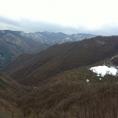
Santa Sofia in the region of Emilia-Romagna with its 4,276 residents is located in Italy - some 145 mi or ( 233 km ) North of Rome , the country's capital .
Local time in Santa Sofia is now 08:30 AM (Friday) . The local timezone is named " Europe/Rome " with a UTC offset of 1 hours. Depending on your mobility, these larger destinations might be interesting for you: Verghereto, San Silvestro, San Piero in Bagno, Camaldoli, and Rome. While being here, you might want to check out Verghereto . We discovered some clip posted online . Scroll down to see the most favourite one or select the video collection in the navigation. Are you curious about the possible sightseeing spots and facts in Santa Sofia ? We have collected some references on our attractions page.
Videos
JOY CUT a Urlalalavida!
concerto dei bolognesi Joy Cut al festival Urlalalavida!2007 San Piero in Bagno. - prodotto da www.pensatojo.it - ..
Rocca San Casciano Festa Falo 2010.mp4
Rocca San Casciano, La festa dei Falò, 1 maggio 2010 ..
Wandern am Comer See
Der Comer See - abseits von Villen, Hotels und Restaurants. Beim Wandern entdeckt man... wunderschöne Motive für Postkarten :-) ..
Pinguini del Comero 10-11 gennaio 09 www.guidegar.it
Week end 10-11 Gennaio 2009 E Sul Monte Comero con le Ciaspole (FC). Neve e montagna non vogliono dire soltanto sci. Se agli slalom sulle piste affollate preferisci il silenzio dei boschi, fatti conqu ..
Videos provided by Youtube are under the copyright of their owners.
Interesting facts about this location
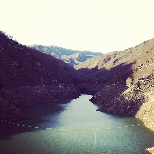
Ridracoli
Ridracoli is a frazione of the comune of Bagno di Romagna, province of Forlì-Cesena, Emilia-Romagna. In the nearby is a 103.5 m-high dam on the Bidente river, with a lake. It is part of the Foreste Casentinesi, Monte Falterona, Campigna National Park.
Located at 43.83 11.97 (Lat./Long.); Less than 13 km away
Giardino Botanico di Valbonella
The Giardino Botanico di Valbonella is a nature preserve and botanical garden in the Foreste Casentinesi, Monte Falterona, Campigna National Park, about 3 kilometers from Corniolo, Santa Sofia, Province of Forlì-Cesena, Emilia-Romagna, Italy. Located at an altitude of 700 meters, it has a surface of two hectares.
Located at 43.86 11.78 (Lat./Long.); Less than 14 km away
Foreste Casentinesi, Monte Falterona, Campigna National Park
The Parco Nazionale delle Foreste Casentinesi, Monte Falterona, Campigna is a national park in Italy. Created in 1993, it covers an area of about 368 square kilometres, on the two sides of the Apennine watershed between Romagna and Tuscany, and is divided between the provinces of Forlì Cesena, Arezzo and Florence.
Located at 43.84 11.79 (Lat./Long.); Less than 15 km away
Monte Falterona
Monte Falterona is a mountain in the Tuscan-Romagnolo Apeninnes, in the Casentino traditional region, standing at 1,654 m. It is part of the Casentino forests, Monte Falterona and Campigna National Park. The peak is crossed by the borders of the provinces of Florence, Arezzo and Forlì-Cesena. The mountain, mostly composed of sandstone, is covered by beeches and, from one of its sides, the Arno River springs.
Located at 43.87 11.70 (Lat./Long.); Less than 19 km away
Montecoronaro
Montecoronaro is a town and tourist destination in Italy. It is a frazione of Verghereto. It is situated in a pass through the Apennine Mountains. The source of the Savio River is located nearby on Mount Castelvecchio. The wolf is the symbol of Montecoronaro.
Located at 43.78 12.03 (Lat./Long.); Less than 21 km away
Pictures

Historical Weather
Related Locations
Information of geographic nature is based on public data provided by geonames.org, CIA world facts book, Unesco, DBpedia and wikipedia. Weather is based on NOAA GFS.