-
You are here:
- Homepage »
- Mexico »
- The Federal District » Iztapalapa

Iztapalapa Destination Guide
Delve into Iztapalapa in Mexico
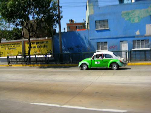
Iztapalapa in the region of The Federal District with its 1,820,888 residents is located in Mexico - some 7 mi or ( 12 km ) South-East of Mexico City , the country's capital .
Local time in Iztapalapa is now 10:32 AM (Friday) . The local timezone is named " America/Mexico City " with a UTC offset of -6 hours. Depending on your mobility, these larger destinations might be interesting for you: Xochimilco, Tomatlan, Toluca, Puebla, and Pachuca. While being here, you might want to check out Xochimilco . We discovered some clip posted online . Scroll down to see the most favourite one or select the video collection in the navigation. Are you curious about the possible sightseeing spots and facts in Iztapalapa ? We have collected some references on our attractions page.
Videos
FIEBRE DEL 2 - FITO GIRÒN - LOVE WON`T BE DENIED
Mùsica Disco Cantada En Vivo por el conductor de Televisiòn Fito Giròn. Gran sorpresa escuchar mùsicos 100% Mexicanos tocando mùsica disco en 1979 tan bien ejecutada, que, serìa dificil decidir cual s ..
Meshika in Mexico (92)
Glimpses of Mexico: Meshika Sahay participating in her friends`s birthday in Santa Fe, Mexico City, 16 May, 2009. All present on the occasion are singing the traditional Mexican Piñata song:dale, dale ..
The Best Skateboard & BMX video ever made in high speed camera
Using Fuji HS10 and after effects to get best of both worlds, HD quality and High Speed Video, the fps range from 30 fps to 1000 fps per second. The location was the biggest park in Latin America, Cab ..
Iztapalapa Downhill - 70 km/h Cerro de la Estrella high speed cycling
Para los que piden prueba de la velocidad: en esta liga puden ver un tramo de la bajada del cerro www.gmap-pedometer.com lo cual nos marca una distancia de 323 metros, ese tramo se realiza en 17.0 seg ..
Videos provided by Youtube are under the copyright of their owners.
Interesting facts about this location
Metro Constitución de 1917
Constitución de 1917 is a terminal station at the southeastern end of line 8 of the Mexico City Metro in Mexico City, Mexico. The logo of the station depicts a quill above a document dated 1917 and is intended to represent the Constitution of Mexico, which was adopted 5 February 1917. The station was opened on 20 July 1994.
Located at 19.35 -99.06 (Lat./Long.); Less than 1 km away
Metro UAM-I
Metro UAM-I is a station along Line 8 of the Mexico City Metro. The station's logo is the logo of the Universidad Autónoma Metropolitana campus Iztapalapa, which is close to the station. The station was opened on 20 July 1994. Until September 1996 this station was known as La Purísima, the name of the street where it is located. The previous logo was the silhouette of the Virgin of Guadalupe.
Located at 19.35 -99.07 (Lat./Long.); Less than 2 km away
Metro Cerro de la Estrella
Metro Cerro de la Estrella (English: Hill of the Stars) is an underground station along Line 8 of the metro of Mexico City. The station is located along the Calzada Ermita-Iztapalapa and serves the Colonia Hidalgo y Mina neighborhood within the Iztapalapa borough on the east side of the city. The station is named for the Cerro de la Estrella – a mesoamerican archaeological site located nearby. It was opened on 20 July 1994.
Located at 19.36 -99.09 (Lat./Long.); Less than 4 km away
Cerro de la Estrella (archeological site)
Cerro de la Estrella is a mesoamerican archaeological site located in southeastern Central Mexico's Valley of Mexico, in the Iztapalapa delegación of the Mexican Federal District at an elevation of 2460 meters (8070ft) above sea level, hence its Summit is 224 m over the Valley of Mexico level. At the southeast edge of what was the Great Texcoco Lake. Historical sources establish that ancient inhabitants of the Mexican Plateau knew this place as Huizachtecatl.
Located at 19.34 -99.09 (Lat./Long.); Less than 4 km away
Iztapalapa
Iztapalapa is one of the Federal District of Mexico City’s 16 boroughs, located on the east side of the entity. The borough is named after and centered on the formerly independent municipality of Iztapalapa, which is officially called Iztapalapa de Cuitláhuac for disambiguation purposes. The rest is made up of a number of other communities which are governed by the city of Iztapalapa.
Located at 19.36 -99.09 (Lat./Long.); Less than 4 km away
Pictures


Related Locations
Information of geographic nature is based on public data provided by geonames.org, CIA world facts book, Unesco, DBpedia and wikipedia. Weather is based on NOAA GFS.