
Delve into Keetmanshoop in Namibia
Keetmanshoop in the region of Karas with its 15,608 residents is a city in Namibia - some 286 mi or ( 460 km ) South of Windhoek , the country's capital .
Current time in Keetmanshoop is now 06:33 PM (Friday) . The local timezone is named " Africa/Windhoek " with a UTC offset of 2 hours. Depending on your travel modalities, these larger destinations might be interesting for you: and Walvis Bay. While being here, make sure to check out Walvis Bay . We encountered some video on the web . Scroll down to see the most favourite one or select the video collection in the navigation. Are you curious about the possible sightseeing spots and facts in Keetmanshoop ? We have collected some references on our attractions page.
Videos
Namibia - Keetmanshoop, (Lucky Dube - Umadakeni)
Keetmanshoop in January of 1992. Music: Lucky Dube - Umadakeni (Mbaqanga) ..
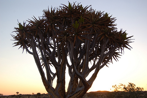
Keetmanshoop Quiver Tree Namibia
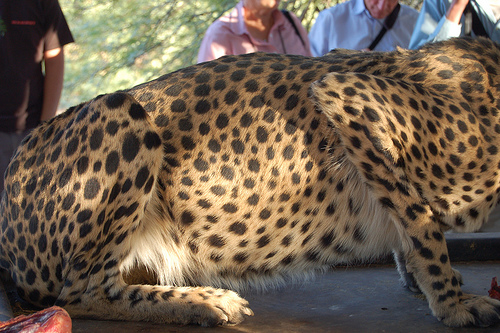
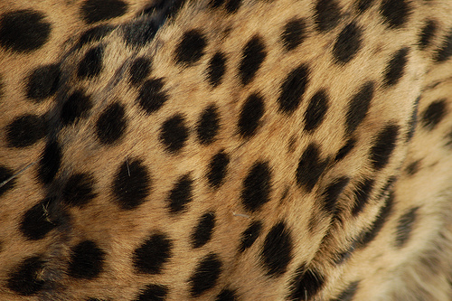
Visit Keetmanshoop in Namibia to see the Quiver Tree Forest, Giants Playground and a Cheetah Project. Copyright to www.roomsforafrica.com ..
Namibia Road Trip - Day 4 Iantrickett's photos around QuiverTree Forest, Namibia
Preview of Iantrickett's blog at TravelPod. Read the full blog here: www.travelpod.com This blog preview was made by TravelPod using the TripAdvisor™ TripWow slideshow creator. Learn more about these ..
Sesriem and Fish River Canyons Vermaakjeanne's photos around Hobas, Namibia (sesriem campsite)
Preview of Vermaakjeanne's blog at TravelPod. Read the full blog here: www.travelpod.com This blog preview was made by TravelPod using the TripAdvisor™ TripWow slideshow creator. Learn more about thes ..
Videos provided by Youtube are under the copyright of their owners.
Interesting facts about this location
Keetmanshoop Urban
Keetmanshoop Urban is a constituency in the Karas Region of Namibia. Its population is 14,945. It includes the city of Keetmanshoop.
Located at -26.58 18.13 (Lat./Long.); Less than 0 km away
Keetmanshoop Railway Station
Keetmanshoop Railway Station is a railway station serving the town of Keetmanshoop in Namibia. It is part of the TransNamib Railway, and is located along the Windhoek to Upington line that was inaugurated in 1915 and connects Namibia with South Africa. Keetmanshoop also has a junction to Seeheim and Aus, completed in 1908. The station building was erected in 1908.
Located at -26.58 18.13 (Lat./Long.); Less than 0 km away
J. Stephanus Stadium
J. Stephanus Stadium is a sports venue in Keetmanshoop, Karas Region, Namibia. It is the home stadium of Fedics United F.C. of the Namibia Premier League.
Located at -26.57 18.12 (Lat./Long.); Less than 1 km away
Karas Region
The Karas Region is the southernmost region of Namibia. The name assigned to the region reflects the prominence of the Karas mountain range in its southern part. The Karas region is considered as a natural organic administrative and economic unit and includes the magisterial districts of Keetmanshoop, Karasburg, Bethanie and Lüderitz. Karas' western border is the shores of the Atlantic Ocean.
Located at -26.57 18.13 (Lat./Long.); Less than 2 km away
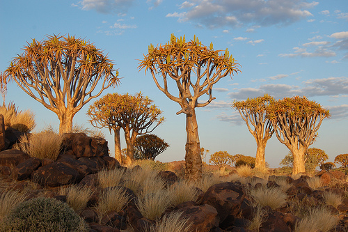
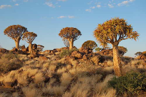
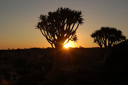
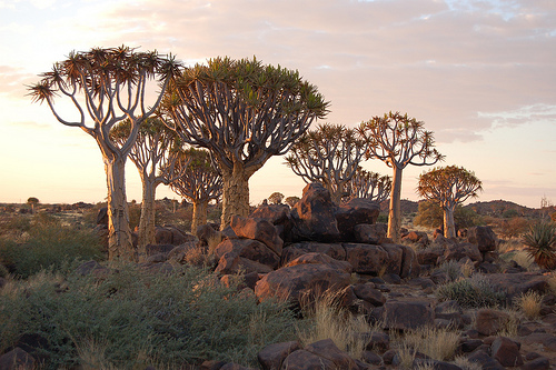
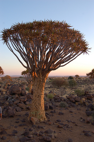
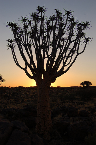
Quiver Tree Forest
The Quiver Tree Forest (Kokerboom Woud in Afrikaans) is a forest and a well-known tourist attraction of southern Namibia. It is located about 14 km north of Keetmanshoop, on the road to Koës, in the Gariganus farm. It comprises about 250 specimens of Aloe dichotoma, a species of aloe that is also locally known as "quiver tree" because bushmen use its branches to make quivers. The forest is spontaneous; the tallest quiver trees are two to three centuries old.
Located at -26.55 18.17 (Lat./Long.); Less than 5 km away
Pictures

Historical Weather
Related Locations
Information of geographic nature is based on public data provided by geonames.org, CIA world facts book, Unesco, DBpedia and wikipedia. Weather is based on NOAA GFS.