-
You are here:
- Homepage »
- New Zealand »
- Canterbury » Arthur's Pass

Arthur's Pass Destination Guide
Explore Arthur's Pass in New Zealand
Arthur's Pass in the region of Canterbury with its 930 inhabitants is a town in New Zealand - some 201 mi or ( 323 km ) South-West of Wellington , the country's capital city .
Current time in Arthur's Pass is now 09:02 AM (Friday) . The local timezone is named " Pacific/Auckland " with a UTC offset of 13 hours. Depending on the availability of means of transportation, these more prominent locations might be interesting for you: Wellington, Richmond, Otira, New Plymouth, and Nelson. Since you are here already, make sure to check out Wellington . We saw some video on the web . Scroll down to see the most favourite one or select the video collection in the navigation. Where to go and what to see in Arthur's Pass ? We have collected some references on our attractions page.
Videos
Caving & Hiking in Arthurs Pass NewZealand : Sprachreise
International English Institute, Christchurch, New Zealand NZ. Language school day trip to Cave Stream and Arthurs Pass National Park. The trip included caving, barbecue and trekking in the national p ..
Arthurs Pass Mt Bealey.flv
A winter climb up Mt Bealey from Arthurs Pass ..
Avalanche Peak Pete-r's photos around Otira, New Zealand (things to do in otira new zealand)
Preview of Pete-r's blog at TravelPod. Read the full blog here: www.travelpod.com This blog preview was made by TravelPod using the TripAdvisor™ TripWow slideshow creator. Learn more about these video ..
Devils Punchbowl Falls - New Zealand (HD)
Pour d'autres découvertes, c'est ici / You enjoy ? Check out more videos here : www.youtube.com Plus de photos et commentaires ici / Read & see more about this water falls at : voyagesoulemondeenimage ..
Videos provided by Youtube are under the copyright of their owners.
Interesting facts about this location
Avalanche Peak (New Zealand)
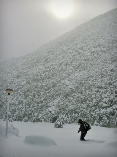
Avalanche Peak is a 1833-metre peak in the Arthur's Pass National Park in New Zealand. It is subject to avalanches in the winter, hence its name. It is the most popular day walking peak from Arthur's Pass as it is easily accessible from the village and offers views of several mountain ranges in the park on a clear day. It is also a popular place for Kea. There is an annual mountain run, the Avalanche Peak Challenge which crosses the peak
Located at -42.94 171.54 (Lat./Long.); Less than 3 km away
Mingha River
The Mingha River is a river of the Canterbury Region of New Zealand's South Island. It flows east then south from its origin on the slopes of Mt Temple, meeting the Bealey River eight kilometres south of Arthur's Pass. Together with Goat Pass (1,071 metres) and the Deception River, the Mingha valley forms a route across the Southern Alps known as the Mingha/Deception. It is used for the mountain running segment of the annual Coast to Coast race.
Located at -42.98 171.58 (Lat./Long.); Less than 4 km away
Temple Basin
Temple Basin is a club skifield in Arthur's Pass, in New Zealand's South Island. Operated by two clubs, the Temple Basin Ski Club, and the Canterbury University Snow Sports Club, the ski area has 3 rope tows, two on-site lodges, a ski school and ski shop. The tows cover an elevation range of 1326–1753 metres, for a skiable domain of 320 hectares. Its natural terrain has been highly recommended by adventure skiers on several occasions.
Located at -42.91 171.57 (Lat./Long.); Less than 5 km away
Edwards River (New Zealand)
The Edwards River is a river of New Zealand. A tributary of the Bealey River, it arises in the Polar Range to the east of Arthur's Pass and flows south-west within Arthur's Pass National Park. The Mingha River joins it just before it enters the Bealey. It is one of the headwaters of the Waimakariri River. A tramping track runs part of the way along the river to a backcountry hut.
Located at -42.98 171.62 (Lat./Long.); Less than 5 km away
Arthur's Pass (mountain pass)
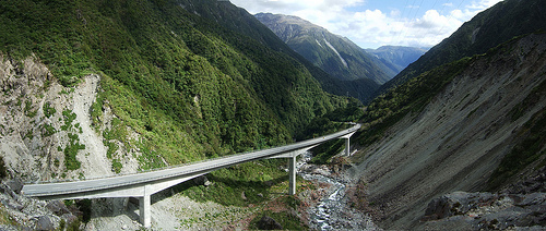
Arthur's Pass (el. 920 m. ) is a mountain pass in the Southern Alps of the South Island of New Zealand. It marks part of the boundary between the West Coast and Canterbury regions, 140 km from Christchurch and 95 km from Greymouth. The pass lies in a saddle between the valleys of the Otira River, a tributary of the Taramakau, in the west and the Bealey River in the east. Arthur's Pass lies on the border of the Selwyn and Westland districts.
Located at -42.90 171.56 (Lat./Long.); Less than 5 km away
Pictures
Historical Weather
Related Locations

Information of geographic nature is based on public data provided by geonames.org, CIA world facts book, Unesco, DBpedia and wikipedia. Weather is based on NOAA GFS.