-
You are here:
- Homepage »
- New Zealand »
- Taranaki » Manaia

Manaia Destination Guide
Explore Manaia in New Zealand
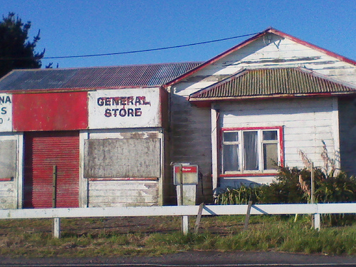
Manaia in the region of Taranaki with its 902 inhabitants is a town in New Zealand - some 125 mi or ( 201 km ) North of Wellington , the country's capital city .
Current time in Manaia is now 05:55 PM (Wednesday) . The local timezone is named " Pacific/Auckland " with a UTC offset of 13 hours. Depending on the availability of means of transportation, these more prominent locations might be interesting for you: Wellington, Te Roti, Riverlea, Richmond, and Palmerston North. Since you are here already, make sure to check out Wellington . We saw some video on the web . Scroll down to see the most favourite one or select the video collection in the navigation. Where to go and what to see in Manaia ? We have collected some references on our attractions page.
Videos
Hang-gliding in Auckland, New Zealand
Show how Aqua Air Adventure ( www.gethigh.co.nz ) does tandem hang-gliding on the wild west coast beaches one hour out from Auckland City at Karioitahi Beach , near Waiuku ..
Waitara Excursion (A ride with a difference)
Perhaps the best train ride of my life - an excursion on the old Waitara Branch in the Taranaki, New Zealand thanks to the Waitara Preservation Society for the ride- our train was being propelled by a ..
Videos provided by Youtube are under the copyright of their owners.
Interesting facts about this location
Manaia, Taranaki
Manaia is a rural town in South Taranaki District, New Zealand. Opunake is 29 km to the northwest, and Hawera is 13 km to the southeast. Kaponga is 15 km north. State Highway 45 passes through the town. Manaia is named after the former Māori chief of the district, Hukunui Manaia. The Manaia and surrounding community has a South Taranaki District Council LibraryPlus, which provides a full library service and Council related services.
Located at -39.55 174.13 (Lat./Long.); Less than 0 km away
Waingongoro River
The Waingongoro River is a river of the Taranaki Region of New Zealand's North Island. It flows initially southeast from the slopes of Taranaki/Mount Egmont and passes through the town of Eltham before veering southwest to reach the coast five kilometres west of Hawera.
Located at -39.58 174.18 (Lat./Long.); Less than 6 km away
Kapuni
Kapuni is a small hydrocarbons field and drilling site in the North Island of New Zealand. It is located within a dairy farming area in Taranaki, 85 km south of New Plymouth. It is the second largest onshore gas/condensate field in New Zealand after the Maui gas field off the Taranaki coast. Economically viable quantities of oil and gas were discovered in 1959 by a Royal Dutch/Shell-British Petroleum-Todd consortium, and full production began in 1969.
Located at -39.48 174.17 (Lat./Long.); Less than 9 km away
Normanby, Taranaki
Normanby is a small village in South Taranaki, New Zealand. It is approximately 6 km inland from Hawera along State Highway 3. Eltham is 13 km further north. It is also situated on the Marton - New Plymouth Line railway, which has been freight-only through Normanby since the cessation of passenger railcar services between Wellington and New Plymouth on 30 July 1977. The population of Normanby and its surrounding hinterland was 849 in the 2006 Census, a decrease of 24 from 2001.
Located at -39.53 174.27 (Lat./Long.); Less than 12 km away
Hawera Observatory
Hawera Observatory is situated in King Edward Park, Hawera, New Zealand, and is administered and maintained by the Hawera Astronomical Society, which meets at the observatory on the second Wednesday of the month from February to December. Also, by arrangement, open nights (weather permitting) are held for local groups as well as members. The observatory was founded by amateur astronomer and telescope maker, George Mortimer Townsend, who also co-founded the Hawera Astronomical Society in 1926.
Located at -39.59 174.27 (Lat./Long.); Less than 13 km away
Pictures
Historical Weather
Related Locations
Information of geographic nature is based on public data provided by geonames.org, CIA world facts book, Unesco, DBpedia and wikipedia. Weather is based on NOAA GFS.