-
You are here:
- Homepage »
- Philippines »
- Central Luzon » Mabayo

Mabayo Destination Guide
Touring Mabayo in Philippines
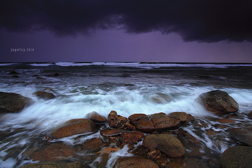
Mabayo in the region of Central Luzon with its 2,843 citizens is located in Philippines - some 48 mi or ( 77 km ) West of Manila , the country's capital city .
Time in Mabayo is now 12:09 AM (Wednesday) . The local timezone is named " Asia/Manila " with a UTC offset of 8 hours. Depending on your budget, these more prominent places might be interesting for you: Tuguegarao City, Taguig City, Subic, Sexmoan, and Sawat. Being here already, consider visiting Tuguegarao City . We collected some hobby film on the internet . Scroll down to see the most favourite one or select the video collection in the navigation. Check out our recommendations for Mabayo ? We have collected some references on our attractions page.
Videos
Crocodiles at Zoobic Safari
Feeding crocodiles at Zoobic Safari ..
Welcome to the Family Aeta singers in Kanawan church
Singing in the Kanawan Church Service. The local Kanawan worship team, mostly teen girls, lead the congregation in the singing of "Welcome to the Family", accompanied by drums and a guitar. Welcome to ..
Olongapo City Subic Bay Kalaklan Sandbars
A report on the situation at the mouth of Kalaklan River in Olongapo City whereby a jetty was built at the foot of Kalaklan Lighthouse. The report confirm the finding of Canadian Flood Experts that th ..
Tiger Safari Philippines .. we touch & feed the Tigers chic
Location: SUBIC BAY, PHILIPPINES. Tiger Safari trip for only a couple hundred pesos ( 42 pesos to 1 USD). Great time, amazing to be that close and you could pay a couple more dollars and get extra chi ..
Videos provided by Youtube are under the copyright of their owners.
Interesting facts about this location
Philippine Refugee Processing Center
The Philippine Refugee Processing Center (PRPC) was a large facility near Morong, Bataan, Philippines, which was used as the final stop for Indochinese refugees making their way to permanent resettlement in other nations. Opened in 1980, PRPC was located to the south of Subic Bay and north of the Bataan Nuclear Power Plant.
Located at 14.71 120.29 (Lat./Long.); Less than 3 km away
Fort Wint
Fort Wint (Grande Island, the Philippines) was part of the harbor defenses of Manila and Subic Bays built by the Philippine Department of the United States Army between 1907 and 1920 in response to recommendations of the Taft Board prior to the non-fortification clause of the Washington Naval Treaty. Fort Wint was located on Grande Island at the entrance of Subic Bay, approximately 35 miles (56 km) north of Manila Bay. The fort was named for Brigadier General Theodore J. Wint.
Located at 14.77 120.23 (Lat./Long.); Less than 7 km away
Subic Bay
Subic Bay is a bay forming part of Luzon Sea on the west coast of the island of Luzon in Zambales, Philippines, about 100 kilometers northwest of Manila Bay. Its shores were formerly the site of a major United States Navy facility named U.S. Naval Base Subic Bay, it is now the location of an industrial and commercial area known as the Subic Bay Freeport Zone under the Subic Bay Metropolitan Authority.
Located at 14.75 120.22 (Lat./Long.); Less than 7 km away
Subic Bay International Airport
Subic Bay International Airport or SBIA serves as a secondary airport and a main diversion airport of the Ninoy Aquino International Airport. It is also the airport serving the immediate area of the Subic Bay Freeport Zone and the general area of Olongapo City in the Philippines. This airport used to be the Naval Air Station Cubi Point of the United States Navy. Its airport terminal has 2 gates. In January 2010, Subic Bay Metropolitan Authority Administrator and CEO Armand C.
Located at 14.79 120.27 (Lat./Long.); Less than 7 km away
Naval Air Station Cubi Point
U.S. Naval Air Station Cubi Point was a United States Navy aerial facility located at the edge of Naval Base Subic Bay and abutting the Bataan Peninsula in the Philippines.
Located at 14.79 120.27 (Lat./Long.); Less than 7 km away
Pictures
Historical Weather
Related Locations
Information of geographic nature is based on public data provided by geonames.org, CIA world facts book, Unesco, DBpedia and wikipedia. Weather is based on NOAA GFS.