
Explore Barruera in Spain
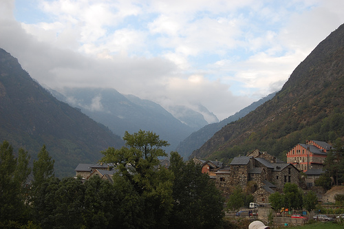
Barruera in the region of Catalonia with its 707 inhabitants is a town in Spain - some 274 mi or ( 441 km ) North-East of Madrid , the country's capital city .
Current time in Barruera is now 01:27 PM (Thursday) . The local timezone is named " Europe/Madrid " with a UTC offset of 1 hours. Depending on the availability of means of transportation, these more prominent locations might be interesting for you: Toulouse, Tarbes, Pau, Montpellier, and Limoges. Since you are here already, make sure to check out Toulouse . We encountered some video on the web . Scroll down to see the most favourite one or select the video collection in the navigation. Where to go and what to see in Barruera ? We have collected some references on our attractions page.
Videos
Falles 2007 El Pont de Suert
Falles 2007 El Pont de Suert ..
3er festival hivernal Vall de Boi 2009
3a edició festival hivernal Vall de Boí 2009 ..
Hotel Mestre **
Hotel Mestre ( Pont de suert - Lleida ) www.hotelesvisitados.com ..
Boí 08
Video de la presentación de la ronda 2008/2009 del Grupo Scout Azahar de Algemesí. Recordando el campamento de verano en Boí ..
Videos provided by Youtube are under the copyright of their owners.
Interesting facts about this location
Roca de la Feixa
Roca de la Feixa is a massive mountain of the Pyrenees, Catalonia, Spain. It has an altitude of 2,093 metres above sea level. This mountain's summit rises above Durro village. It is located within the municipal limits of Vall de Boí, Alta Ribagorça.
Located at 42.50 0.84 (Lat./Long.); Less than 3 km away
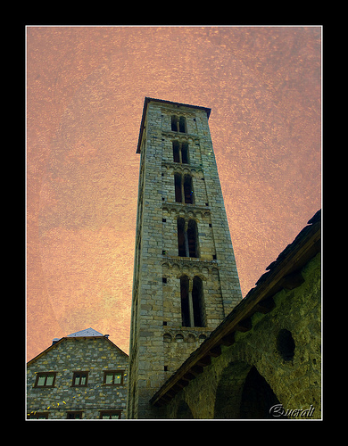
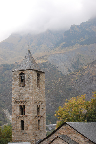
Sant Climent de Taüll
Sant Climent de Taüll, also known as the Church of St. Clement of Tahull is a Roman Catholic church. It is a form of Romanesque architecture that contains magnificent Romanesque art. Other influences include the Lombard and Byzantine styles, which can be seen throughout the exterior and interior of the building. The church is a basilica plan structure with three naves,(each of them with a terminal apse) and large columns separating the side naves.
Located at 42.52 0.85 (Lat./Long.); Less than 4 km away
Alta Ribagorça
Alta Ribagorça is one of the comarques of Catalonia, Spain. Its capital is Pont de Suert. The highest peak is the Comaloformo (3030 meters above sea level) in the massif of Bessiberri. Northeast of the region is the western part of the National Aiguas Tortas and Lake of San Mauricio. It is connected with the Val d'Aran valley thorough the Vielha tunnel. Municipalities of Alta Ribagorça: El Pont de Suert - pop. 2,725 Vall de Boí - pop. 1,062 Vilaller - pop.
Located at 42.46 0.83 (Lat./Long.); Less than 5 km away
Montanuy
Montanuy or Montanui is a municipality located in the province of Huesca, Aragon, Spain. According to the 2004 census, the municipality has a population of 308 inhabitants.
Located at 42.47 0.70 (Lat./Long.); Less than 9 km away
GR 11 (Spain)
The GR 11 is part of the extensive GR footpath network of paths, tracks and trails. It runs through the Spanish Pyrenees, passing only briefly into France near Candanchu. From West to East, the trail starts at Cape Higuer, crosses Navarre and Aragon and finishes at Cap de Creus Its exact distance is difficult to measure, roughly 840 km and a total elevation change of 39,000 m. The route is separated into 45 sections.
Located at 42.60 0.74 (Lat./Long.); Less than 11 km away
Pictures


Historical Weather
Related Locations
Information of geographic nature is based on public data provided by geonames.org, CIA world facts book, Unesco, DBpedia and wikipedia. Weather is based on NOAA GFS.