-
You are here:
- Homepage »
- United Kingdom »
- England » Bournemouth

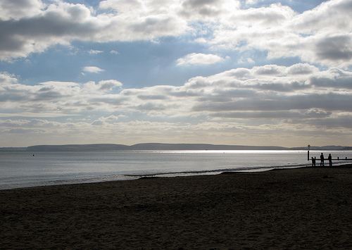
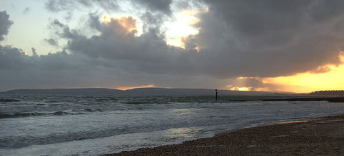
Bournemouth Destination Guide
Explore Bournemouth in United Kingdom
Bournemouth in the region of England with its 163,600 inhabitants is a town in United Kingdom - some 94 mi or ( 151 km ) South-West of London , the country's capital city .
Current time in Bournemouth is now 05:29 PM (Tuesday) . The local timezone is named " Europe/London " with a UTC offset of 0 hours. Depending on the availability of means of transportation, these more prominent locations might be interesting for you: Wimborne Minster, West Parley, Southampton, Reading, and Portsmouth. Since you are here already, make sure to check out Wimborne Minster . We encountered some video on the web . Scroll down to see the most favourite one or select the video collection in the navigation. Where to go and what to see in Bournemouth ? We have collected some references on our attractions page.
Videos
Bournemouth Trolleybuses
On April 20th 1969 Bournemouth closed its fine trolleybus system. The system had a number of features that were unusual. Christchurch High Street was too narrow for a conventional turning loop so trol ..
Sue Stone and Positive Thinking
Sue Stone describes how positive thinking transformed her life and gave her happiness. Sue Stone is a happiness and empowerment coach and author of Love Life, Live Life and the Happiness and Success V ..
The City - Ben Goddard
Ben Goddard's video for 'The City', taken from his NEW album, OUT NOW and available on iTunes. Directed by Ollie Robbins. Hearts & Arrows released 10th April 2010 itunes.apple.com ..
euro truck sim part 2
the second part of the journey ..
Videos provided by Youtube are under the copyright of their owners.
Interesting facts about this location
The Square, Bournemouth
The Square is a public square that marks the centre of Bournemouth, England. It has been almost totally pedestrianised since 2000. Prior to this it was a large roundabout.
Located at 50.72 -1.88 (Lat./Long.); Less than 0 km away
Bournemouth
Bournemouth is a large coastal resort town in the ceremonial county of Dorset, England. According to the mid-year estimates for 2010 from the Office for National Statistics, the town has a population of 168,100, making it the largest settlement in Dorset. It is also the largest settlement between Southampton and Plymouth. With Poole and Christchurch, Bournemouth forms the South East Dorset conurbation, which has a total population of approximately 400,000.
Located at 50.72 -1.88 (Lat./Long.); Less than 0 km away
Bournemouth (UK Parliament constituency)
Bournemouth is a former United Kingdom Parliamentary constituency. The seaside resort was created as a parliamentary borough in 1918 and the seat existed until it was divided in 1950. During the existence of the constituency it was the most south-westerly seat in Hampshire (although the border between Dorset and Hampshire was altered in the late twentieth century so the town was transferred to Dorset).
Located at 50.72 -1.88 (Lat./Long.); Less than 0 km away
Westover, Hampshire
Westover, Hampshire, is the ancient manor, now in Dorset, over which much of modern Bournemouth has developed. This area of land marked a historic boundary between Celtic and Saxon civilisations, which found expression as the county boundary between Hampshire to the east and Dorset to the west.
Located at 50.72 -1.88 (Lat./Long.); Less than 0 km away
St Peter's Church, Bournemouth
St Peter's Church is a Church of England parish church in Bournemouth in the English county of Dorset. The building, which is a Grade I listed building, was completed in 1879 to a design by G.E. Street as the founding mother church of Bournemouth. It has unusual paintings, notable stained glass and alabaster, and a renowned musical tradition. The chancel has been described as 'one of the richest Gothic Revival interiors in England'.
Located at 50.72 -1.88 (Lat./Long.); Less than 0 km away
Pictures


Related Locations
Information of geographic nature is based on public data provided by geonames.org, CIA world facts book, Unesco, DBpedia and wikipedia. Weather is based on NOAA GFS.