-
You are here:
- Homepage »
- United Kingdom »
- England » Longdendale

Longdendale Destination Guide
Delve into Longdendale in United Kingdom
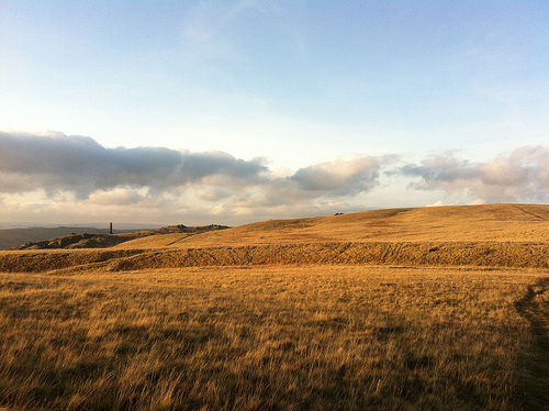
Longdendale in the region of England with its 8,873 residents is a city in United Kingdom - some 157 mi or ( 252 km ) North-West of London , the country's capital .
Current time in Longdendale is now 01:09 PM (Friday) . The local timezone is named " Europe/London " with a UTC offset of 0 hours. Depending on your travel modalities, these larger destinations might be interesting for you: Stockport, Sheffield, Rochdale, Oxford, and Oldham. While being here, make sure to check out Stockport . We encountered some video on the web . Scroll down to see the most favourite one or select the video collection in the navigation. Are you curious about the possible sightseeing spots and facts in Longdendale ? We have collected some references on our attractions page.
Videos
Soulmate In Every City Summer Channel
Soulmate In Every City Summer Channel, video made and edited by uk.youtube.com thanks again for watching :) ..
Manhattan Modification 20 Minutes of Gameplay
20 Minutes of Gameplay from BETA version 0.9.7.8b ..
MAN CITY WIN QPR 3 - 2 THE WINNING GOAL LIVE :13 May 2012.
MAN CITY WIN QPR 3 - 2 THE WINNING GOALS LIVE youtu.be with queen soundtrack we are the champions MCFC you make Mancunians happy today Roberto Mancini your a star ..
Glossop Football Train
Special Train from Glossop to Wembley for the FA Vase Final, 10 May 2009 ..
Videos provided by Youtube are under the copyright of their owners.
Interesting facts about this location
Longdendale Bypass
The Longdendale Bypass (also known as the A57/A628 Mottram-in-Longdendale, Hollingworth & Tintwistle Bypass) was a controversial road scheme in England (abandoned in March 2009) by the Highways Agency. The aim was to alleviate traffic congestion on the A57 road/A628 road/A616 road routes that presently pass through the villages.
Located at 53.47 -2.00 (Lat./Long.); Less than 0 km away
Hollingworth Reservoir
Hollingworth Reservoir is a former reservoir near Hollingworth, Tameside, Greater Manchester. The reservoir straddles the Greater Manchester–Derbyshire border. It was constructed in 1854 as part of the Longdendale Chain, but was abandoned in 1987 and now forms part of the Swallows Wood nature reserve. Reservoir to West Longdendale Chain Reservoir to East none Bottoms Reservoir
Located at 53.48 -1.99 (Lat./Long.); Less than 1 km away
Arnfield Reservoir
Arnfield Reservoir is a man-made lake in Longdendale in north Derbyshire. It was constructed in 1854 as part of the Longdendale chain to supply water from the River Etherow to the urban areas of Greater Manchester. Unlike the other reservoirs in the chain, Arnfield and Hollingworth Reservoir are not in the Etherow valley but lie in the valley of tributary brooks to the north and above (Arnfield lies around 1 mile from Bottoms Reservoir in the Longdendale Chain).
Located at 53.47 -1.98 (Lat./Long.); Less than 1 km away
Tintwistle Rural District
Tintwistle Rural District was a local government district in north east Cheshire, England from 1894 to 1974. It was created a rural district by the Local Government Act 1894 from the part of the Ashton-under-Lyne rural sanitary district which was in Cheshire. It consisted of the civil parishes of: Tintwistle Hattersley (until 1936) Matley (until 1936) Hattersley and Matley formed an exclave of the district.
Located at 53.47 -1.97 (Lat./Long.); Less than 2 km away
Matley
Matley is a semi-rural area of Greater Manchester, England. It is located in the Metropolitan Borough of Tameside between the towns of Stalybridge, Hyde and Dukinfield. Matley was a township of Mottram in Longdendale, one of the eight ancient parishes of the Macclesfield Hundred of Cheshire. Under the Poor Law Amendment Act 1886 the township became civil parish in its own right. Between 1894 and 1936 Matley was a civil parish in the Tintwistle Rural District of Cheshire.
Located at 53.47 -2.03 (Lat./Long.); Less than 2 km away
Pictures


Related Locations
Information of geographic nature is based on public data provided by geonames.org, CIA world facts book, Unesco, DBpedia and wikipedia. Weather is based on NOAA GFS.