-
You are here:
- Homepage »
- United States »
- California » Alta

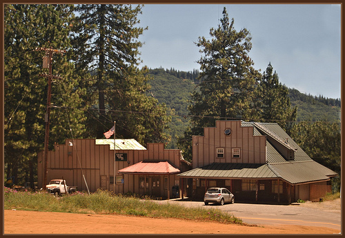
Alta Destination Guide
Explore Alta in United States
Alta in the region of California with its 610 inhabitants is a town in United States - some 2,325 mi or ( 3742 km ) West of Washington , the country's capital city .
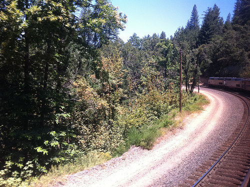
Current time in Alta is now 11:01 PM (Thursday) . The local timezone is named " America/Los Angeles " with a UTC offset of -7 hours. Depending on the availability of means of transportation, these more prominent locations might be interesting for you: Bear River Pines, Blue Canyon, Colfax, Emigrant Gap, and Fairfield. Since you are here already, make sure to check out Bear River Pines . We saw some video on the web . Scroll down to see the most favourite one or select the video collection in the navigation. Where to go and what to see in Alta ? We have collected some references on our attractions page.
Videos
Gold Mining Part 4 - Hydraulic Mining.wmv
Part 1 of the Hydraulic Gold Mining series. Featuring the devastation of the 1800's Hydraulic mining operations. A first hand look at an old sluice box and the Blue Lead along with some history and pi ..
Gold Mining pt 5 - Hydraulic Mining.wmv
Hydraulic Mining part 2 continued ..
Amtrak Train # 6 California Part 4 Tunnels
Ride the NYC-3.com Private Railroad Car in the California Mountains. Movie taken from the back of Amtrak's California Zephyr, through Donner Pass with plenty of tunnels. ..
Little house in the big woods.wmv
A little hiking & driving in the woods on a very rare summer California day. Drinking natural spring water straight from the ground right at the source tastes so delicious. When you buy bottled spring ..
Videos provided by Youtube are under the copyright of their owners.
Interesting facts about this location
Alta Dutch Flat Elementary School District
The Alta-Dutch Flat School District is a school district in Placer County, California. It currently maintains two schools, one in Alta, California and one in Emigrant Gap, California. Emigrant Gap Elementary School District was consolidated with Alta-Dutch Flat Elementary School District in 2001. Alta-Dutch Flat School was recognized as a California Distinguished School in 2004. Alta-Dutch Flat School had 8 teachers in 2005, a decrease from 11 in 2003.
Located at 39.21 -120.81 (Lat./Long.); Less than 0 km away
Nevada County, California
Nevada County is a county located in the Sierra Nevada of California, in the Mother Lode Country. As of 2010 its population was 98,764. The county seat is Nevada City.
Located at 39.30 -120.77 (Lat./Long.); Less than 11 km away
KVMR
KVMR is a progressive, independent radio station founded in 1978 in Nevada City, California. KVMR's coverage from its transmitter on nearby 3000' Banner Mountain includes the foothills of the Sierra Nevada mountain range in Northern California, as well as the Central Valley region around California's state capital, Sacramento. A translator on Mount Pluto covers much of the Truckee, California area and the northern end of the Lake Tahoe region at (105.1 FM).
Located at 39.25 -120.96 (Lat./Long.); Less than 14 km away
Emigrant Gap
Emigrant Gap is a gap in a ridge on the California Trail as it crosses the Sierra Nevada, to the west of what is now known as Donner Pass. Here the cliffs are so steep that, back in the 1840s, the pioneers on their way to California had to lower their wagons on ropes in order to continue. The Emigrant Gap was so named because it was a low gap on a ridge where the emigrants' wagons crossed from the American River drainage to the Bear River drainage.
Located at 39.30 -120.67 (Lat./Long.); Less than 16 km away
Nevada County Air Park
Nevada County Air Park is a county-owned public use airport in Nevada County, California, United States. The airport is located three nautical miles east of the central business district of Grass Valley, California. It is also known as Nevada County Airport. Although most U.S.
Located at 39.22 -121.00 (Lat./Long.); Less than 17 km away
Pictures
Related Locations
Information of geographic nature is based on public data provided by geonames.org, CIA world facts book, Unesco, DBpedia and wikipedia. Weather is based on NOAA GFS.