-
You are here:
- Homepage »
- United States »
- Ohio » Vandalia

Vandalia Destination Guide
Delve into Vandalia in United States
Vandalia in the region of Ohio with its 15,246 residents is a city in United States - some 388 mi or ( 625 km ) West of Washington , the country's capital .
Current time in Vandalia is now 07:33 AM (Friday) . The local timezone is named " America/New York " with a UTC offset of -4 hours. Depending on your travel modalities, these larger destinations might be interesting for you: Newport, Cincinnati, Columbus, Dayton, and Englewood. While being here, make sure to check out Newport . We encountered some video on the web . Scroll down to see the most favourite one or select the video collection in the navigation. Are you curious about the possible sightseeing spots and facts in Vandalia ? We have collected some references on our attractions page.
Videos
Inside the May 10, 2010 Oklahoma Tornado
A look inside the May 10, 2010 Oklahoma tornado ..
2008 Vectren Dayton Air Show -- F22 Slow Fly Over
F22 Raptor fly over at about 90knots. ..
Vandalia Butler Marching Band 2009 Journey of Man
Vandalia-Butler High School Marching Band 2009 show @ MSBA Championships at Kings High School. Total Score: 61.2 Class AA 12th place ..
2008 Vectren Dayton Air Show -- F22 Fast Fly Over
F22 fly over at about 600 knots, not full speed. ..
Videos provided by Youtube are under the copyright of their owners.
Interesting facts about this location
Butler High School (Vandalia, Ohio)
Butler High School is a public high school in Vandalia, Ohio, a suburb of Dayton. The school is the only high school in the Vandalia-Butler City Schools district. The school mascot is the aviator. Butler has been rated as "Excellent" since 2005 by the Ohio Department of Education. The school met all 12 of the state indicators for the 2005-2006 school year.
Located at 39.88 -84.20 (Lat./Long.); Less than 1 km away
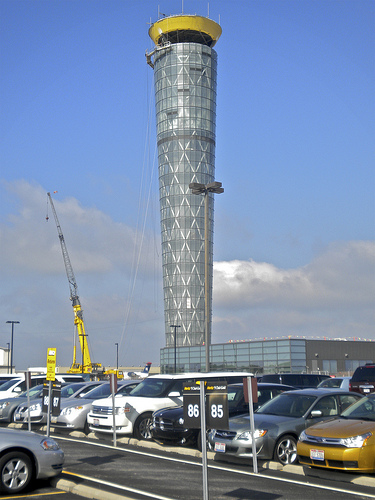
Dayton International Airport
James M. Cox Dayton International Airport, also referred to as simply Dayton International Airport, is a public airport located nine miles (14 km) north of the central business district of Dayton, a city in Montgomery County, Ohio, United States. The airport is owned and operated by the City of Dayton. The Dayton International Airport is the third busiest and third largest airport in Ohio behind Cleveland Hopkins International Airport and Port Columbus International Airport.
Located at 39.90 -84.22 (Lat./Long.); Less than 2 km away
WSWO-LP
WSWO-LP "Ultimate Oldies Radio" is a non-commercial low-power FM station at 97.5 MHz with a translator at 101.1 MHz licensed to Southwestern Ohio Public Radio Inc. in Huber Heights, Ohio.
Located at 39.89 -84.14 (Lat./Long.); Less than 5 km away
Phoneton, Ohio
Phoneton (also known as Phonetown) is an unincorporated community in southwestern Bethel Township, Miami County, Ohio, United States. It is part of the Dayton Metropolitan Statistical Area. At one time, it was the center of telephone communications in America. The AT&T Company (Bell System) placed a three-story brick building on the National Road in Phoneton to house the switchboards and operators to relay calls moving over its lines across the country.
Located at 39.90 -84.14 (Lat./Long.); Less than 5 km away
West Charleston, Ohio
West Charleston is an unincorporated community in western Bethel Township, Miami County, Ohio, United States. It was laid out in 1807 by Charles Friend and was at that time known as Friendtown. Notable early residents were John Newcomb, the first merchant, and Jack Schlosser, the first tavernkeeper. Also from West Charleston was the Hoagland family, developers of Royal Baking Powder. The business was later moved to the nearby city of Troy, Ohio, and later to New York City.
Located at 39.92 -84.13 (Lat./Long.); Less than 7 km away
Pictures
Related Locations
Information of geographic nature is based on public data provided by geonames.org, CIA world facts book, Unesco, DBpedia and wikipedia. Weather is based on NOAA GFS.