-
You are here:
- Homepage »
- Australia »
- New South Wales » Peak Hill

Peak Hill Destination Guide
Delve into Peak Hill in Australia
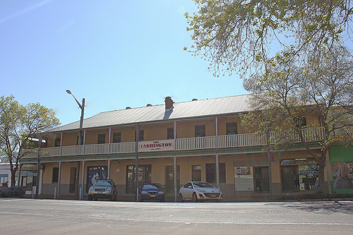
Peak Hill in the region of New South Wales with its 1,280 residents is located in Australia - some 185 mi or ( 297 km ) North of Canberra , the country's capital .
Local time in Peak Hill is now 10:15 AM (Sunday) . The local timezone is named " Australia/Sydney " with a UTC offset of 11 hours. Depending on your mobility, these larger destinations might be interesting for you: Tomingley West, Tomingley, Sydney City, Katoomba, and Canberra. While being here, you might want to check out Tomingley West . We discovered some clip posted online . Scroll down to see the most favourite one or select the video collection in the navigation. Are you curious about the possible sightseeing spots and facts in Peak Hill ? We have collected some references on our attractions page.
Videos
Peak Hill on The Newell Highway
A completely unofficial guide to the history of Peak Hill on the Newell Highway, in the Central West of NSW ..
Videos provided by Youtube are under the copyright of their owners.
Interesting facts about this location
Peak Hill, New South Wales
Peak Hill is a town in Parkes Shire in the Central West of New South Wales, Australia. At the 2006 census, Peak Hill had a population of 946 people. It is on the Newell Highway and the Dubbo to Parkes railway line, completed to Peak Hill in 1910. The first public wheat silo built in Australia was constructed at Peak Hill in 1918 after government surveys indicated the district had great potential as a wheat producing region.
Located at -32.72 148.18 (Lat./Long.); Less than 1 km away
Goobang National Park
Goobang is a national park in New South Wales, Australia, 296 km northwest of Sydney. It protects the largest remnant forest and woodland in the central west region of the state, where interior and coastal NSW flora and fauna species overlap. Originally named Hervey Range by John Oxley in 1817, the area was reserved in 1897 as state forest because of its importance as a timber resource, and was designated a national park in 1995.
Located at -32.69 148.34 (Lat./Long.); Less than 14 km away
Tomingley
Tomingley is a town in the Central West region of New South Wales, Australia. The town in in the Narromine Shire local government area and on the Newell Highway, 425 kilometres west of the state capital, Sydney and 54 kilometres south west of the regional centre of Dubbo. At the 2006 census, Tomingley had a population of 230.
Located at -32.57 148.23 (Lat./Long.); Less than 18 km away
Alectown, New South Wales
Alectown, New South Wales, Australia is a country town in Parkes Shire on the Newell Highway.
Located at -32.93 148.24 (Lat./Long.); Less than 24 km away
Pictures
Historical Weather
Related Locations
Information of geographic nature is based on public data provided by geonames.org, CIA world facts book, Unesco, DBpedia and wikipedia. Weather is based on NOAA GFS.