-
You are here:
- Homepage »
- Australia »
- New South Wales » Williamtown

Williamtown Destination Guide
Discover Williamtown in Australia
Williamtown in the region of New South Wales is a town located in Australia - some 231 mi or ( 372 km ) North-East of Canberra , the country's capital .
Local time in Williamtown is now 07:45 PM (Saturday) . The local timezone is named " Australia/Sydney " with a UTC offset of 11 hours. Depending on your flexibility, these larger cities might be interesting for you: Tomago, Tahlee, Sydney City, Stockton, and Raymond Terrace. When in this area, you might want to check out Tomago . We found some clip posted online . Scroll down to see the most favourite one or select the video collection in the navigation. Are you looking for some initial hints on what might be interesting in Williamtown ? We have collected some references on our attractions page.
Videos
Williamtown Air Show 2010 - F18 Hornet Solo Final Display
Final Flight Display - F/A-18A Hornet Solo Demo Bluray of the airshow videos available on request. PM me or email m171562@live.com ..
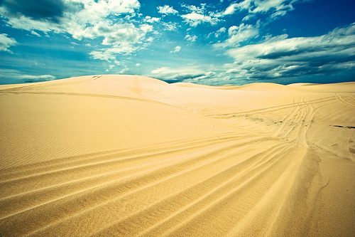
Camping at Stockton Beach
Camping at Stockton Beach between Lavis lane and Anna Bay. ..
Outback, Triton and Patrol on Stockton Beach
Trip to Stockton Beach, 2WD Triton getting stuck a lot and helped out by Patrol and Outback. ..
Quad Bikes on Stockton Sand Dunes
Come on your own adventure www.quadbikeking.com.au or 01 4919 0088 ..
Videos provided by Youtube are under the copyright of their owners.
Interesting facts about this location
Williamtown, New South Wales
Williamtown is a rural suburb of the Port Stephens local government area in the Hunter Region of New South Wales, Australia. It is located on the main road between Newcastle and Nelson Bay.
Located at -32.81 151.84 (Lat./Long.); Less than 1 km away
Fullerton Cove, New South Wales
Fullerton Cove is a rural suburb of the Port Stephens local government area in the Hunter Region of New South Wales, Australia, located just north of Fern Bay and adjacent to Fullerton Cove, from which the suburb gets its name. At the 2011 census the population of Fullerton Cove was 300. Like Fern Bay Fullerton Cove lies to the west of the Tasman Sea. Although the entire coastline is part of Stockton Beach there is no public access to the beach from Fullerton Cove.
Located at -32.84 151.83 (Lat./Long.); Less than 4 km away
MV Sygna
The MV Sygna was a 53,000 tonne Norwegian bulk carrier and now shipwreck on Stockton Beach in the Port Stephens LGA in New South Wales, Australia. The ship ran aground during a major storm on 26 May 1974 and the wreck has become an icon and landmark for the local area.
Located at -32.86 151.85 (Lat./Long.); Less than 5 km away
Worimi conservation lands
The Worimi conservation lands are located on and adjacent to Stockton Beach in New South Wales, Australia. They were created in February 2007 when Crown land at Stockton Bight was granted to the Worimi Local Aboriginal Land Council. The lands were then leased back to the NSW Government as three conservation reserves covering an area of 4,436 ha . Day to day management of the Worimi conservation lands is undertaken by the NSW National Parks and Wildlife Service.
Located at -32.82 151.92 (Lat./Long.); Less than 7 km away
Salt Ash, New South Wales
Salt Ash is a rural suburb of the Port Stephens local government areas in the Hunter Region of New South Wales, Australia. It is located on the main road between Newcastle and Nelson Bay but is largely undeveloped, partly because it is the location of the Salt Ash Air Weapons Range which is used by pilots from RAAF Base Williamtown for training purposes. The southern border of Salt Ash is occupied entirely by Stockton Beach.
Located at -32.79 151.92 (Lat./Long.); Less than 7 km away
Pictures
Historical Weather
Related Locations
Information of geographic nature is based on public data provided by geonames.org, CIA world facts book, Unesco, DBpedia and wikipedia. Weather is based on NOAA GFS.