
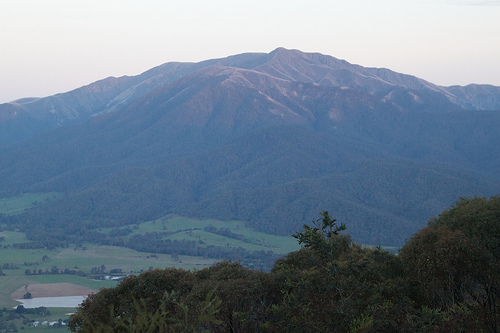
Explore Tawonga in Australia
Tawonga in the region of Victoria is a town in Australia - some 148 mi or ( 237 km ) South-West of Canberra , the country's capital city .
Current time in Tawonga is now 01:49 AM (Thursday) . The local timezone is named " Australia/Melbourne " with a UTC offset of 11 hours. Depending on the availability of means of transportation, these more prominent locations might be interesting for you: Wandiligong, Mongans Bridge, Melbourne, Katoomba, and Kancoona. Since you are here already, make sure to check out Wandiligong . We encountered some video on the web . Scroll down to see the most favourite one or select the video collection in the navigation. Where to go and what to see in Tawonga ? We have collected some references on our attractions page.
Videos
Chilli Yabby Singapore Style
From the Vault, 1994 Andrew cooks Singapore style Chilli Yabby on the open fire. ..
Roast Lamb from 1994
From the archives, Andrew cooks Roast Lamb for Brigitte Adams. Originally filmed for Channel 7's The Great Outdoors, which was broadcast Prime Time Friday evenings at 7.30pm. Andrew went on to record ..
Mt Beauty. Motorcycling Holiday
AUSTRALIAN SNOWY MOUNTAIN ROADS. Assorted motorbikes +BMW M3. ..
Chooka's Pride
Chooka flying his RC Skim-a-dair ..
Videos provided by Youtube are under the copyright of their owners.
Interesting facts about this location
Mount Beauty, Victoria
Mount Beauty is a town in Victoria, Australia. It is in the Alpine Shire local government area. The town was originally established by the State Electricity Commission of Victoria to house construction workers from the Kiewa Hydroelectric Scheme in 1949, passing to the control of the local shire council in 1967 after construction was completed. Post Offices opened at Tawonga South (to the north) on 15 April 1943 and at Mount Beauty on 17 February 1947.
Located at -36.73 147.17 (Lat./Long.); Less than 5 km away
Tawonga, Victoria
Tawonga is a town in north east Victoria, Australia. The town is located on the Kiewa Valley Highway, in the Alpine Shire local government area, 350 kilometres north east of the state capital, Melbourne. At the 2006 census, Tawonga had a population of 289. Tawonga Post Office opened on 4 October 1879.
Located at -36.63 147.10 (Lat./Long.); Less than 7 km away
Kiewa Hydroelectric Scheme
The Kiewa Hydroelectric Scheme is the largest hydro-electric scheme in Victoria and the second largest in mainland Australia after the Snowy Mountains Scheme. The scheme is situated in the Australian Alps in north-eastern Victoria about 200 km from Melbourne and is wholly owned by AGL Energy. The scheme was originally constructed between 1938 and 1961 by the State Electricity Commission of Victoria although it was privatised in the 1990s.
Located at -36.81 147.23 (Lat./Long.); Less than 15 km away
Wandiligong
Wandiligong is a town in north-eastern Victoria, Australia. The town is located on Morses Creek and in the Alpine Shire local government area, 6 kilometres south of Bright and 330 kilometres north east of the state capital, Melbourne. At the 2006 census, Wandiligong had a population of 281. Wandiliong was established in the 1850s during the Victorian gold rush and at one stage the town was home to 2,000 people.
Located at -36.76 146.98 (Lat./Long.); Less than 16 km away
Shire of Bright
The Shire of Bright was a local government area about 280 kilometres east-northeast of Melbourne, the state capital of Victoria, Australia. The shire covered an area of 3,108 square kilometres, and existed from 1862 until 1994.
Located at -36.73 146.97 (Lat./Long.); Less than 16 km away
Pictures
Historical Weather
Related Locations
Information of geographic nature is based on public data provided by geonames.org, CIA world facts book, Unesco, DBpedia and wikipedia. Weather is based on NOAA GFS.