-
You are here:
- Homepage »
- Belgium »
- Walloon Region » Moresnet

Moresnet Destination Guide
Delve into Moresnet in Belgium
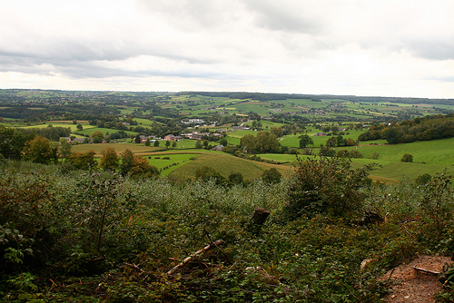
Moresnet in the region of Walloon Region is located in Belgium - some 72 mi or ( 116 km ) East of Brussels , the country's capital .
Local time in Moresnet is now 02:47 AM (Wednesday) . The local timezone is named " Europe/Brussels " with a UTC offset of 1 hours. Depending on your mobility, these larger destinations might be interesting for you: Vaals, Simpelveld, The Hague, Haarlem, and Amsterdam. While being here, you might want to check out Vaals . We discovered some clip posted online . Scroll down to see the most favourite one or select the video collection in the navigation. Are you curious about the possible sightseeing spots and facts in Moresnet ? We have collected some references on our attractions page.
Videos
Aachen Germany
Kent Germany vacation in fall of 2010. UNESCO Historical City of Aachen. ..
GPS logger for Windows Phone 7 (WP7) preview
Alpha version of the GPS logger I'm writing. Needs another name. ..
CAN'T TAKE IT WITH YOU WHEN YOU DIE ! The Trailer
MAY 2009 : German outlaw illustrator Christoph Mueller invited American blues and gospel maverick Reverend Deadeye to stop by his hometown, the city of Aachen during the reverend's last european tour. ..
Aachen Hbf 13.12.2008
Der Aachener Hbf an einem Samstag. ..
Videos provided by Youtube are under the copyright of their owners.
Interesting facts about this location
Neutral Moresnet
Neutral Moresnet was a tiny Belgian-Prussian condominium that existed from 1816 to 1920 between present-day Belgium and Germany. Its northernmost border point at the Vaalserberg connected it to a quadripoint shared additionally with the Dutch Province of Limburg, which today is known as the "Three Country Point". Prior to Belgian independence in 1830, the territory was a Dutch-Prussian condominium.
Located at 50.73 6.01 (Lat./Long.); Less than 2 km away
Quadripoint
A quadripoint is a point on the Earth that touches the border of four distinct territories. The term has never been in common use — it may not have been used before 1964 by the Office of the Geographer of the United States Department of State.
Located at 50.75 6.02 (Lat./Long.); Less than 4 km away
Vaals
Vaals is a town in the extreme southeastern part of the Dutch province of Limburg, which in its turn finds itself in the southeastern part of the Netherlands. The municipality covers an area of 23.90 km² in the foothills of the Ardennes–Eifelrange and is located about 23 km east of Maastricht and 5 km west of the city centre of Aachen. It borders on both Belgium and Germany. The three borders meet on the Drielandenpunt, a few meters from the highest point of the Netherlands, the Vaalserberg.
Located at 50.77 6.02 (Lat./Long.); Less than 5 km away
Hauset
Hauset is a village in the Belgian municipality of Raeren into the German-speaking Community of Belgium with around 1700 inhabitants. The village is around 260m over Mean Sea Level, along the small river Geul and borders the Forest of Aachen. The population is German speaking and is about half of German citizens who come from the Aachen region. Hauset is on the border to Germany, close to Aachen. Adjacent Belgian villages are Hergenrath, Walhorn and Eynatten.
Located at 50.71 6.07 (Lat./Long.); Less than 6 km away
Eynatten
Eynatten is a village in the Belgian municipality of Raeren into the German-speaking Community of Belgium. Eynatten is on the border to Germany, 6 km south from Aachen. Around half of the population are foreigners, most of them Germans. Eynatten is located on route N68 between Aachen, Germany and the German speaking Belgian town of Eupen. Eupen is around 7.5 km to the southwest. Frequent bus services run between Aachen and Eupen, stopping at various places in Eynatten en route.
Located at 50.70 6.07 (Lat./Long.); Less than 6 km away
Pictures


Historical Weather
Related Locations
Information of geographic nature is based on public data provided by geonames.org, CIA world facts book, Unesco, DBpedia and wikipedia. Weather is based on NOAA GFS.