-
You are here:
- Homepage »
- Czech Republic »
- South Moravian Region » Ricmanice

Ricmanice Destination Guide
Discover Ricmanice in Czech Republic
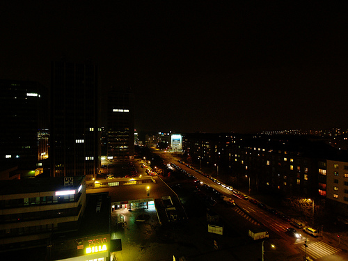
Ricmanice in the region of South Moravian Region with its 656 habitants is a place located in Czech Republic - some 117 mi or ( 188 km ) South-East of Prague , the country's capital .
Local time in Ricmanice is now 05:36 AM (Monday) . The local timezone is named " Europe/Prague " with a UTC offset of 1 hours. Depending on your mobility, these larger cities might be interesting for you: Vienna, Sankt Pölten, Mödling, Berlin, and Budapest. When in this area, you might want to check out Vienna . We discovered some clip posted online . Scroll down to see the most favourite one or select the video collection in the navigation. Are you looking for some initial hints on what might be interesting in Ricmanice ? We have collected some references on our attractions page.
Videos
Tram nr. 4 _T3R_1615 Raketa
Odjezd Rakety z maloměřické smyčky za mostem. Páteční služba se sluníčkem i krátkými přeháňkami byla nakonec na 1/4 příjemná. ..
Železniční most nad Svitavou v Obřanech
Spěšný vlak uhání po vysokém mostě nad Svitavou směrem od Kuřimi a Lesné na Hlavní nádraží v Brně. Vlaky objíždí celé Brno pěkně dokola a tak se dají využít i jako rychlá doprava skrz město. ..
Antea in the Bull Rock Cave 2011 Documentary
Short documentary about concert in the cave called the Bull Rock (Býčí skála) in Moravian Karst, Czech Republic. Song that Antea performed is called Te Deum from the musical Bastard, written by Zdeněk ..
Tram K2, Line 4_Stanice Konečná.
Na konečné čtverky v Obřanech. Fotogalerie v tramvaji : Evropské hry handicapované mládeže Brno 2011 a vystavené fotografie jsou z Her handicapované mládeže 2010 v Brně. Možná si lidi v zaplněné šalin ..
Videos provided by Youtube are under the copyright of their owners.
Interesting facts about this location
Moravian Karst
The Moravian Karst is a karst landscape and protected nature reserve to the north of Brno in the eastern part of the Czech Republic, located near the town of Blansko. It encompasses a number of notable geological features, including roughly 1100 caverns and gorges and covers an area of roughly 92 km². Currently, four of the cave systems are open for public tours and exploration.
Located at 49.28 16.73 (Lat./Long.); Less than 4 km away
Býčí skála Cave
Býčí skála Cave (in Czech Býčí skála, in English The Bull Rock Cave) is part of the second longest cave system in the Czech Republic. It is also famous for archaeological findings. Except for the entrance the cave is not accessible to the public. Infrequently it gets opened for the visitors. The cave is located in the central part of Moravian Karst, in Josefovské Valley (Josefovské údolí) between the town Adamov and village Křtiny.
Located at 49.31 16.69 (Lat./Long.); Less than 6 km away
Křtiny (Blansko District)
Křtiny is a market town (městys) in Blansko District, South Moravian Region, Czech Republic, lying on boundary of the Moravian Karst nature reserve. It has 792 inhabitants (2006). The town is an old Marian pilgrimage site (administered by the Premonstratensians) and is dominated by a Baroque pilgrim complex; the original project by Jan Santini Aichel was modified during construction and was not fully completed.
Located at 49.30 16.75 (Lat./Long.); Less than 6 km away
Stadion Za Lužánkami
The Stadion Za Lužánkami is a currently inactive stadium in Brno, Czech Republic. It was primarily used for football, and was the home ground of FC Zbrojovka Brno. It held 50,000 people. The stadium was constructed 1949-1953 and in the 1960s-1970s was the biggest stadium in Czechoslovakia. Za Lužánkami holds the record for the highest attendance in the Gambrinus liga, set in a match in the 1996–97 Gambrinus liga between Brno and Slavia Prague. It was closed in 2001 after 1.
Located at 49.21 16.61 (Lat./Long.); Less than 8 km away
Villa Tugendhat
Villa Tugendhat is a historical building in the wealthy neighbourhood of Černá Pole in Brno, Czech Republic. It is one of the pioneering prototypes of modern architecture in Europe, and was designed by the German architect Ludwig Mies van der Rohe. Built of reinforced concrete between 1928-1930 for Fritz Tugendhat and his wife Greta, the villa soon became an icon of modernism.
Located at 49.21 16.62 (Lat./Long.); Less than 8 km away
Pictures

Historical Weather
Related Locations
Information of geographic nature is based on public data provided by geonames.org, CIA world facts book, Unesco, DBpedia and wikipedia. Weather is based on NOAA GFS.