
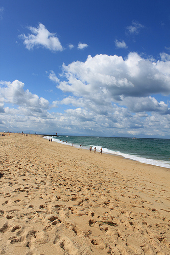
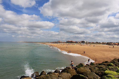
Touring Tosse in France
Tosse in the region of Aquitaine with its 1,820 citizens is located in France - some 398 mi or ( 640 km ) South-West of Paris , the country's capital city .
Time in Tosse is now 11:42 AM (Wednesday) . The local timezone is named " Europe/Paris " with a UTC offset of 1 hours. Depending on your budget, these more prominent places might be interesting for you: Vieux-Boucau-les-Bains, Tarnos, Saint-Martin-de-Seignanx, Saint-Martin-de-Hinx, and Saint-Geours-de-Maremne. Being here already, consider visiting Vieux-Boucau-les-Bains . We collected some hobby film on the internet . Scroll down to see the most favourite one or select the video collection in the navigation. Check out our recommendations for Tosse ? We have collected some references on our attractions page.
Videos
Surf Factory Outlets in Soorts - Hossegor
The heart of the european surf industrie beats at the atlantic coast of south france, in a small industrial area near Soorts - Hossegor. All the big players of the surf industrie have their Europe Bas ..
Französisches Baskenland
Impressions from a trip through the Basque country in France. Eindrücke von einer Reise durch das Baskenland in Frankreich ..
yt3d Seignosse dans les Landes , France
Seignosse dans les Landes ,Lacs, Forêts, plages, coucher de Soleil, surf, France ..
Left time
Décembre 2011, surf session de Rudy Marechal et son ami Arnaud Darrigade. ..
Videos provided by Youtube are under the copyright of their owners.
Interesting facts about this location
Boudigau
The Boudigau is a coastal river of the Landes, in Aquitaine, Southwest France. It collects waters of the Orx marsh, in Maremne, and flows north behind the dunes fronting the Atlantic Ocean. It flows into the sea, between Capbreton and Hossegor, through the old estuary of the Adour, an estuary which is shared by another coastal river, the Bourret. Owing to this estuary, Capbreton is the only port between Bayonne and Arcachon. Formerly a fishing port, Capbreton is today more of a resort.
Located at 43.65 -1.45 (Lat./Long.); Less than 10 km away
Luy
The Luy, is a left tributary of the Adour, in the Landes, in the Southwest of France.
Located at 43.66 -1.14 (Lat./Long.); Less than 16 km away
Bec du Gave
Bec du Gave, or Bec-des-Gaves, is the point at which the Gavis Réunis stream meets the Adour River in France. The Chateau du Bec du Gavehttp://translate. google. com/translate?hl=en&sl=fr&u=http://www. port-de-lanne. fr/chateau. html&ei=6rirS9LCHsX7lwfx8-m0Dg&sa=X&oi=translate&ct=result&resnum=3&ved=0CBAQ7gEwAg&prev=/search%3Fq%3DCh%25C3%25A2teau%2Bdu%2BBec%2Bdu%2BGave%26hl%3Den is located nearby. Nearest village is Port-de-Lanne.
Located at 43.55 -1.19 (Lat./Long.); Less than 19 km away
Gaves réunis
The Gaves réunis is a 9.4 km river in southwestern France connecting Peyrehorade to the Adour at Bec du Gave. It is formed by the confluence of the Gave de Pau and the Gave d'Oloron.
Located at 43.55 -1.19 (Lat./Long.); Less than 19 km away
Gave de Pau
The Gave de Pau is a river of south-western France and a left tributary of the Adour. It takes its name from the city Pau, through which it flows. The river is 180 kilometres in length, and its source is at the Cirque de Gavarnie in the Pyrenees mountains. The Gave de Pau receives its main tributary, the Gave d'Oloron in Peyrehorade. The 10 km stretch between the mouth of the Gave d'Oloron and the confluence with the Adour is called Gaves Réunis (united Gaves).
Located at 43.55 -1.19 (Lat./Long.); Less than 19 km away
Pictures

Related Locations
Information of geographic nature is based on public data provided by geonames.org, CIA world facts book, Unesco, DBpedia and wikipedia. Weather is based on NOAA GFS.