-
You are here:
- Homepage »
- France »
- Basse-Normandie » La Cambe

La Cambe Destination Guide
Discover La Cambe in France
La Cambe in the region of Basse-Normandie with its 542 habitants is a town located in France - some 155 mi or ( 250 km ) West of Paris , the country's capital .
Local time in La Cambe is now 03:40 AM (Thursday) . The local timezone is named " Europe/Paris " with a UTC offset of 1 hours. Depending on your flexibility, these larger cities might be interesting for you: London, Cambridge, Bristol, Birmingham, and Vierville-sur-Mer. When in this area, you might want to check out London . We found some clip posted online . Scroll down to see the most favourite one or select the video collection in the navigation. Are you looking for some initial hints on what might be interesting in La Cambe ? We have collected some references on our attractions page.
Videos
Charme & Traditions - château de Colombières
Visite virtuelle de la propriété 'château de Colombières' plus d'informations sur www.charme-traditions.com ..
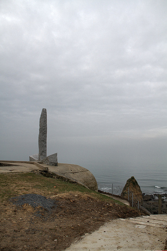
World Peace Statue, Grandchamp-Maisy, Normandy
Perhaps the most beautiful memorial in all of Normandy the World Peace Statue, located in Granchamp-Maisy, a small village close to Pointe du Hoc. As a relatively new memorial it did not feature in an ..
Adelphoi: Visit Brittany Commercial
We composed a beautiful and calm piano track to reflect the changing emotions of one man's visit to Brittany. Project: Visit Brittany Production Company: Imagination Director: Daryl Goodrich ..
La Cambe German Cemetery, Calvados, Basse Normandie, France
There are over 21000 German personnel of World War II laid to rest in this cemetery which is not far from Bayeux. The site is managed by the German War Graves Commission. From www.a-motorhome-on-tour. ..
Videos provided by Youtube are under the copyright of their owners.
Interesting facts about this location
La Cambe German war cemetery
La Cambe is a military war grave cemetery, located close to Bayeux, France. Presently containing in excess of 21,000 German military personnel of World War II, it is maintained and managed by the German War Graves Commission.
Located at 49.34 -1.03 (Lat./Long.); Less than 1 km away
Deux Jumeaux Airfield
Deux Jumeaux Airfield is an abandoned World War II military airfield, which is located near the commune of Deux Jumeaux in the Basse-Normandie region of northern France.
Located at 49.34 -0.98 (Lat./Long.); Less than 2 km away
Cricqueville Airfield
Cricqueville Airfield is an abandoned World War II military airfield, which is located near the commune of Cricqueville-en-Bessin in the Basse-Normandie region of northern France.
Located at 49.37 -1.01 (Lat./Long.); Less than 2 km away
Cardonville Airfield
Cardonville Airfield is an abandoned World War II military airfield located near the commune of Cardonville in the Basse-Normandie region of northern France.
Located at 49.35 -1.04 (Lat./Long.); Less than 3 km away
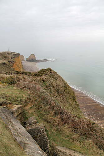
Pointe du Hoc
Pointe du Hoc is a clifftop location on the coast of Normandy in northern France. It is situated between Utah Beach to the west and Omaha Beach to the east, and stands on 100 ft (30 m) tall cliffs overlooking the sea. Marking the Western end of the Omaha beach sector, it was a point of attack by the United States Army Ranger Assault Group during Operation Overlord in World War II.
Located at 49.40 -0.99 (Lat./Long.); Less than 6 km away
Pictures

Related Locations
Information of geographic nature is based on public data provided by geonames.org, CIA world facts book, Unesco, DBpedia and wikipedia. Weather is based on NOAA GFS.