
Delve into Roz-sur-Couesnon in France
Roz-sur-Couesnon in the region of Bretagne with its 1,038 residents is located in France - some 181 mi or ( 291 km ) West of Paris , the country's capital .
Local time in Roz-sur-Couesnon is now 04:23 AM (Wednesday) . The local timezone is named " Europe/Paris " with a UTC offset of 1 hours. Depending on your mobility, these larger destinations might be interesting for you: London, Cambridge, Bristol, Birmingham, and Vannes. While being here, you might want to check out London . We discovered some clip posted online . Scroll down to see the most favourite one or select the video collection in the navigation. Are you curious about the possible sightseeing spots and facts in Roz-sur-Couesnon ? We have collected some references on our attractions page.
Videos
How to Get out of Quicksand
Our very capable guide shows us how to get out of quicksand on the walk across the bay to Mont St. Michel. ..
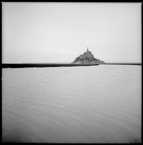
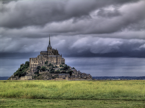
Mont Saint Michel - Normandy, France
France's Mont Saint Michel is an international treasure. The shrine to the Arch Angel Micheal was begun in 708. Today this extraordinary island is visited by 3 and one half million people each year. W ..
The Island Cathedral: Le Mont Saint Michel
Photos taken of Le Mont Saint Michel in June, 2008 ..
Sables Mouvants Mont Saint Michel
Démonstration de sables mouvants au Mont Saint Michel. Traversée de la baie organisée par Stéphane GUENO guide de la baie www.sport-evasion-fr.com ..
Videos provided by Youtube are under the copyright of their owners.
Interesting facts about this location
Couesnon
The Couesnon River is a river running from the département of Mayenne in north-western France, forming an estuary at Mont Saint-Michel. Its final stretch forms the border between the historical duchies of Normandy and Brittany.
Located at 48.62 -1.51 (Lat./Long.); Less than 7 km away
Pontorson Airfield
Pontorson Airfield is an abandoned World War II military airfield, which is located near the commune of Pontorson in the Basse-Normandie region of northern France. Located just outside of Pontorson (likely to the northeast), the United States Army Air Force established a temporary airfield on 7 August 1944, shortly after the Allied landings in France The airfield was constructed by the IX Engineering Command, 819th Engineer Aviation Battalion.
Located at 48.54 -1.50 (Lat./Long.); Less than 9 km away
Tombelaine
Tombelaine is a small tidal island off the coast of Normandy in France. It lies a few kilometres north of Mont Saint-Michel. At low tide the island can be reached on foot (with a guide) from the coast of Cotentin, 3.5 km to the north-east, and from Mont Saint-Michel. The island lies just to the south of the course of the Sélune river, which has to be forded to access the island from Cotentin. The island is 250 metres by 150 metres, and 45 metres high. It is composed of granite.
Located at 48.66 -1.51 (Lat./Long.); Less than 10 km away
Menhir de Champ-Dolent
The menhir of Champ Dolent is the largest menhir erected in Brittany. Located in the city of Dol-de-Bretagne, it measures nearly 10 m high. It has been registered as a monument historique by the French Ministry of Culture since 1889.
Located at 48.53 -1.74 (Lat./Long.); Less than 12 km away
Gare de Dol-de-Bretagne
Gare de Dol-de-Bretagne is a railway station serving the town Dol-de-Bretagne, Ille-et-Vilaine department, western France. The station is situated on the Rennes–Saint-Malo and the Lison–Lamballe railways.
Located at 48.54 -1.75 (Lat./Long.); Less than 13 km away
Pictures

Related Locations
Information of geographic nature is based on public data provided by geonames.org, CIA world facts book, Unesco, DBpedia and wikipedia. Weather is based on NOAA GFS.