-
You are here:
- Homepage »
- France »
- Franche-Comte » Ronchamp

Ronchamp Destination Guide
Discover Ronchamp in France
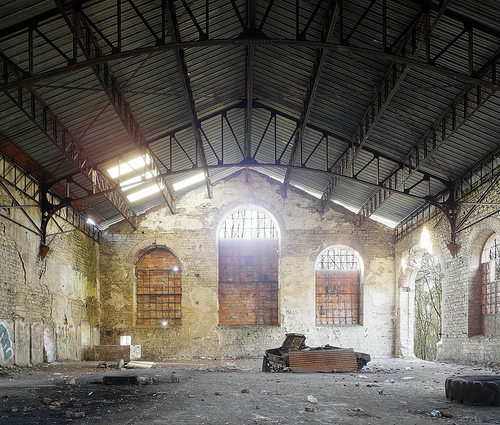
Ronchamp in the region of Franche-Comté with its 3,086 habitants is a town located in France - some 213 mi or ( 342 km ) East of Paris , the country's capital .
Local time in Ronchamp is now 09:05 PM (Tuesday) . The local timezone is named " Europe/Paris " with a UTC offset of 1 hours. Depending on your flexibility, these larger cities might be interesting for you: Berne, Basel, Brussels, Strasbourg, and Saint-Germain. When in this area, you might want to check out Berne . We found some clip posted online . Scroll down to see the most favourite one or select the video collection in the navigation. Are you looking for some initial hints on what might be interesting in Ronchamp ? We have collected some references on our attractions page.
Videos
NOTRE DAME DU HAUT DE RONCHAMP-1.avi
mi-cha-el.livejournal.com ..
Cracheur de feu @ soirée hardstyle
Pour la première fois, maron city organise une soirée à deux scènes. Une scène scène Soft "Alpha" - house electro trance - et une scène Hard "Omega" - hardtrance hardstyle hardcore. Le principe est de ..
Balade contée
Franches Conteries 2008 Festival des arts du récit de Lure & alentours Haute-Saône - France bande son : "Danse avec le Diable" (texte par Hervé Thiry-Duval - musique originale) Chanson interprétée par ..
Ronchamp Lkjr77's photos around Ronchamp, France (ronchamp chapel of notre dame)
Preview of Lkjr77's blog at TravelPod. Read the full blog here: www.travelpod.com This blog preview was made by TravelPod using the TripAdvisor™ TripWow slideshow creator. Learn more about these video ..
Videos provided by Youtube are under the copyright of their owners.
Interesting facts about this location
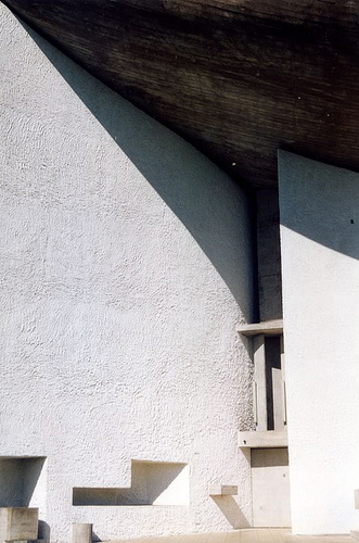
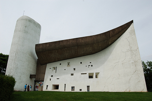
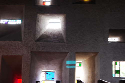
Notre Dame du Haut
The chapel of Notre Dame du Haut in Ronchamp (French: Chapelle Notre-Dame-du-Haut de Ronchamp), completed in 1954, is one of the finest examples of the architecture of Franco-Swiss architect Le Corbusier and one of the most important examples of twentieth-century religious architecture.
Located at 47.70 6.62 (Lat./Long.); Less than 1 km away
Lac de Malsaucy
Lac de Malsaucy is a lake in the Territoire de Belfort, Franche-Comté, France. The lake with a surface of is 0.64 km² shared by three communes: Evette-Salbert, Lachapelle-sous-Chaux and Sermamagny. The rock festival Eurockéennes is held each July on a peninsula on the lake.
Located at 47.69 6.80 (Lat./Long.); Less than 12 km away
Lanterne river
The Lanterne is a river in the east of France, a substantial left tributary of the Saône, and sub-tributary of the Rhône.
Located at 47.80 6.54 (Lat./Long.); Less than 13 km away
Fort du Salbert
Fort du Salbert, also known as Fort Lefebvre, was built between 1874 and 1877. It was named after General François Joseph Lefebvre. It forms part of the Séré de Rivières system fortifications in the fortified region of Belfort in northeastern France. It is located at the summit of Salbert hill to the northwest of Belfort. During the early years of the Cold War it briefly served as an air defense coordination center.
Located at 47.66 6.82 (Lat./Long.); Less than 14 km away
Belfort Gap
The Belfort Gap (French: Trouée de Belfort) or Burgundian Gate is a plateau located between the northern rim of the Jura Mountains and the southernmost part of the Vosges in France. It marks the divide between the drainage basins of the Rhine River in the east and that of the Rhône in the west, part of the European Watershed between the North Sea and the Mediterranean Sea.
Located at 47.57 6.75 (Lat./Long.); Less than 17 km away
Pictures
Historical Weather
Related Locations
Information of geographic nature is based on public data provided by geonames.org, CIA world facts book, Unesco, DBpedia and wikipedia. Weather is based on NOAA GFS.