-
You are here:
- Homepage »
- France »
- Haute-Normandie » Bourg-Achard

Bourg-Achard Destination Guide
Explore Bourg-Achard in France
Bourg-Achard in the region of Haute-Normandie with its 2,652 inhabitants is a town in France - some 77 mi or ( 125 km ) North-West of Paris , the country's capital city .
Current time in Bourg-Achard is now 03:34 AM (Wednesday) . The local timezone is named " Europe/Paris " with a UTC offset of 1 hours. Depending on the availability of means of transportation, these more prominent locations might be interesting for you: London, The Hague, Haarlem, Brussels, and Rouen. Since you are here already, make sure to check out London . We encountered some video on the web . Scroll down to see the most favourite one or select the video collection in the navigation. Where to go and what to see in Bourg-Achard ? We have collected some references on our attractions page.
Videos
SHIPS ON SEINE
A small town along the bent of the river, between Rouen and the Channel, ships going up and downstream. The ferry boldly crosses this traffic. En aval de Rouen, les cargos et les péniches négocient la ..
La mère L'Amour, star de Duclair
A Duclair, vous pouviez pas la louper la mère L'Amour. Portrait de star... ..
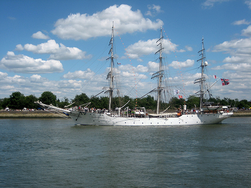
Creoula.
Portuguese ship on the Seine on its way to Rouen to participate in the Armada on the 14th of July. ..
Grande Parade 08 Armada CUAUHTEMOC
La grande parade ARMADA 2008 passe par LA BOUILLE! 14/07/08 ..
Videos provided by Youtube are under the copyright of their owners.
Interesting facts about this location
Roumois
The Roumois is a region in the northwestern part of the Eure département in Normandy, France. It is a plateau situated southwest of Rouen. Its northern boundary is the Seine downstream of Elbeuf, its western boundary is the Risle valley. The plain of Le Neubourg lies to the south. The main towns of the Roumois are Bourg-Achard and Bourgtheroulde-Infreville. The landscape is similar to that of the Pays de Caux on the north side of the Seine.
Located at 49.36 0.76 (Lat./Long.); Less than 4 km away
Jumièges Abbey
Jumièges Abbey was a Benedictine monastery, situated in the commune of Jumièges in the Seine-Maritime département, in Normandy, France.
Located at 49.43 0.82 (Lat./Long.); Less than 9 km away
Château de Robert-le-Diable
The Château de Robert-le-Diable is a French feudal castle from the time of the Dukes of Normandy. It is more properly, though less commonly, known as the Château de Moulineaux. It is situated at Moulineaux, near Rouen, in the département of Seine-Maritime at the side of the A13 autoroute. It takes its name from Robert the Devil who, according to some, was Robert de Montgommery, also known as Robert le Magnifique ('the magnificent'), Duke of Normandy and father of William the Conqueror.
Located at 49.34 0.96 (Lat./Long.); Less than 11 km away
Forêt de Rouvray
The once vast Forêt de Rouvray ("Forest of Rouvray", from Gallo-Romance “oak wood″ or more probably French rouvre “sessile oak” and old suffix -ey, meaning a “collection of the same trees”) was a forest that extended from west of Paris in the Île-de-France region westwards into Normandy, virtually unbroken, threaded by the winding loops of the River Seine, traversed by forest traces and dotted with isolated woodland hamlets, as far as Rouen.
Located at 49.33 1.00 (Lat./Long.); Less than 13 km away
Rouen-Les-Essarts
Rouen-Les-Essarts was a 6.542 km motor racing circuit in Grand-Couronne, near Rouen, France. From its opening in 1950, Rouen-Les-Essarts was recognized as one of Europe's finest circuits, with modern pits, a wide track, and spectator grandstands.
Located at 49.33 1.00 (Lat./Long.); Less than 14 km away
Pictures
Historical Weather
Related Locations
Information of geographic nature is based on public data provided by geonames.org, CIA world facts book, Unesco, DBpedia and wikipedia. Weather is based on NOAA GFS.