-
You are here:
- Homepage »
- France »
- Rhone-Alpes » La Roche-sur-Foron

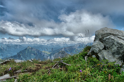
La Roche-sur-Foron Destination Guide
Discover La Roche-sur-Foron in France
La Roche-sur-Foron in the region of Rhône-Alpes with its 10,026 habitants is a town located in France - some 267 mi or ( 430 km ) South-East of Paris , the country's capital .
Local time in La Roche-sur-Foron is now 04:02 PM (Sunday) . The local timezone is named " Europe/Paris " with a UTC offset of 1 hours. Depending on your flexibility, these larger cities might be interesting for you: Geneva, Berne, Viuz-en-Sallaz, Villaz, and Saint-Sixt. When in this area, you might want to check out Geneva . We found some clip posted online . Scroll down to see the most favourite one or select the video collection in the navigation. Are you looking for some initial hints on what might be interesting in La Roche-sur-Foron ? We have collected some references on our attractions page.
Videos
Downhill Mtb in Mont Chery, Les gets 2010
Oscar and I decided to make a movie about Timothy riding a local, non-marked trail on Mont Chery, Les Gets, France. It's a steep and loose track, but still really fast. It ends up in the black marked ..
La fusée pressée
Plus aboutie que la premiere vidéo, elle intègre cette fois de la musique, mais aussi notre label, Room 11 Pictures, et des titres et générique plus élaboré. Admirez =D ! ..
Vieil Annecy et croisière sur le lac (Hte Savoie)
Balade dans le Vieil Annecy (la petite Venise) et croisière sur le lac d'Annecy - 'Haute Savoie) - France - « la Venise des Alpes» en raison des trois cours d'eau qui parcourent sa vieille ville, ce c ..
Le Tomawack
a walibi et le cri super aigu CEST MOIIIIII ..
Videos provided by Youtube are under the copyright of their owners.
Interesting facts about this location
Château de Sales
The Château de Sales is a ruined castle in the commune of Thorens-Glières in the Haute-Savoie département of France. It is often confused with the nearby Château de Thorens.
Located at 45.99 6.26 (Lat./Long.); Less than 9 km away
Château de Thorens
The Château de Thorens is a castle in the commune of Thorens-Glières in the Haute-Savoie département of France. It is accessible from the north-east of Annecy by a road of about 20 km, going up to the plateau of Glières. It is often confused with the Château de Sales that was formerly its neighbour of a few hundred metres; Sales was destroyed on the order of king Louis XII in 1630.
Located at 45.99 6.26 (Lat./Long.); Less than 9 km away
Maquis des Glières
The Maquis des Glières was a Free French Resistance group, which fought against the 1940-1944 German occupation of France in World War II. The name is also given to the military conflict that opposed Resistance fighters to German, Vichy and Milice forces. Battle of Glières Part of Second World War File:Monument des Glières.
Located at 45.97 6.33 (Lat./Long.); Less than 11 km away
Glières Plateau
The Glières Plateau is a limestone plateau in the Bornes Massif. Distant from La Roche-sur-Foron and Thorens-Glières by 29 km and 15 km respectively, it is located around the communes of Le Petit-Bornand-les-Glières and Thorens-Glières.
Located at 45.97 6.33 (Lat./Long.); Less than 11 km away
Menoge
The Menoge is a French river found in the Haute-Savoie department. Its source is near the Col des Moise, and flows into the Arve just before Annemasse, giving it a length of 29.8 km. Its tributaries are: Brevon de Saxel Le Foron de Fillinges, Ruisseau du Nantet (confluence at Vétraz-Montoux). Settlements along its length include: Habère-Poche, Habère-Lullin, Villard, Burdignin, Boëge, Saint-André-de-Boëge, Fillinges, Bonne, Arthaz-Pont-Notre-Dame, Cranves-Sales and Vetraz-Monthoux.
Located at 46.17 6.25 (Lat./Long.); Less than 13 km away
Pictures
Historical Weather
Related Locations
Information of geographic nature is based on public data provided by geonames.org, CIA world facts book, Unesco, DBpedia and wikipedia. Weather is based on NOAA GFS.