-
You are here:
- Homepage »
- Greece »
- North Aegean » Kapi

Kapi Destination Guide
Discover Kapi in Greece
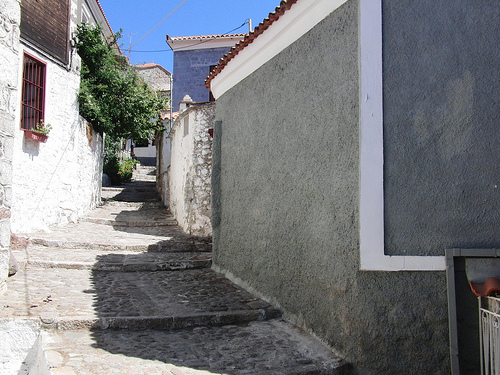
Kapi in the region of North Aegean is a town located in Greece - some 168 mi or ( 271 km ) North-East of Athens , the country's capital .
Local time in Kapi is now 04:05 PM (Saturday) . The local timezone is named " Europe/Athens " with a UTC offset of 2 hours. Depending on your flexibility, these larger cities might be interesting for you: Vafios, Stypsi, Petra, Mytilini, and Mithymna. When in this area, you might want to check out Vafios . We found some clip posted online . Scroll down to see the most favourite one or select the video collection in the navigation. Are you looking for some initial hints on what might be interesting in Kapi ? We have collected some references on our attractions page.
Videos
Molivos -Tsonia beach
Tsonia beach ..
Man' Katsa Waterfalls, Lesvos, Greece
Man' Katsa Waterfalls are located in Lesvos island in Greece, between the villages of Mantamados and Pedi. ..
The Beauty of Lesvos
12 Beautiful pictures of the stunning Greek island of Lesvos. A must for everyone that has fallen in love with this jewel set in the sparkling, azure Aegean sea. ελληνικά English Nederlands Keep your ..
Lesvos 2010 Skala Sikamnias
The picturesque Skala Sikamnias on the north Leasvos, a litle church by a tiny harbour. ..
Videos provided by Youtube are under the copyright of their owners.
Interesting facts about this location
Greek National Road 36
Greek National Road 36 is a national highway on the island of Lesbos, Greece. It connects Mytilene with Kalloni.
Located at 39.20 26.28 (Lat./Long.); Less than 15 km away
Saint Ignatios Monastery
The Saint Ignatios Monastery is found outside the city of Kalloni on the island of Lesbos, Greece, and is also known as the Leimonos Monastery or the Limonos Monastery (alternative spelling), due to the field on which it is built. The monastery was founded in 1526 by Saint Ignatios Agallianos. The monastery contains many important relics collected since its founding, and houses a library which contains many manuscripts and icons.
Located at 39.25 26.17 (Lat./Long.); Less than 15 km away
Lesbos Prefecture
Lesbos Prefecture was one of the prefectures of Greece. It comprised three main islands: Lesbos itself, Lemnos, and the smaller island of Agios Efstratios. In 2011 the prefecture was abolished and the territory is now covered by the regional units of Lesbos and Lemnos. Its capital was the town of Mytilene, on Lesbos.
Located at 39.17 26.33 (Lat./Long.); Less than 19 km away
Anemotia
Anemotia is a village on the Greek Island of Lesbos. It belongs to the municipality of Kalloni and is located in the mountains, roughly halfway between Kalloni and Eresos. Anemotia's beautiful cobbled streets, stone houses and panoramic vistas make it picturesque. The fertile but rocky terrain of the mountains is covered with olive trees. The local farmers claim that the olives grown on these trees produce the most fragrant olive oil in the country.
Located at 39.25 26.10 (Lat./Long.); Less than 20 km away
Lamponeia
Lamponeia (Ancient Greek Λαμπώνεια, also spelled Λαμπωνία and Λαμπώνιον) was a Greek city on the southern coast of the Troad region of Anatolia. Its archaeological remains have been located above the village of Kozlu in the district of Ayvacık in Çanakkale Province in Turkey. The site was first visited by Platon de Tchiatcheff in 1849, and later surveyed and identified as Lamponeia by Joseph Thacher Clarke, the excavator of nearby Assos, in 1882, and by Walter Judeich in 1896.
Located at 39.54 26.41 (Lat./Long.); Less than 24 km away
Pictures


Historical Weather
Related Locations
Information of geographic nature is based on public data provided by geonames.org, CIA world facts book, Unesco, DBpedia and wikipedia. Weather is based on NOAA GFS.