-
You are here:
- Homepage »
- Greece »
- Peloponnese » Ayios Petros

Ayios Petros Destination Guide
Touring Ayios Petros in Greece
Ayios Petros in the region of Peloponnese with its 857 citizens is a city located in Greece - some 78 mi or ( 125 km ) South-West of Athens , the country's capital city .
Time in Ayios Petros is now 04:11 AM (Sunday) . The local timezone is named " Europe/Athens " with a UTC offset of 2 hours. Depending on your travel resources, these more prominent places might be interesting for you: Yiokaraiika, Vresthena, Vounon, Vervena, and Lacedaemon. Being here already, consider visiting Yiokaraiika . We collected some hobby film on the internet . Scroll down to see the most favourite one or select the video collection in the navigation. Check out our recommendations for Ayios Petros ? We have collected some references on our attractions page.
Videos
Karyes Lakonia Greece Morning Drive
An early morning drive through the main road of karyes Lakonias Greece ..
ΚΑΡΥΕΣ - ΙΑΝΟΥΑΡΙΟΣ 2010.wmv
A visit to karyes lakonias by Stevy, Socrates, Stamatis and their friends in January 2010. It is still a great looking village no mater what season of the year it is. ..
Greek Ceramic Sculptor
A Greek sculptor displays his skill ..
Korfu 2010 Urlaub
Korfu 2010 Urlaub Auschnitte ..
Videos provided by Youtube are under the copyright of their owners.
Interesting facts about this location
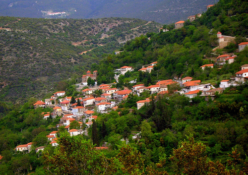
Kastanitsa
Kastanitsa is a village in Arcadia in Greece, on the southern slope of Mount Parnon. It is noted for its production of chestnuts, from which it takes its name, and for formerly being a majority Tsakonian-speaking settlement.
Located at 37.27 22.65 (Lat./Long.); Less than 12 km away
Elaiochori, Arcadia
Elaiochori is a mountain village in Arcadia, Greece. It lies near the border of Argolis. It was historically called Masklina, a Slavic name meaning "olives". The Korinth-Kalamata railway runs through the village. Elaiochori has a population of 487 and is part of the municipal unit of Korythio. Its name comes from its considerable production of olives and olive oil.
Located at 37.45 22.57 (Lat./Long.); Less than 14 km away
Prastos
Prastos is a settlement in Arcadia, Greece. Formerly, Prastos was the premier town of the Tsakonian region, but declined in importance after its devastation by Ibrahim Pasha of Egypt during the Greek War of Independence and a general economic migration to urban areas that occurred in the following decades.
Located at 37.27 22.68 (Lat./Long.); Less than 14 km away
Eua, Argolis
Eua or Eva is an archaeological location in the regional unit of Argolis in the Peloponnese, Greece. It is mentioned as a village by Pausanias and its name is also attested by archaeological findings. It is located in the valley of the river Tanos (ancient Tanaos), below the north-eastern slopes of the Parnon mountain range, between the modern towns of Astros and Kato Doliana. It is close to the site of the Byzantine Monastery of Loukou.
Located at 37.42 22.69 (Lat./Long.); Less than 15 km away
Mount Parthenion
Mount Parthenion ("Mount of the Virgin", modern Greek: Παρθένιο - Parthenio) is a mountain on the border of Arcadia and Argolis, in the Peloponnese, Greece. Its elevation is 1,215 m. It is situated between the villages Achladokampos to the northeast and Partheni to the southwest. It is 16 km east of Tripoli. In antiquity, it divided the little plain of Hysiae from that of Tegea. Mount Parthenion is the mountain where the hero Telephus was exposed. Below its slopes lay Tegea.
Located at 37.49 22.55 (Lat./Long.); Less than 17 km away
Pictures
Historical Weather
Related Locations
Information of geographic nature is based on public data provided by geonames.org, CIA world facts book, Unesco, DBpedia and wikipedia. Weather is based on NOAA GFS.