
Discover El Eden in Honduras
El Eden in the region of Cortés with its 954 habitants is a town located in Honduras - some 81 mi or ( 130 km ) North-West of Tegucigalpa , the country's capital .
Local time in El Eden is now 01:45 AM (Saturday) . The local timezone is named " America/Tegucigalpa " with a UTC offset of -6 hours. Depending on your flexibility, these larger cities might be interesting for you: Belmopan, Belize City, San Salvador, Santa Tecla, and New Guatemala. When in this area, you might want to check out Belmopan . We found some clip posted online . Scroll down to see the most favourite one or select the video collection in the navigation. Are you looking for some initial hints on what might be interesting in El Eden ? We have collected some references on our attractions page.
Videos
Manejando en Honduras / Driving in Honduras [1]
Tramo de la carretera panamericana (CA-5) que conecta TGU-Comayagua-Siguatepeque-SPS... Main highway part of the panamerican road (CA-5) which connects Tegucigalpa - Comayagua, Siguatepeque - San Pedr ..
Mazda BT50 4x4
First REAL 4x4 trip for me in my New BT50. Taken @ beautiful Honduras countryside (Rio Frio) a bunch of friends and me. 2 Land Cruisers 1 Mazda BT50. Obviously Toyota lead the way, but mazda Ruled!!! ..
Honduras 21 años despues
Despues de 21 años regreso a San Pedro Sula para ver como estan todos, y cuanto han cambiado, en esta primera parte me reencuentro con mis amigos y vamos a comer pescado a el lago de yojoa. ..
Pullapanzak Falls
A short video from a big waterfall in Honduras. ..
Videos provided by Youtube are under the copyright of their owners.
Interesting facts about this location
San Francisco de Yojoa
San Francisco de Yojoa is a municipality in the Honduran department of Cortés. Religion: Mostly Christians. Jehovah's Witnesses or Baptist.
Located at 15.02 -87.97 (Lat./Long.); Less than 9 km away
Lake Yojoa
Lake Yojoa is the largest lake in Honduras with a surface area of 285 square kilometers (110 mi²) and an average depth of 15 meters (50 ft). At an altitude of 700 meters (2,300 ft), it lies in a depression formed by volcanoes. The Lake Yojoa volcanic field consists of Pleistocene to Holocene scoria cones, craters, and lava flows. The west side of the lake is bordered by steep mountains and Santa Bárbara National Park while the east side is adjacent to Cerro Azul Meambar National Park.
Located at 14.87 -87.98 (Lat./Long.); Less than 10 km away
Las Vegas, Santa Bárbara
Las Vegas is a municipality in the Honduran department of Santa Bárbara.
Located at 14.87 -88.07 (Lat./Long.); Less than 11 km away
Santa Cruz de Yojoa
Santa Cruz de Yojoa is a municipality in the Honduran department of Cortés. Santa Cruz de Yojoa is located approximately 50 miles south of San Pedro Sula on top of a large hillside on the way to the dam that supplies power to many Central American cities. Santa Cruz de Yojoa, over the years, has become a large populated city, with its central park known as "Parque Central de Santa Cruz de Yojoa" which translated into English means "Santa Cruz de Yojoa Central Park".
Located at 14.98 -87.90 (Lat./Long.); Less than 13 km away
Santa Rita, Santa Bárbara
Santa Rita is a municipality in the Honduran department of Santa Bárbara.
Located at 14.95 -88.17 (Lat./Long.); Less than 16 km away
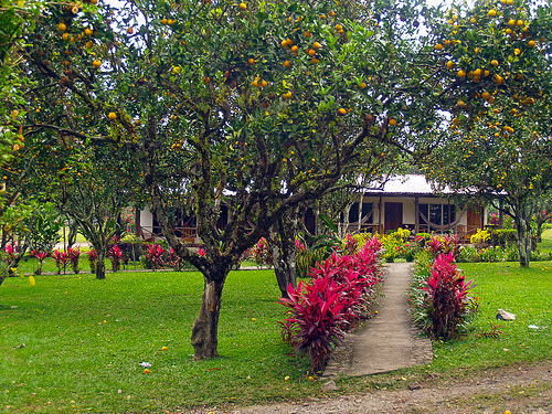
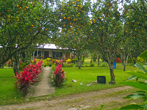
Pictures

Related Locations
Information of geographic nature is based on public data provided by geonames.org, CIA world facts book, Unesco, DBpedia and wikipedia. Weather is based on NOAA GFS.