-
You are here:
- Homepage »
- Italy »
- Aosta Valley » Aymavilles

Aymavilles Destination Guide
Explore Aymavilles in Italy
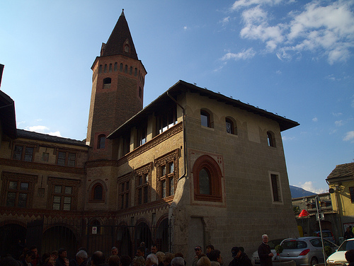
Aymavilles in the region of Aosta Valley with its 1,850 inhabitants is a town in Italy - some 371 mi or ( 596 km ) North-West of Rome , the country's capital city .
Current time in Aymavilles is now 04:30 PM (Saturday) . The local timezone is named " Europe/Rome " with a UTC offset of 1 hours. Depending on the availability of means of transportation, these more prominent locations might be interesting for you: Lausanne, Geneva, Berne, Dijon, and Besançon. Since you are here already, make sure to check out Lausanne . We saw some video on the web . Scroll down to see the most favourite one or select the video collection in the navigation. Where to go and what to see in Aymavilles ? We have collected some references on our attractions page.
Videos
Farting in italy
Italy was the bomb. Well and truly a big nuke in my brain. I friggen loved it. So for a wee while all the videos that i make will be about my lovely holiday. Only the good bits though. Which was basic ..
Valle d'Aosta - Unica per natura
Nel cuore dell'Europa, tra le vette più alte di importanza internazionale, rifugio vitale per animali e piante, un'enclave preziosa e fragile. ..
Wellness Valle d'Aosta
Wellness VdA ..
6° Escursione inalto
16 dicembre 2007, ciaspolata agli alpeggi di Grandes-Arpilles a Vétan, Saint-Pierre (Ao) ..
Videos provided by Youtube are under the copyright of their owners.
Interesting facts about this location
Pont d'Aël
The Pont d'Aël is a Roman aqueduct bridge in the village of the same name, in the comune of Aymavilles, in Aosta Valley, Italy. The bridge, constructed in 3 BC, carried water for the agricultural lands of the newly founded colony Augusta Prætoria Salassorum across a side valley, 66 m above the bottom. It belonged to a sophisticated, 6 km long aqueduct, running along the steep cliffs of the valley.
Located at 45.68 7.22 (Lat./Long.); Less than 3 km away
Pila, Aosta Valley
Pila is a ski-resort in the Aosta Valley region of northern Italy. It is a frazione of the comune of Gressan. There are more than 24 pistes (70km+ total length), including 4 blue runs, 29 red runs and 4 black runs, with a pipe zone and a slopestyle zone. There is one cable car, 3 gondolas, 8 chairlifts and 5 conveyors. The resort itself is at 1814 metres altitude, while the highest skiing can be done at 2700m. Pila is located in the Alps near to some notable major mountains.
Located at 45.72 7.29 (Lat./Long.); Less than 4 km away
Aosta Cathedral
Aosta Cathedral (Italian: Cattedrale di Aosta, Cattedrale di Santa Maria Assunta e San Giovanni Battista; French: Cathédrale d'Aoste, Cathédrale Notre-Dame-de-l'Assomption et Saint-Jean-le-Baptiste) is a Roman Catholic cathedral in Aosta, in north-west Italy, built in the 4th century. In the 11th century the Palaeo-Christian structure was replaced by a new edifice dedicated to the Virgin Mary. The architecture of the cathedral was modified during the 15th and 16th century.
Located at 45.74 7.32 (Lat./Long.); Less than 7 km away
Aosta railway station
Aosta railway station is the main station serving the city and comune of Aosta, in the autonomous region of Aosta Valley, northwestern Italy. Opened in 1886, it forms part of the Chivasso–Ivrea–Aosta railway, and is also a junction station for a branch line to nearby Pré-Saint-Didier, in the Valdigne, on the way towards Courmayeur. The station is currently managed by Rete Ferroviaria Italiana (RFI). However, the commercial area of the passenger building is managed by Centostazioni.
Located at 45.73 7.32 (Lat./Long.); Less than 7 km away
Pont de Pierre (Aosta)
The Pont de Pierre (Italian: Ponte di pietra), meaning "Stone Bridge", is a Roman segmental arch bridge in the Italian city of Aosta in the Aosta Valley. The bridge crossed the Buthier about 600 m from the eastern exit of the Roman colony Augusta Praetoria; in later times the torrente changed its course, leaving the ancient bridge today without water. The single-arch bridge has a span of 17.1 m and a width of 5.9 m.
Located at 45.74 7.33 (Lat./Long.); Less than 8 km away
Pictures
Historical Weather
Related Locations
Information of geographic nature is based on public data provided by geonames.org, CIA world facts book, Unesco, DBpedia and wikipedia. Weather is based on NOAA GFS.