
Explore Macugnaga in Italy
Macugnaga in the region of Piedmont with its 651 inhabitants is a town in Italy - some 360 mi or ( 579 km ) North-West of Rome , the country's capital city .
Current time in Macugnaga is now 04:39 PM (Friday) . The local timezone is named " Europe/Rome " with a UTC offset of 1 hours. Depending on the availability of means of transportation, these more prominent locations might be interesting for you: Zermeiggern, Lucerne, Berne, Munich, and Besançon. Since you are here already, make sure to check out Zermeiggern . We saw some video on the web . Scroll down to see the most favourite one or select the video collection in the navigation. Where to go and what to see in Macugnaga ? We have collected some references on our attractions page.
Videos
Capanna Margherita
Sunrise at the refuge of Capanna Margherita at Monte Rosa ..
Macugnaga ( PIEMONTE) 2009
Macugnaga (Piemonte-Italy) Luglio 2009 ..
Concorso Fotografico 2012 - Macugnaga
Selezione delle migliori foto e presentazione delle 6 foto vincenti per i calendarietti 2012 Tutte le immagini che ci sono state inviate le potete vedere sul Forum di Macugnaga.net (clicca sull'indiri ..
Alps - Punta Indren
Video from the italian Alps at Punta Indren (Monte Rosa) ..
Videos provided by Youtube are under the copyright of their owners.
Interesting facts about this location
Belvedere Glacier
The Belvedere Glacier (Italian: Ghiacciaio del Belvedere) is a valley glacier located above Macugnaga in the region of Piedmont. The glacier lies at the base of the east face of Monte Rosa and reaches a height of about 1,800 metres above sea level at its lowest point. The glacier is mostly covered by rocks. The glacier is feed by the snows and glaciers on the east side of Monte Rosa, among which the Ghiacciaio del Monte Rosa, culminating above 4,500 metres.
Located at 45.95 7.91 (Lat./Long.); Less than 5 km away
Schwarzberg Glacier
The Schwarzberg Glacier is a 3 km long glacier (2005) situated in the Pennine Alps in the canton of Valais in Switzerland. In 1973 it had an area of 6.09 km².
Located at 46.01 7.93 (Lat./Long.); Less than 5 km away
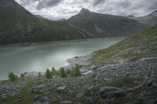
Mattmarksee
Mattmarksee is a reservoir in the Saas Valley of the Canton of Valais, Switzerland. The Mattmark dam was built from 1960-1965. The lake's surface area is 1.76 km².
Located at 46.04 7.96 (Lat./Long.); Less than 8 km away
Cabane Reine Marguerite
Cabane Reine Marguerite is a refuge in the Alps in Aosta Valley, Italy.
Located at 45.93 7.88 (Lat./Long.); Less than 8 km away
Monte Rosa tour
The Monte Rosa Tour is a circular hiking trail through the Swiss & Italian Alps around Monte Rosa (4634m). The tour also encircles the Dom (4,545 m) in the Mischabel range. Typical overnight stops are Zermatt Theodulpass St-Jacques in the Ayas valley Gressoney-La-Trinité Alagna Valsesia Macugnaga-Staffa Saas-Fee Grächen Europahütte The section from Saas-Fee to Grächen is sometimes known as the Höhenweg, or "high path". Grächen to Zermatt is along the Europaweg, and passes the Europa Hut.
Located at 45.94 7.87 (Lat./Long.); Less than 9 km away
Pictures
Historical Weather
Related Locations
Information of geographic nature is based on public data provided by geonames.org, CIA world facts book, Unesco, DBpedia and wikipedia. Weather is based on NOAA GFS.