
Discover Pleyne in Italy
Pleyne in the region of Piedmont is a town located in Italy - some 332 mi or ( 534 km ) North-West of Rome , the country's capital .
Local time in Pleyne is now 04:35 AM (Sunday) . The local timezone is named " Europe/Rome " with a UTC offset of 1 hours. Depending on your flexibility, these larger cities might be interesting for you: Saint-Veran, Nice, Grasse, Gap, and Clermont-Ferrand. When in this area, you might want to check out Saint-Veran . We found some clip posted online . Scroll down to see the most favourite one or select the video collection in the navigation. Are you looking for some initial hints on what might be interesting in Pleyne ? We have collected some references on our attractions page.
Videos
colle dell'agnello
sole dal versante francese e nuvole dal versante italiano ..
Slideshow Val Maira - autunno 2008
Slideshow Val Maira - Acceglio (CN) ..
Sorgenti del fiume Po
Sorgenti del fiume Po - Pian del Re, Crissolo (CN) it.wikipedia.org ..
GS1200 BMW - COL DELL'AGNELLO 240809
GStour 2009- Colle dell'Agnello ..
Videos provided by Youtube are under the copyright of their owners.
Interesting facts about this location
Rifugio Campo Base
The Rifugio Campeggio Campo Base is an alpine refuge located in the Municipality of Acceglio, in the Province of Cuneo, Italy.
Located at 44.50 6.92 (Lat./Long.); Less than 12 km away
Guil
The Guil is a 51.6 km long river in the Hautes-Alpes département, southeastern France. Its source is several small streams which converge in the lake Lestio, at Ristolas. It flows generally west, through the Queyras. It is a left tributary of the Durance into which it flows at Guillestre.
Located at 44.69 7.07 (Lat./Long.); Less than 12 km away
Monte Viso Tunnel
The Monte Viso Tunnel is an Alpine tunnel built during the Renaissance and located eight kilometres north of Monviso, northern Italy. It is 75 m long, 3 m wide, and located at 2,882 metres linking the modern Italian province of Cuneo and the French department of Hautes-Alpes. The tunnel was built between 1478 and 1480 http://www. quid.
Located at 44.71 7.07 (Lat./Long.); Less than 15 km away
Fort de Viraysse
The Fort de Viraysse is a fortification complex in the Cottian Alps overlooking the Ubaye Valley. It was built between 1885 and 1888 to defend France against invasion from Italy. The position was one of the highest military posts in France at 2,772 metres, and the only one in the Alps with a clear view of Italy.
Located at 44.48 6.85 (Lat./Long.); Less than 17 km away
Lago della Meja
Lago della Meja is a lake in the Province of Cuneo, Piedmont, Italy.
Located at 44.40 7.07 (Lat./Long.); Less than 21 km away
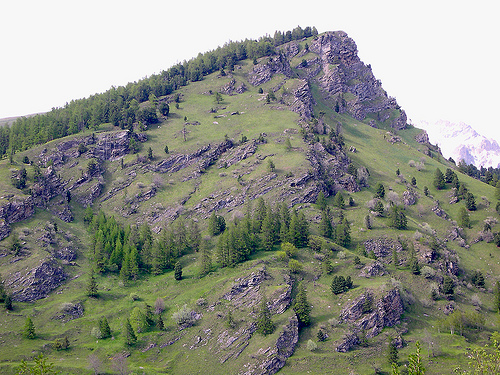
Pictures
Historical Weather
Related Locations
Information of geographic nature is based on public data provided by geonames.org, CIA world facts book, Unesco, DBpedia and wikipedia. Weather is based on NOAA GFS.