-
You are here:
- Homepage »
- Mexico »
- Baja California » Tecate

Tecate Destination Guide
Explore Tecate in Mexico
Tecate in the region of Baja California with its 58,300 inhabitants is a town in Mexico - some 1,412 mi or ( 2273 km ) North-West of Mexico City , the country's capital city .
Current time in Tecate is now 07:28 AM (Monday) . The local timezone is named " America/Tijuana " with a UTC offset of -7 hours. Depending on the availability of means of transportation, these more prominent locations might be interesting for you: Valle Redondo, San Jose, Rancho El Oasis, Mexicali, and La Joya. Since you are here already, make sure to check out Valle Redondo . We saw some video on the web . Scroll down to see the most favourite one or select the video collection in the navigation. Where to go and what to see in Tecate ? We have collected some references on our attractions page.
Videos
Watsu - David Towe from Beyond Body Work
Warm water therapy promotes a deep state of relaxation with dramatic changes in the autonomic nervous system. Available at Ranch La Puerta. ..
Posada Tecate
Una Posada llena de muchas emociones y amigos!! ..
Kiosko en Photosynth
Kiosko del parque Miguel Hidalgo en Photosynth: photosynth.net ..
Day Trip To Tecate
We took a train from Campo, CA to Tecate, Mexico. We were only in the town for about 3 and a half hours, then we had to get back on the train. There wasn't a lot to see in Tecate, so we just went shop ..
Videos provided by Youtube are under the copyright of their owners.
Interesting facts about this location
Tecate Port of Entry
Tecate Port of Entry 300px Tecate Border Inspection Station Location Country United States Location 405 Tecate Road, Tecate, California 91980 Coordinates coord}}{{#coordinates:32.576852|-116.627179|region:US_type:landmark name= }} Details Opened 1919 Phone (619) 938-8330 Hours 5:00 AM-11:00 PM Exit Port Tecate, BC, Mexico Statistics 2011 Cars 1,571,780 2011 Trucks 51,930 Pedestrians 525,312 Websitehttp://www. cbp. gov/xp/cgov/toolbox/contacts/ports/ca/2505.
Located at 32.58 -116.63 (Lat./Long.); Less than 1 km away
Tecate Airport
Tecate Airport is a closed, paved airstrip located South of Tecate in Municipality of Tecate, Baja California, Mexico. The city is on the U.S. -Mexico border. The airport is now no longer operated as an airport, and the runway is now used as a race track for street racing competitions.
Located at 32.54 -116.64 (Lat./Long.); Less than 3 km away
Villa del Campo, Baja California
Villa del Campo – Town of the Country – is a city in Baja California in Tijuana Municipality. The city had a population of 13,906 as of 2010.
Located at 32.51 -116.74 (Lat./Long.); Less than 12 km away
Pacific Southwest Railway Museum
The Pacific Southwest Railway Museum operates two railway museum's in San Diego County - The La Mesa Depot located at La Mesa Blvd and Spring St, as well as the main museum located at 750 Depot St in Campo,CA - near the corner of State Route 94 and Forrest Gate Road in Campo, California, and is a railroad museum dedicated to the preservation and interpretation of railroads as they existed in the Pacific Southwest.
Located at 32.61 -116.47 (Lat./Long.); Less than 15 km away
Campo, California
Campo is a census-designated place (CDP) located in the Mountain Empire area of southeastern San Diego County, California. The population was 2,684 at the 2010 census. This article also describes the smaller community of Cameron Corners, about 1 mile (1.6 km) south and the village of Lake Morena which is the northern part of Campo. Both communities use postal addresses in Campo. The town is approximately 2,620 feet (798.6 m) above mean sea level.
Located at 32.61 -116.47 (Lat./Long.); Less than 15 km away
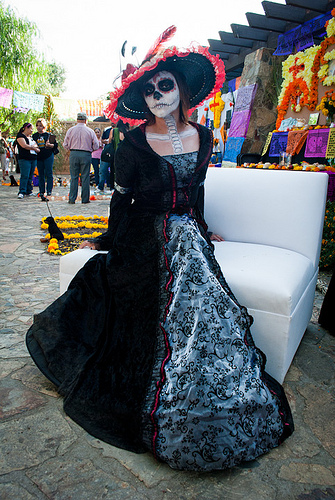
Pictures


Related Locations
Information of geographic nature is based on public data provided by geonames.org, CIA world facts book, Unesco, DBpedia and wikipedia. Weather is based on NOAA GFS.