
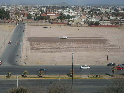
Explore Saltillo in Mexico
Saltillo in the region of Coahuila with its 621,250 inhabitants is a town in Mexico - some 431 mi or ( 693 km ) North of Mexico City , the country's capital city .
Current time in Saltillo is now 06:23 AM (Saturday) . The local timezone is named " America/Monterrey " with a UTC offset of -6 hours. Depending on the availability of means of transportation, these more prominent locations might be interesting for you: Ciudad Victoria, San Luis Potosí, Ramos Arizpe, Monterrey, and La Encantada. Since you are here already, make sure to check out Ciudad Victoria . We saw some video on the web . Scroll down to see the most favourite one or select the video collection in the navigation. Where to go and what to see in Saltillo ? We have collected some references on our attractions page.
Videos
Pollo vs Tsuru
Pollo corriendo contra Tsuru en los arrancones de Saltillito City ..
KCSM 4668, 4669, 4667, 4505 y ex-Santa Fe 4249
Un tren en su mayoria de contenedores con 4 locomotoras de KCSM y una rara b23-7 bueno solo porke traía la esquema Santa Fe aunke la rento una linea ke se llama NREX, aki con direccion al sur tomado e ..
Long Train of KCSM
High-Quality ac4400cw 4571 4560 y las 4540 4551 ( salen el minuto 4:20) kcsm ..
Pollo vs Pointer
Pollo corriendo contra un Pointer en los arracones de Saltillo City. ..
Videos provided by Youtube are under the copyright of their owners.
Interesting facts about this location
Estadio de Béisbol Francisco I. Madero
Estadio de Béisbol Francisco I. Madero is a stadium in Saltillo, Mexico. It is primarily used for baseball and is the home field of the Saraperos de Saltillo. It holds 16,000 people, and features a video screen measuring 14 meters high by 22 meters wide (46 feet high by 72 feet wide). The stadium is named after Coahuila native Francisco I. Madero who served as President of Mexico from 1911 to 1913. The stadium was renovated in 1999, and again in 2011.
Located at 25.43 -100.98 (Lat./Long.); Less than 3 km away
Battle of Buena Vista
The Battle of Buena Vista (23 February 1847), also known as the Battle of Angostura, saw the United States (U.S. ) Army use artillery to repulse the much larger Mexican army in the Mexican-American War. Buena Vista, a village of the state of Coahuila, is seven miles (12 km) south of Saltillo, in northern Mexico.
Located at 25.34 -101.05 (Lat./Long.); Less than 10 km away
Ramos Arizpe
Ramos Arizpe is a city and seat of the surrounding municipality of the same name in the Mexican state of Coahuila. Ramos Arizpe is located 11 km from the state capital of Saltillo. It is part of the Saltillo metropolitan area. The city reported a population of 48,228 in the 2005 census; the municipality had a population of 56,708. Its area is 5,306.6 km² (2,048.9 sq mi).
Located at 25.55 -100.97 (Lat./Long.); Less than 15 km away
Plan de Guadalupe International Airport
Plan de Guadalupe International Airport (Spanish: Aeropuerto Internacional Plan de Guadalupe) is an airport located at Ramos Arizpe in the state of Coahuila in Mexico. It handles national and international air traffic from the metropolitan area of Saltillo and Ramos Arizpe. This airport receives few flights a day due to its proximity to Monterrey's General Mariano Escobedo International Airport and Del Norte International Airport.
Located at 25.55 -100.93 (Lat./Long.); Less than 16 km away
Pictures

Related Locations
Information of geographic nature is based on public data provided by geonames.org, CIA world facts book, Unesco, DBpedia and wikipedia. Weather is based on NOAA GFS.