
Discover Tecali de Herrera in Mexico
Tecali de Herrera in the region of Puebla with its 4,508 habitants is a town located in Mexico - some 84 mi or ( 135 km ) South-East of Mexico City , the country's capital .
Local time in Tecali de Herrera is now 08:48 PM (Tuesday) . The local timezone is named " America/Mexico City " with a UTC offset of -6 hours. Depending on your flexibility, these larger cities might be interesting for you: Toluca, Tochtepec, Santo Tomas Hueyotlipan, Santiago Acatlan, and San Jeronimo Ocotitlan. When in this area, you might want to check out Toluca . We found some clip posted online . Scroll down to see the most favourite one or select the video collection in the navigation. Are you looking for some initial hints on what might be interesting in Tecali de Herrera ? We have collected some references on our attractions page.
Videos
Senderos del Arte (Las corrientes artísticas por el tiempo)
Este es mi primer Stop Motion y video en general que he hecho, es sobre las tendencias artísticas más relevantes en el arte, espero que les guste ..
Volcano Popocatepetl Mexico El Popo
Mexican volcano Popocatepetl is verging on next major eruption. This volcano is nicknamed "El Popo". Activity has been on the increase, this weekend. Previous activity had been in April 2012. This vol ..
Expansion
www.desteni.co.za Let us expound the equality and oneness point practically Written by Bernard Poolman 1.Each human being are in a self accepted reality-- thus created through certain acceptances--whe ..
MI MEXICO 6
VIAJANDO POR MEXICO...EN VACACIONES DE VERANO 2008 ..
Videos provided by Youtube are under the copyright of their owners.
Interesting facts about this location
Atoyatempan
Atoyatempan (municipality) is a town and municipality in Puebla in south-eastern Mexico.
Located at 18.82 -97.92 (Lat./Long.); Less than 11 km away
Santo Tomás Hueyotlipan (municipality)
Santo Tomás Hueyotlipan (municipality) is a town and municipality in Puebla in south-eastern Mexico.
Located at 18.90 -97.85 (Lat./Long.); Less than 12 km away
Santo Tomás Hueyotlipán
Santo Tomas Hueyotlipán is a municipio in the Mexican state of Puebla. It had a population of 3,800 in 1990.
Located at 18.90 -97.85 (Lat./Long.); Less than 12 km away
Autódromo Miguel E. Abed
The Autódromo Internacional Miguel E. Abed is a racing track located in the town of Amozoc, 30 kilometres east of the city of Puebla in the Mexican state of the same name.
Located at 19.03 -97.99 (Lat./Long.); Less than 15 km away
Cuapiaxtla de Madero (municipality)
Cuapiaxtla de Madero (municipality) is a town and municipality in Puebla in south-eastern Mexico.
Located at 18.92 -97.82 (Lat./Long.); Less than 16 km away
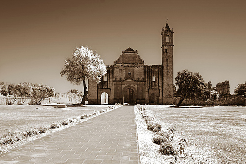
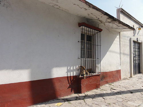
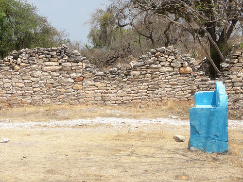
Pictures
Related Locations
Information of geographic nature is based on public data provided by geonames.org, CIA world facts book, Unesco, DBpedia and wikipedia. Weather is based on NOAA GFS.