
Discover Xaltipanapa in Mexico
Xaltipanapa in the region of Puebla is a place located in Mexico - some 108 mi or ( 173 km ) East of Mexico City , the country's capital .
Local time in Xaltipanapa is now 12:33 PM (Monday) . The local timezone is named " America/Mexico City " with a UTC offset of -6 hours. Depending on your mobility, these larger cities might be interesting for you: Tepeyahualco, San Miguel Tenextatiloyan, San Jose Alchichica, San Isidro Xicalahuata, and San Andres Payuca. When in this area, you might want to check out Tepeyahualco . We discovered some clip posted online . Scroll down to see the most favourite one or select the video collection in the navigation. Are you looking for some initial hints on what might be interesting in Xaltipanapa ? We have collected some references on our attractions page.
Videos
School - clip from The Tree of Knowledge at www.docfilm.com
www.docfilm.com - Set in Huehuetla, Puebla, a Totonac Indian community in East Central Mexico, The Tree of Knowledge contrasts two systems of education. The public school system uses patriotic symbols ..
Mexico pharmacy
Mexican pharmacy mascot dancing in the street in palenque ..
Videos provided by Youtube are under the copyright of their owners.
Interesting facts about this location
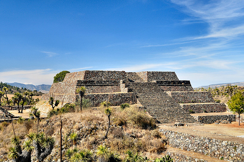
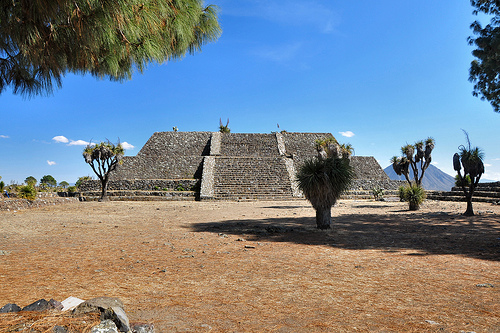
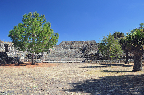
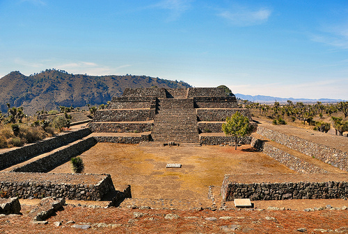
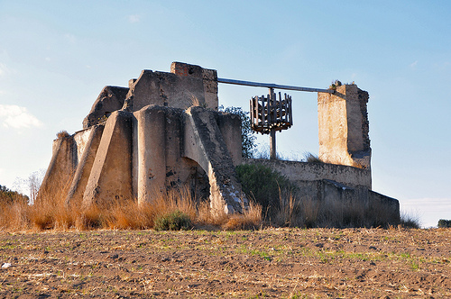
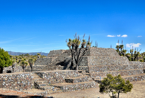
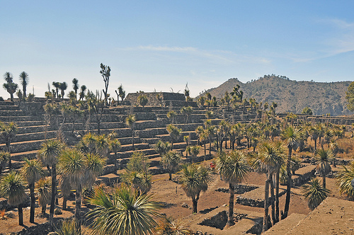
Cantona (Mesoamerican site)
Cantona, (La casa del sol) is a Mesoamerican archaeological site in Mexico. It is located in the state of Puebla, on the border with Veracruz, about an hour's drive from the city of Puebla and about an hour and a half from Xalapa, Veracruz. Limited archaeological work has been done at the site, and only about 10% of the site can be seen. (There are opinions that only 1% has been uncovered) .
Located at 19.57 -97.50 (Lat./Long.); Less than 3 km away
Cuyoaco (municipality)
Cuyoaco (municipality) is a town and municipality in Puebla in south-eastern Mexico.
Located at 19.62 -97.62 (Lat./Long.); Less than 14 km away
Ocotepec (municipality)
Ocotepec (municipality) is a town and municipality in Puebla in south-eastern Mexico.
Located at 19.56 -97.65 (Lat./Long.); Less than 18 km away
Oriental Basin
The Oriental Basin is an endorheic basin in east-central Mexico. It covers an area of 4,958.60 square kilometers, lying in the states of Puebla, Tlaxcala, and Veracruz. The climate is temperate and subtropical, semi-arid to subhumid, with summer rains. Average annual temperature 12-16°C, and annual total precipitation is 400–800 mm. The Trans-Mexican Volcanic Belt pine-oak forests ecoregion covers the mountains surrounding the basin to the west, north, and east.
Located at 19.42 -97.40 (Lat./Long.); Less than 20 km away
La Chingada, Veracruz
La Chingada is a town in the municipality of Perote in the Mexican state of Veracruz. The place is famous for its name, the Mexican Spanish vulgarism La Chingada. It means, roughly, "The Fucked", a vulgar but common reference to La Malinche, the Indian mistress of Hernán Cortés, the Spanish conquistador who conquered Mexico. The term "La Chingada" is used in a variety of mostly offensive or vulgar meanings, Vete a la Chingada means, for example something like "Go to hell".
Located at 19.45 -97.33 (Lat./Long.); Less than 22 km away
Pictures

Related Locations
Information of geographic nature is based on public data provided by geonames.org, CIA world facts book, Unesco, DBpedia and wikipedia. Weather is based on NOAA GFS.