-
You are here:
- Homepage »
- Netherlands »
- South Holland » Stein

Stein Destination Guide
Explore Stein in Netherlands
Stein in the region of South Holland is a place in Netherlands - some 26 mi or ( 42 km ) South of Amsterdam , the country's capital city .
Time in Stein is now 02:29 AM (Wednesday) . The local timezone is named " Europe/Amsterdam " with a UTC offset of 1 hours. Depending on your budget, these more prominent locations might be interesting for you: Woerden, Waddinxveen, Utrecht, Stein, and The Hague. Since you are here already, consider visiting Woerden . We saw some hobby film on the internet . Scroll down to see the most favourite one or select the video collection in the navigation. Where to go and what to see in Stein ? We have collected some references on our attractions page.
Videos
24 hour EV Road Trip
A 24 hour road trip challenge with an electric vehicle. How far can we drive using fast charging? ..
My Tongue Piercing
We were in holland and after like a week of arguing with my parents they agreed to let me get it. ..
Gouda Koninginnedag 2009
For Mary: The official start of Koninginnedag 2009 in Gouda. A day that ended less than an hour later in tragedy. See video 4uGa23kzuhk "Accident Dutch Queen Parade the Netherlands - Car hits crowd - ..
Zilverstad Schoonhoven (HD)
HD versie van de promotieclip voor de stad Schoonhoven, geschoten met de Canon HV30. ..
Videos provided by Youtube are under the copyright of their owners.
Interesting facts about this location
Goejanverwellesluis
The Goejanverwellesluis is a lock in Hekendorp, Netherlands. The 'Goejannen' - the men from the surrounding polders who went to sea - said their last farewells by this channel. According to the tradition, Wilhelmina of Prussia, wife of stadholder William V was captured here on 28 June 1787 by the Patriots from Gouda. In reality, her entourage were arrested at Bonrepas on the river Vlist, on the way to Schoonhoven near Haastrecht.
Located at 52.01 4.81 (Lat./Long.); Less than 2 km away
Vrijhoef en Kalverbroek
Vrijhoef en Kalverbroek is a former heerlijkheid and municipality in the Dutch province of South Holland. It was located about 3 km east of the city of Gouda, in the current municipality of Reeuwijk. The area of the former municipality is now almost completely covered by the lakes of the Reeuwijksche Plassen. According to the 19th century historian A.J.
Located at 52.02 4.75 (Lat./Long.); Less than 3 km away
Lange Ruige Weide
Lange Ruige Weide is a former municipality in the Dutch province of South Holland. It was located west of the city of Oudewater, and covered the hamlets of Langeweide and Ruigeweide. Lange Ruige Weide was a separate municipality from 1818 to 1964, when it became part of Driebruggen.
Located at 52.04 4.80 (Lat./Long.); Less than 5 km away
Hoenkoop
Hoenkoop is a village in the Dutch province of Utrecht. Since 1970, Hoenkoop has been a part of the municipality of Oudewater. Between 1815 and 1970, it was a separate municipality.
Located at 52.00 4.85 (Lat./Long.); Less than 5 km away
Vliet, Utrecht
Vliet is a hamlet in the Dutch province of Utrecht. It is located about 1 km southwest of the city of Oudewater, on the south bank of the Hollandsche IJssel. Vliet was a separate municipality between 1817 and 1846, when it became part of Haastrecht. During that time, the area was part of the province of South Holland. According to the 19th century historian A.J. van der Aa, there was no hamlet in the area in the middle of the 19th century.
Located at 52.02 4.85 (Lat./Long.); Less than 5 km away
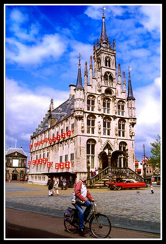
Pictures
Historical Weather
Related Locations
Information of geographic nature is based on public data provided by geonames.org, CIA world facts book, Unesco, DBpedia and wikipedia. Weather is based on NOAA GFS.