
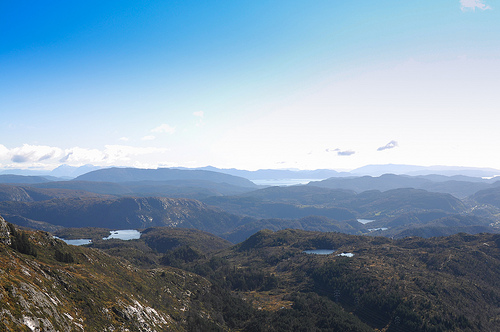
Delve into Indre Arna in Norway
Indre Arna in the region of Hordaland with its 6,117 residents is a city in Norway - some 184 mi or ( 297 km ) West of Oslo , the country's capital .
Current time in Indre Arna is now 12:29 PM (Saturday) . The local timezone is named " Europe/Oslo " with a UTC offset of 1 hours. Depending on your travel modalities, these larger destinations might be interesting for you: Ytre Arna, Tunes, Stavanger, Mirza Rafi Sauda, and Rodland. While being here, make sure to check out Ytre Arna . We encountered some video on the web . Scroll down to see the most favourite one or select the video collection in the navigation. Are you curious about the possible sightseeing spots and facts in Indre Arna ? We have collected some references on our attractions page.
Videos
Chainsaw Carving Ole Bull, by Arne Askeland
Artist Arn (Arne Askeland) carves the legendary violinist Ole Bull in full size. The sculpture is carved from one log of wood using a chainsaw. For more information about Arn and his work, see www.mot ..
Flam Fjord
Visit of Fjord, Simply amazing nature ..
Fjord Cruise
Some images from a cruise round the Norwegian Fjords ..
viaggio in norvegia giugno 2010
viaggio in norvegia, da oslo a bergen passando per flam, e con il postale da bergen a trondhiem attraveso i fiordi ..
Videos provided by Youtube are under the copyright of their owners.
Interesting facts about this location
Arna Station
Arna Station is the second largest railway station in Bergen, Norway; located in the Arna borough on the east side of Ulriken and between the two tunnels Ulriken Tunnel and Arnanipa. The present station was opened in 1964, when the tunnels was completed. The old station, located north of the new station, is still in use for heritage trains on Gamle Vossebanen. All passenger trains on Bergensbanen stop at Arna.
Located at 60.42 5.47 (Lat./Long.); Less than 1 km away
Indre Arna
Indre Arna is a settlement in Arna borough in Bergen, Norway. While Indre Arna is relatively far from most of the city by road, an 8-minute train journey through Ulriken connects Indre Arna to the city centre. On January 1, 2008, the Indre Arna urban settlement, as defined by Statistics Norway, had a population of 6198. The urban settlement covered a land area of 3.80 square kilometres, and had a population density of 1631 per square kilometre.
Located at 60.42 5.48 (Lat./Long.); Less than 1 km away
Takvam Station
Takvam Station was a railway station located at Takvam in Bergen, Norway that closed on 9 December 2012. Prior to closure, the station was served by two daily departures per direction by the Bergen Commuter Rail operated by Norges Statsbaner. The station opened in 1966, replacing the former Herland Station.
Located at 60.42 5.52 (Lat./Long.); Less than 3 km away
Haus, Norway
Haus is a village and a former municipality in Hordaland county, Norway. The village is located at the south-western coastline of the Osterøy island, at the Sørfjorden fiord. The parish of Haus was established as a municipality January 1, 1838, including the annex Bruvik. On January 1, 1870 Bruvik with 2,062 inhabitants was separated from Haus to form a municipality of its own. The split left Haus with a population of 4,229.
Located at 60.45 5.50 (Lat./Long.); Less than 3 km away
Osterøy Bridge
Osterøy Bridge connects Kvisti on the island of Osterøy in Hordaland County with the mainland at Herland east from Bergen, Norway. Osterøy Bridge is a suspension bridge and has a main span of 595 meter. The towers are 121.5 meters high. The bridge was completed October 3, 1997 and cost about 308 million Norwegian kroner. The bridge is the third largest suspension bridge in Norway. It is part of the highway 566 (Fylkesvei 566) runs between Herland in Bergen and Løno in Osterøy.
Located at 60.43 5.54 (Lat./Long.); Less than 3 km away
Pictures
Historical Weather
Related Locations
Information of geographic nature is based on public data provided by geonames.org, CIA world facts book, Unesco, DBpedia and wikipedia. Weather is based on NOAA GFS.