
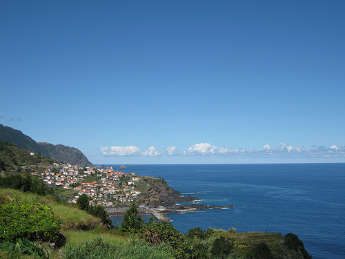
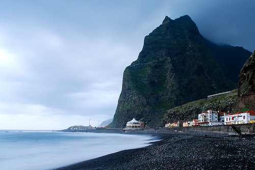
Explore Seixal in Portugal
Seixal in the region of Madeira is a place in Portugal - some 605 mi or ( 973 km ) South-West of Lisbon , the country's capital city .
Time in Seixal is now 01:53 PM (Sunday) . The local timezone is named " Atlantic/Madeira " with a UTC offset of 0 hours. Depending on your budget, these more prominent locations might be interesting for you: Senhora do Rosario, Santa Maria Madalena, Salao, Ribeira do Raposo, and Ponta do Sol. Since you are here already, consider visiting Senhora do Rosario . We saw some hobby film on the internet . Scroll down to see the most favourite one or select the video collection in the navigation. Where to go and what to see in Seixal ? We have collected some references on our attractions page.
Videos
Madeira extreme roads - old tunnels
North old Madeira roads and old tunnel. Stare drogi polnocnej Madery i recznie wykuwany tunel ..
Madeira. Old road
From Sào Vicente to Seixal on the old northcoast road, also called The Donkey Road. ..
The Old North Coast Road in Madeira
www.love-madeira.com presents a car tour of the Old North Coast Road in Madeira. Stretching along the north coast via Sao Vincente - Seixal - Ribeira Funda - Ribeira da Janela - Porto Moniz, the Antig ..
Sao Vicente y costa noroeste de MADEIRA en HD
En la Isla de Madeira, la costa norte y oeste es especialmente de mar agitada y muy empinada, formando rompientes, acantilados y cascadas naturales formando una costa espectacular y excepcionalmente b ..
Videos provided by Youtube are under the copyright of their owners.
Interesting facts about this location
25 Fontes Falls
The 25 Fontes Falls (literally 25 Sources Falls) is a waterfall that is located in Serrado, Ribeira da Janela, near Porto Moniz in the Madeira Islands. This waterfall is 30 feet high forming a variety of drops of water coming down the rocks covered in small plants resulting in a small lagoon. It is involved in the primitive forest Laurisilva of Madeira, in the Macaronesia group os islands in the Atlantic Ocean. The Forest in this location is populated by large quantities of bay trees.
Located at 32.87 -17.17 (Lat./Long.); Less than 7 km away
Caminho Real do Paul do Mar
The Caminho Real do Paul do Mar (Royal Path of Paul do Mar) is a municipal trail in Paul do Mar, in the island of Madeira. It is the first walking trail of the annual Madeira Walking Festival, which takes place in January. The trail starts from the village of Prazeres (535 metres altitude) {{#invoke:Coordinates|coord}}{{#coordinates:32.752483|-17.217014||||||| | |name= }}, and goes down to Paul do Mar Harbour {{#invoke:Coordinates|coord}}{{#coordinates:32.75269|-17.223827||||||| | |name= }}.
Located at 32.75 -17.22 (Lat./Long.); Less than 12 km away
Calheta beach
The Calheta Beach is a beach located near the town Calheta, on the island of Madeira, Portugal. Calheta beach is one of the few sandy beaches of Madeira, with sand imported from North Africa. However, these sand-imports were quite controversial, as the sand was taken from Western Sahara, a Non-Self Governing Territory which has been largely occupied by Morocco since 1975.
Located at 32.72 -17.17 (Lat./Long.); Less than 12 km away
Madeira Natural Park
The Madeira Natural Park (Portuguese: Parque Natural da Madeira) is a large biological reserve in Madeira with a unique endemic flora and fauna. It was created in 1982 to safeguard the natural heritage of the archipelago, and contains a number of endangered species including global rarities such as Zino's Petrel. This national park encompasses nearly two-thirds of the territory of the island of Madeira, and within it are nature reserves, protected landscapes and leisure zones.
Located at 32.75 -17.00 (Lat./Long.); Less than 13 km away
Ribeira Brava (parish)
Ribeira Brava is the name of a parish in the west-central part of Madeira. It is located in the similarly named district of Ribeira Brava, Madeira It is located SW of Santana, W of Machico, W of Funchal and ESE of Calheta. It is linked with a road linking Calheta and Funchal.
Located at 32.67 -17.06 (Lat./Long.); Less than 17 km away
Pictures


Related Locations
Information of geographic nature is based on public data provided by geonames.org, CIA world facts book, Unesco, DBpedia and wikipedia. Weather is based on NOAA GFS.