-
You are here:
- Homepage »
- Saint Lucia »
- Soufriere » Soufriere

Soufriere Destination Guide
Discover Soufriere in Saint Lucia
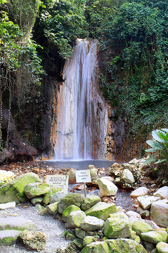
Soufriere in the region of Soufrière with its 2,918 habitants is a place located in Saint Lucia - some 10 mi or ( 16 km ) South of Castries , the country's capital .
Local time in Soufriere is now 02:18 AM (Saturday) . The local timezone is named " America/St Lucia " with a UTC offset of -4 hours. Depending on your mobility, these larger cities might be interesting for you: Bridgetown, Fort-de-France, Port of Spain, Basseterre, and Roseau. When in this area, you might want to check out Bridgetown . We discovered some clip posted online . Scroll down to see the most favourite one or select the video collection in the navigation. Are you looking for some initial hints on what might be interesting in Soufriere ? We have collected some references on our attractions page.
Videos
Anse Chastanet
www.ansechastanet.com Anse Chastanet - a St Lucia Resort in Soufriere, voted "Most Romantic Caribbean Resort" by Caribbean Travel and Life Magazine, in the Eastern Caribbean which is also called the W ..
Drive Into Soufriere, St. Lucia - Dec. 6, 2008
Our drive into Soufriere, St. Lucia. Beautiful. ..
Room JA4 at Jade Mountain, St. Lucia
Jade Mountain Star Room JA4 walkthru ..
Walk from Jade Mountain to the beach
This is the walk from Jade Mountain to the beach at Anse Chastanet. It's steeper than it looks on video. ..
Videos provided by Youtube are under the copyright of their owners.
Interesting facts about this location
Soufrière River
The Soufrière river (French la Soufrière) is a river on the island of Saint Lucia. The French term "Soufrière" is a generic one referring to "Sulphury" volanic peaks called La Soufrière or Soufrière Hills on each of St. Vincent, St. Lucia, Dominica, Guadeloupe. A river separates the town of Soufrière from the Fond Beniere area. A section of the river above the town was canalised and realigned in 1972; the river was realigned again in 1994.
Located at 13.85 -61.05 (Lat./Long.); Less than 1 km away
Mamin River
The Mamin River is a river of Saint Lucia.
Located at 13.87 -61.07 (Lat./Long.); Less than 2 km away
Petit Piton
Petit Piton is one of two mountains overlooking Soufrière Bay in the southwest of Saint Lucia. Petit Piton lies towards the middle of the bay, south of the town of Soufrière and north of the larger mountain, Gros Piton, to which it is linked by the Piton Mitan Ridge. Petit Piton rises to a height of 2461 ft (739 m).
Located at 13.83 -61.07 (Lat./Long.); Less than 3 km away
Canaries River
The Canaries River is a river on the island of Saint Lucia.
Located at 13.90 -61.07 (Lat./Long.); Less than 5 km away
Pitons
The Pitons are two volcanic plugs in a World Heritage Site in Saint Lucia. The Gros Piton is 771 m, and the Petit Piton is 743 m high; they are linked by the Piton Mitan ridge.
Located at 13.81 -61.07 (Lat./Long.); Less than 6 km away
Pictures


Related Locations
Information of geographic nature is based on public data provided by geonames.org, CIA world facts book, Unesco, DBpedia and wikipedia. Weather is based on NOAA GFS.